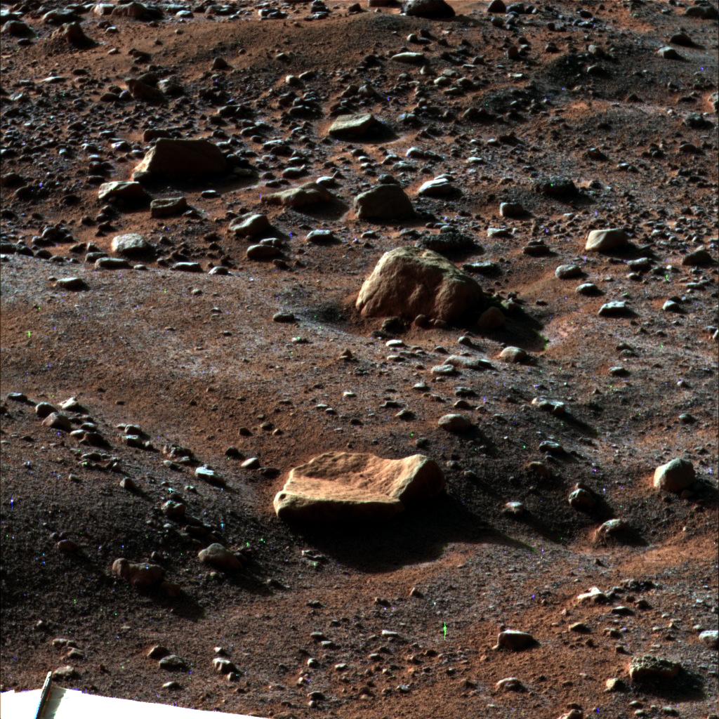
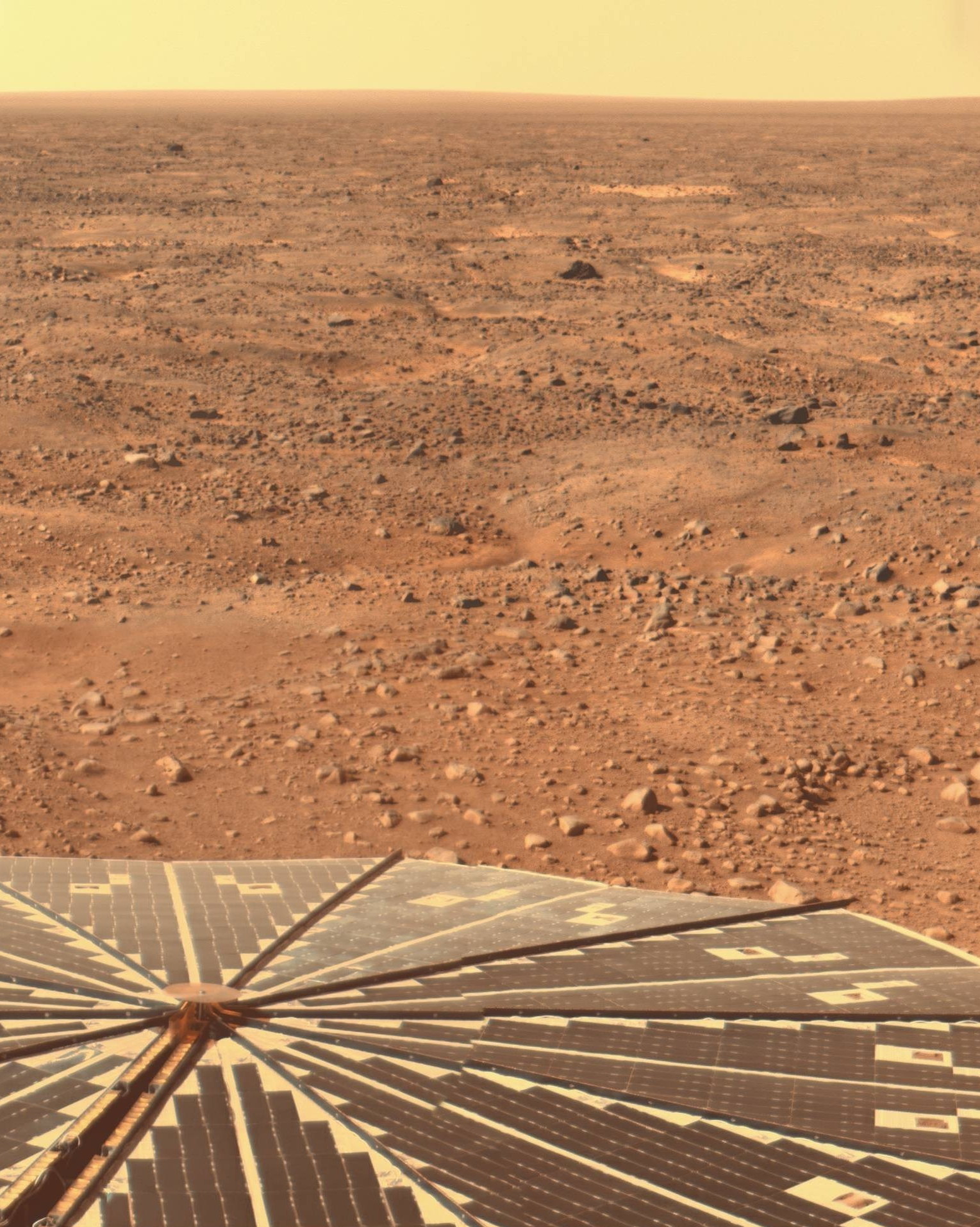
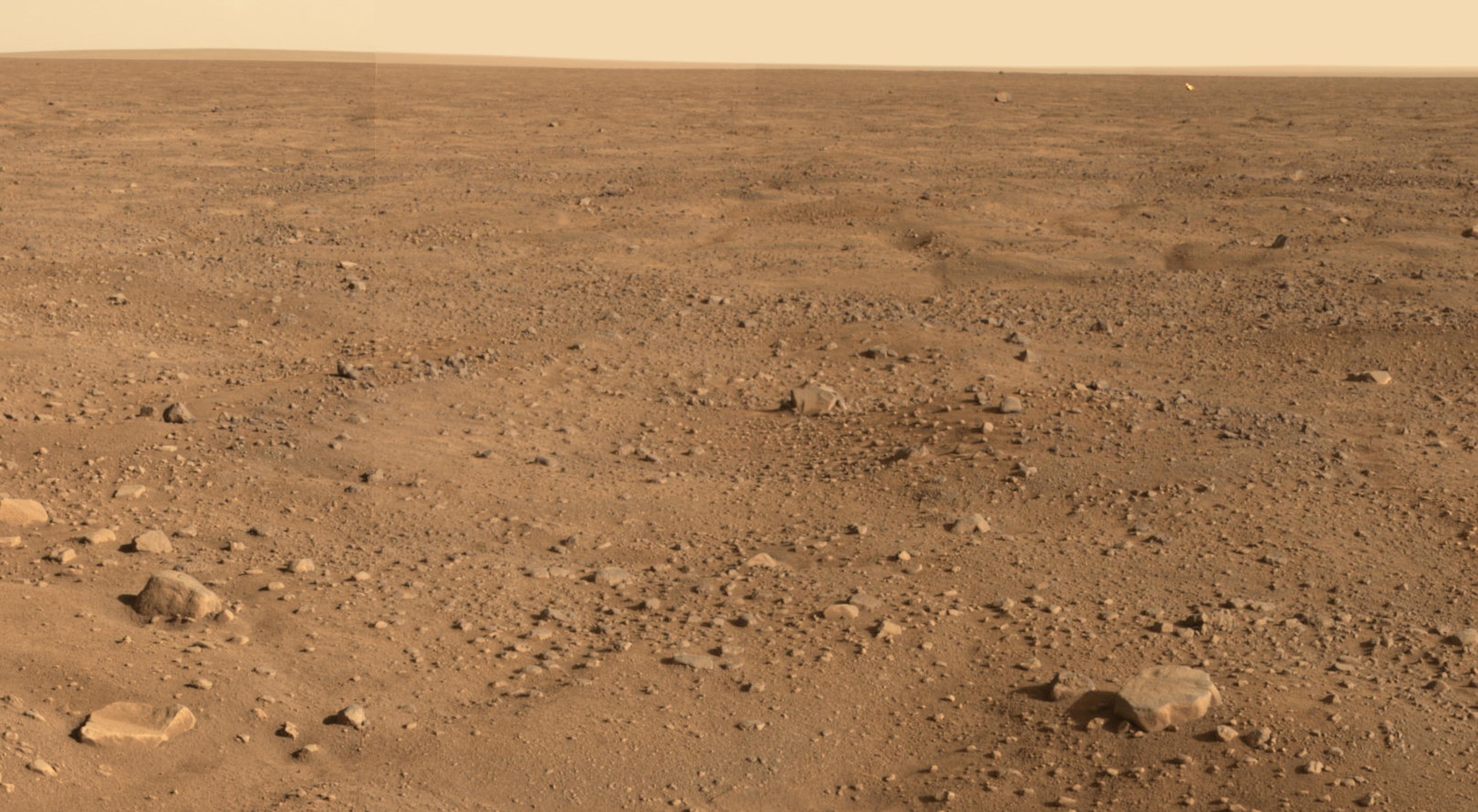
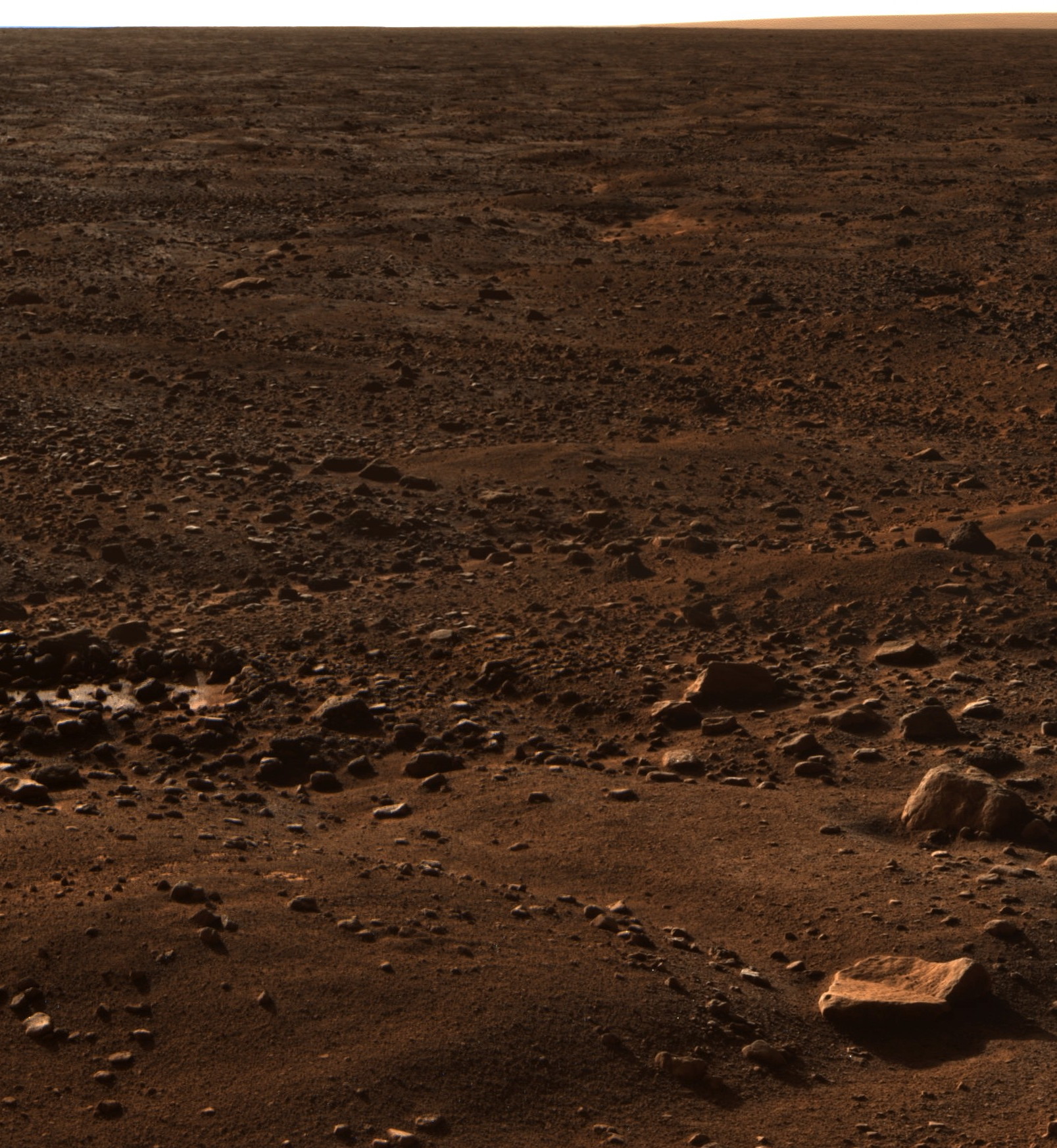
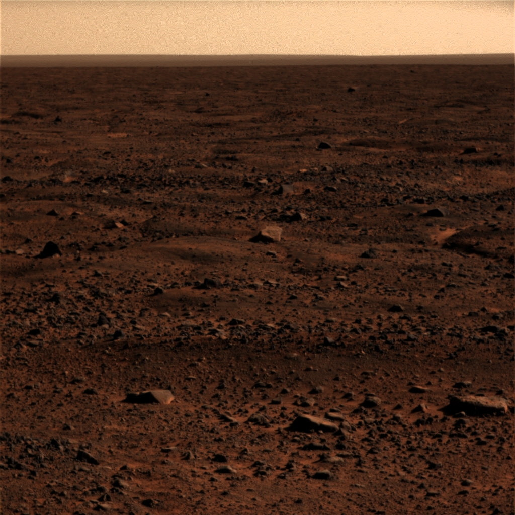
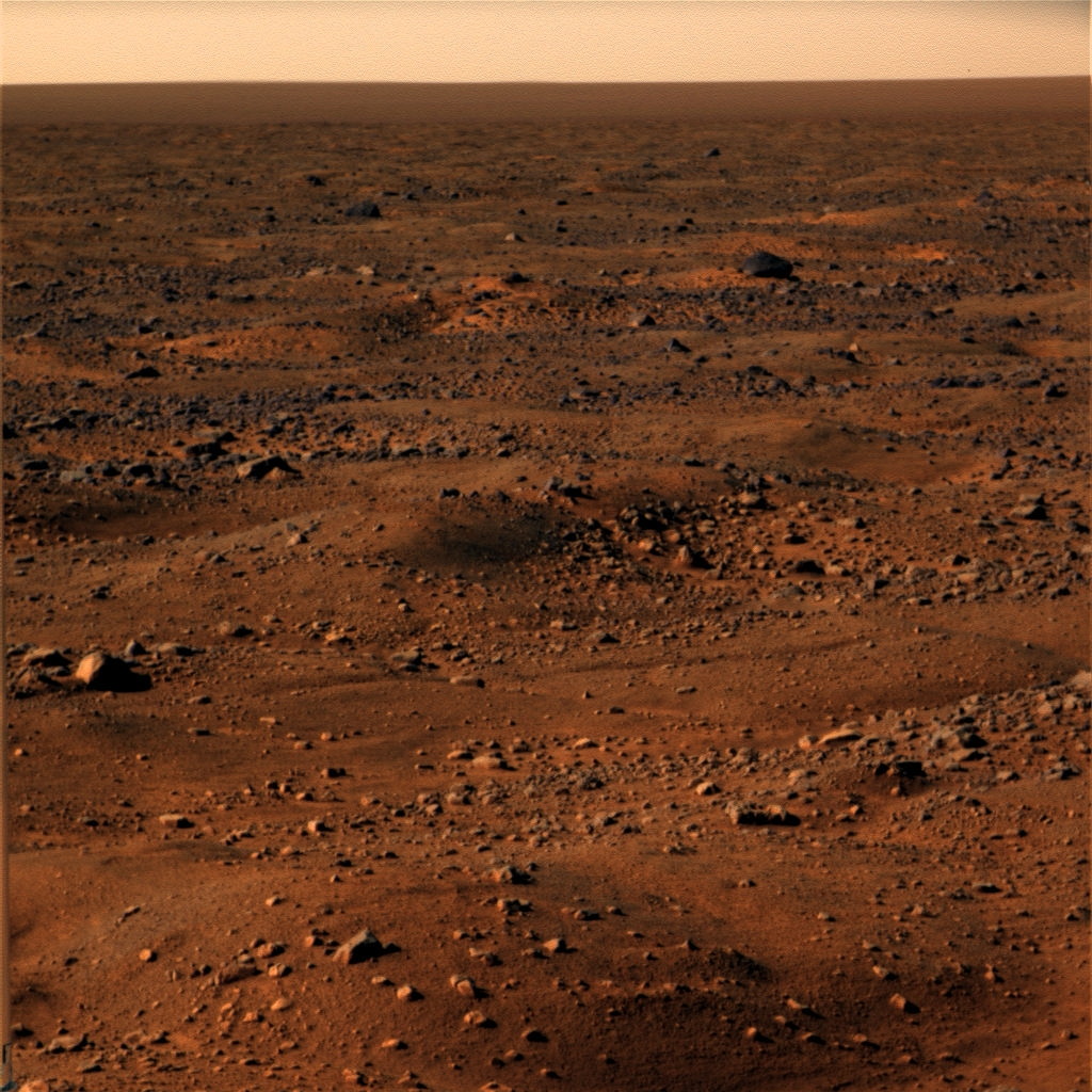
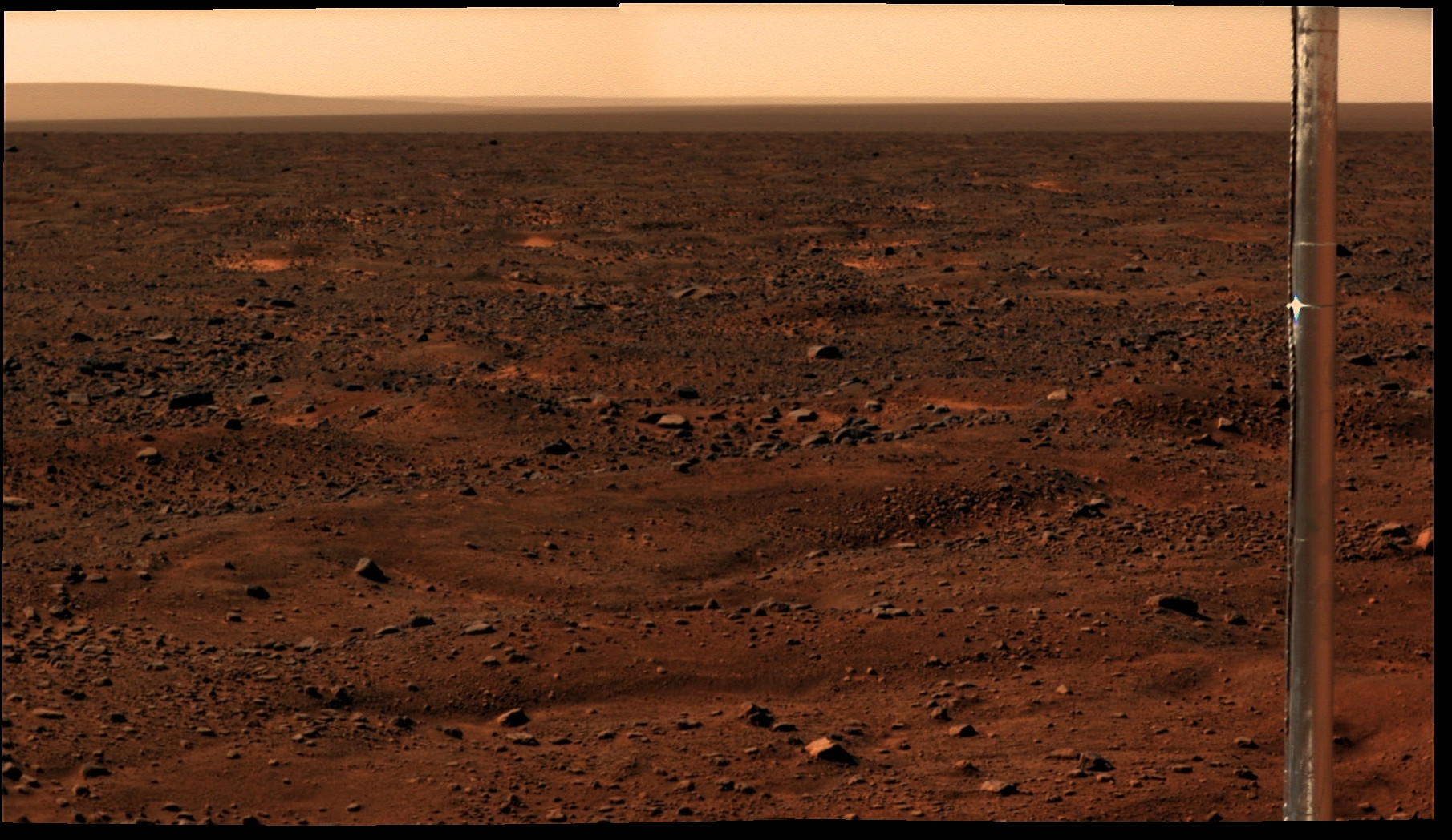
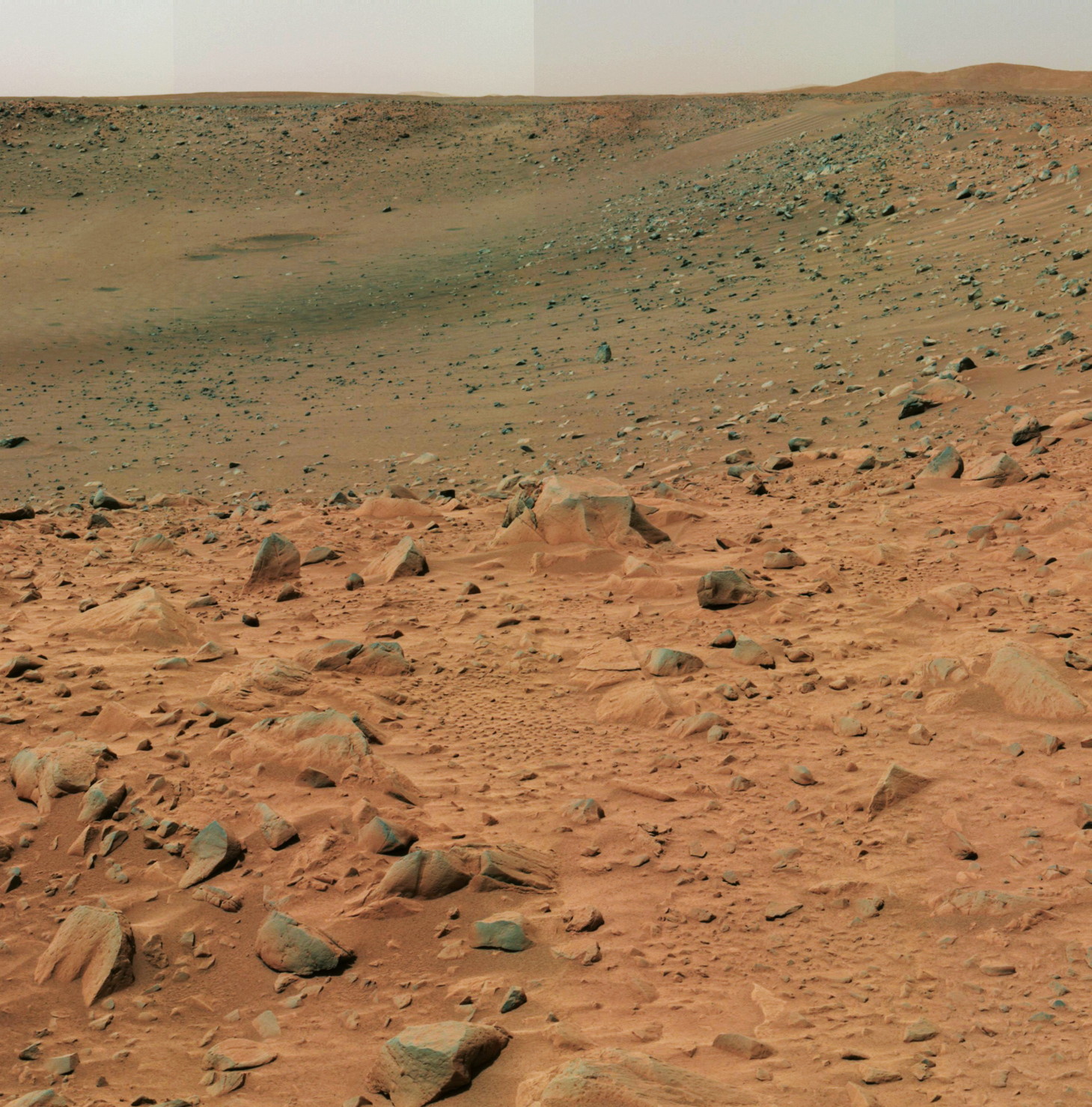
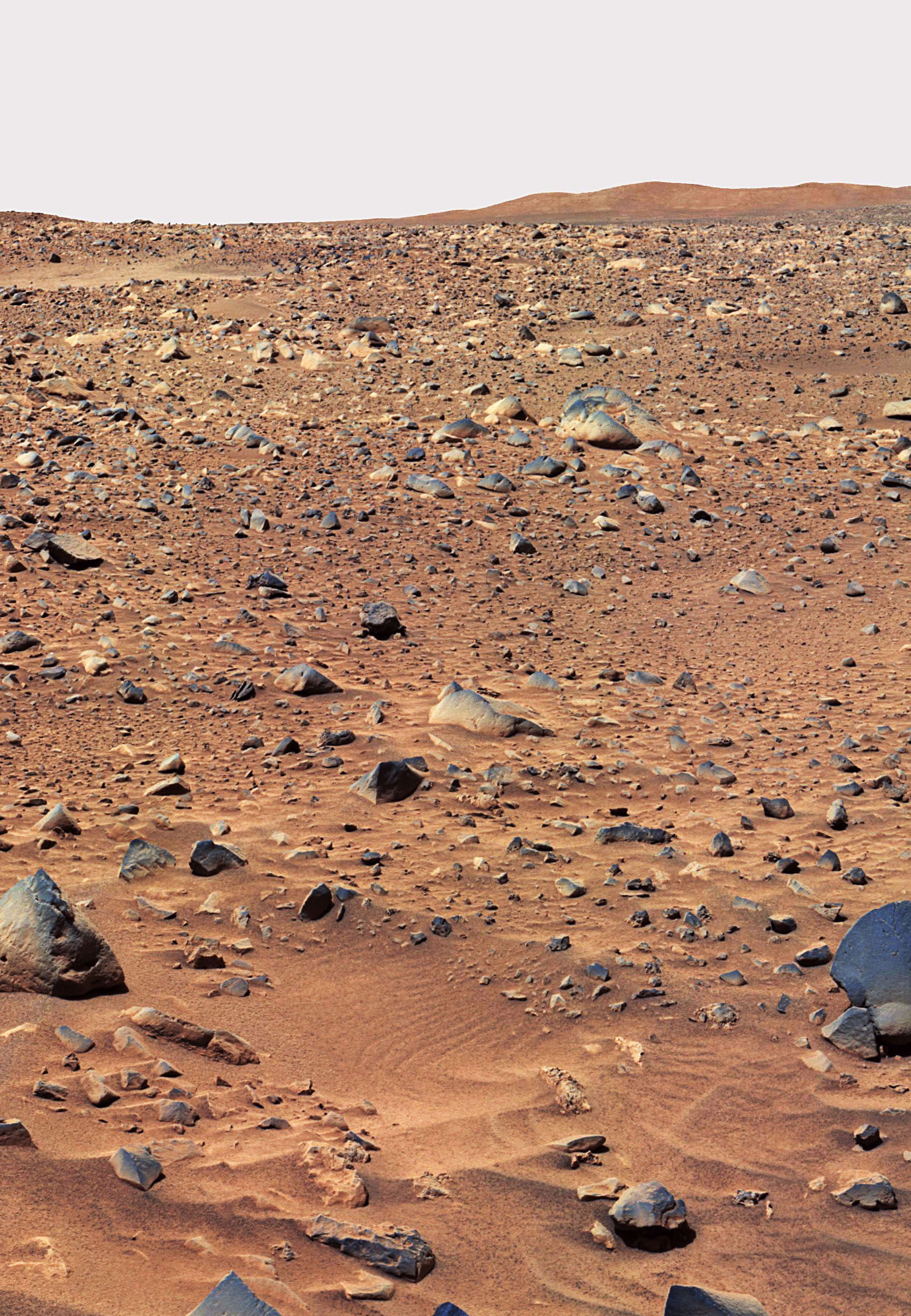
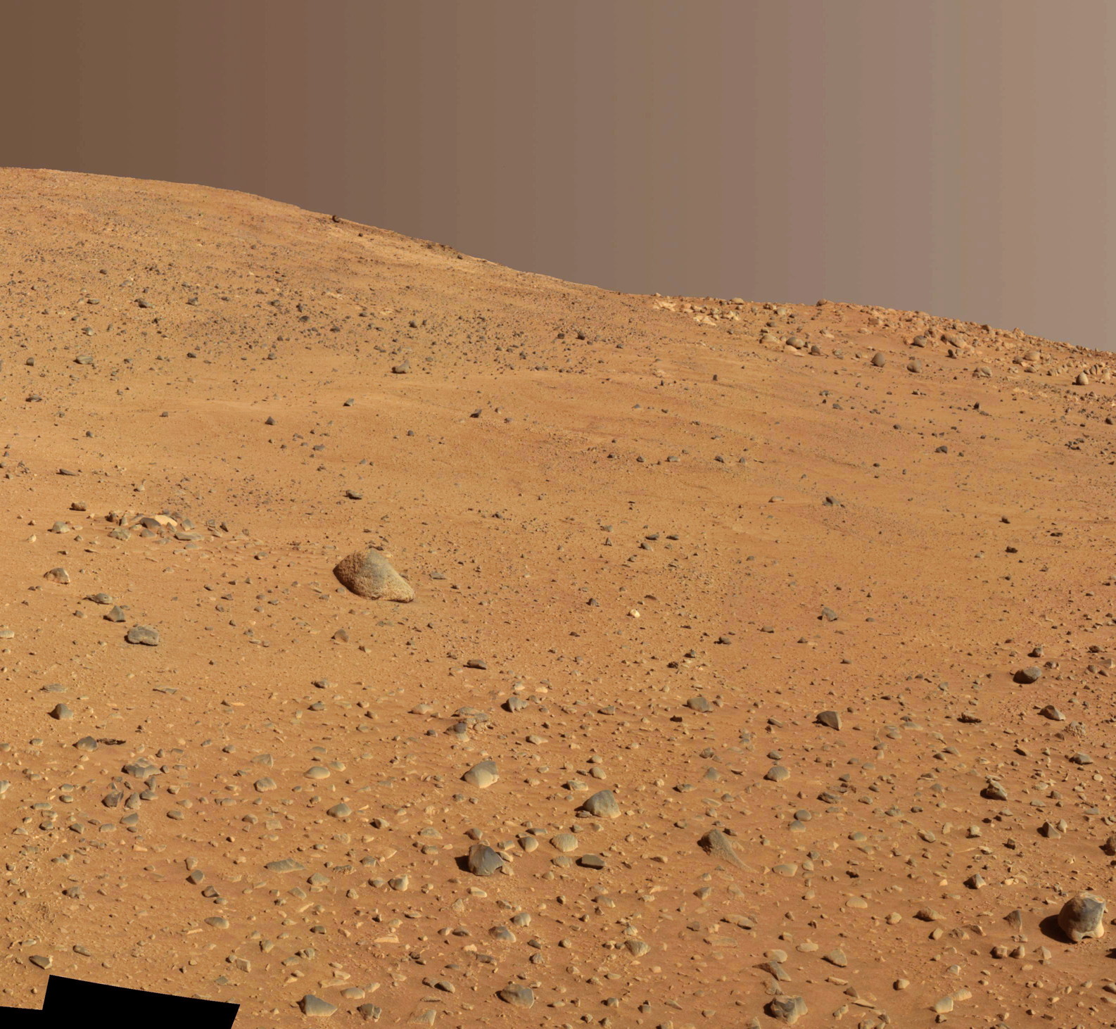
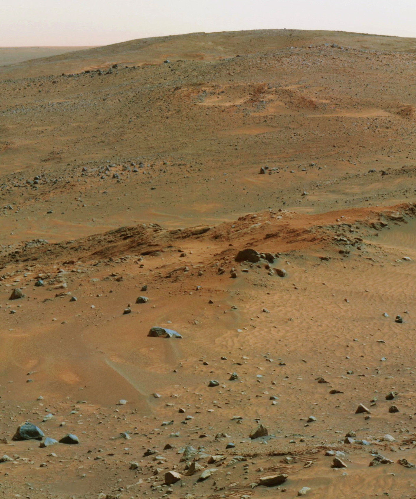
Documentation : Images from Mars (Edit)
| To download pictures : http://jeromejoy.org/files/imgmars/ (Pour télécharger l'intégralité des images) | Catalogs : — http://pdsimg.jpl.nasa.gov/Atlas/Atlas.html — http://photojournal.jpl.nasa.gov/targetFamily/Mars — http://www.jpl.nasa.gov/spaceimages/search_grid.php?category=mars — http://www.jpl.nasa.gov/spaceimages/ — http://grin.hq.nasa.gov/ — http://nssdc.gsfc.nasa.gov/planetary/chronology.html |
Articles connexes / Related Articles:
- PAYSAGES DE MARS (Mars Landscapes) (Essay) — lire/read
- MARS MICROPHONE (Essay) — [soon]
- Images from planets and satellites (Documentation images) — [soon]
| (Cliquez sur les images pour les agrandir. À partir d'une image agrandie, vous pouvez activer le diaporama en cliquant à droite ou à gauche de l'image) ( / Click pictures to enlarge. From an enlarged picture, you can use the slideshow feature by clicking on the right-side or left-side of the picture) |
- MAVEN (2013)
- (Launch date : November 18, 2013)
- — (USA). The Mars Atmosphere and Volatile EvolutioN (MAVEN) mission is designed to explore Mars' upper atmosphere and ionosphere, and interactions with the solar wind, specifically to determine the loss of volatile compounds to space through time and how it has affected the history of Mars' atmosphere and climate. MAVEN has four primary scientific objectives: (1) Determine the role that loss of volatiles from the Mars atmosphere to space has played through time; (2) determine the current state of the upper atmosphere, ionosphere, and interactions with the solar wind; (3) determine the current rates of escape of neutral gases and ions to space and the processes controlling them; and, (4) determine the ratios of stable isotopes that will tell Mars' history of loss through time. MAVEN is part of NASA's Mars Scout program. It is scheduled to reach Mars on 22 September 2014. At Mars it will go into a 4.5 hour science orbit with an inclination of 75 degrees and a periapsis of 150 km. The nominal science mission will last 1 year and will include 5 "deep-dip" maneuvers during which the periapsis will be lowered to 125 km for 5-day periods.
- Mangalyaan (MOM Mars Orbiter Mission) (2013)
- (Launch date : November 5, 2013)
- — (India). The Mars Orbiter Mission (MOM) or Mangalyaan (Hindi for "Mars Craft") is designed to study Mars from orbit. The scientific objectives are to explore Mars' surface features, morphology, mineralogy, and atmosphere. To achieve these objectives, the spacecraft is equipped with five scientific instruments and will nominally spend 6-10 months orbiting and making measurements at Mars. After a 300-day cruise an orbital insertion burn on 24 September 2014 will put the spacecraft in an elliptical 76.7-hour Mars orbit, 366 x 80,000 km with an inclination of 150 degrees. The nominal mission is planned for 6-10 months at Mars.
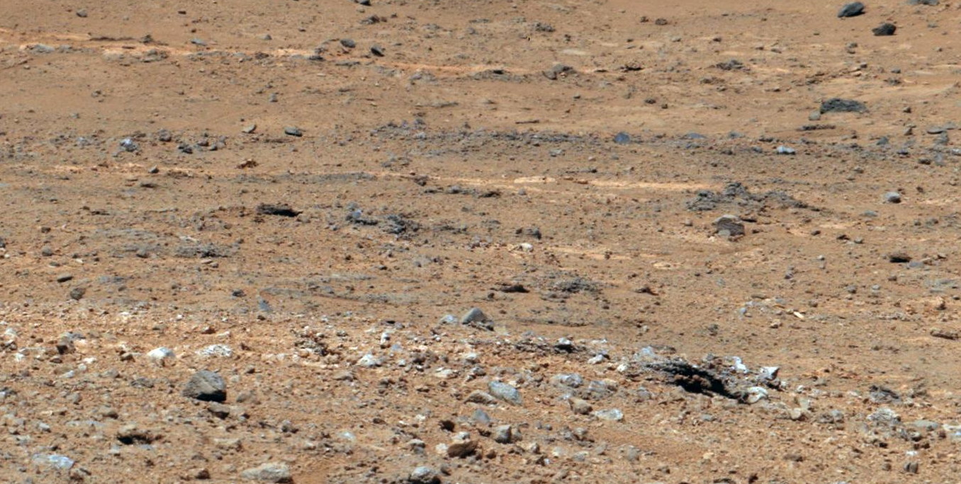
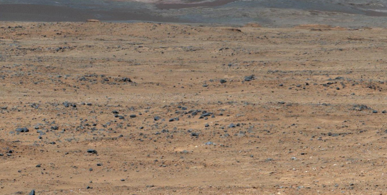
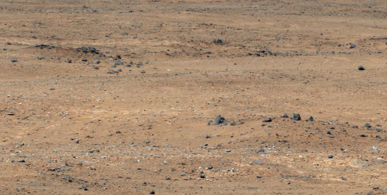
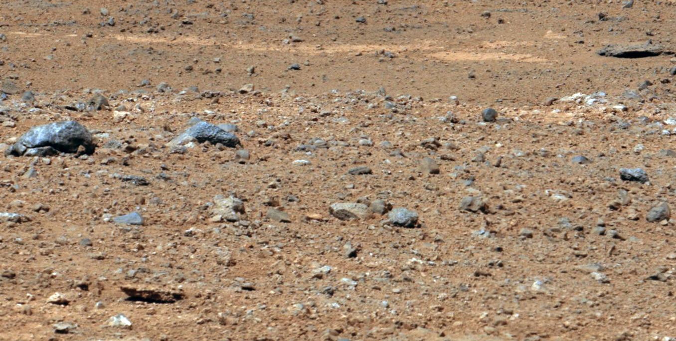
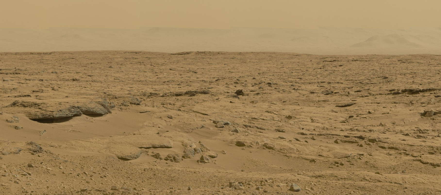
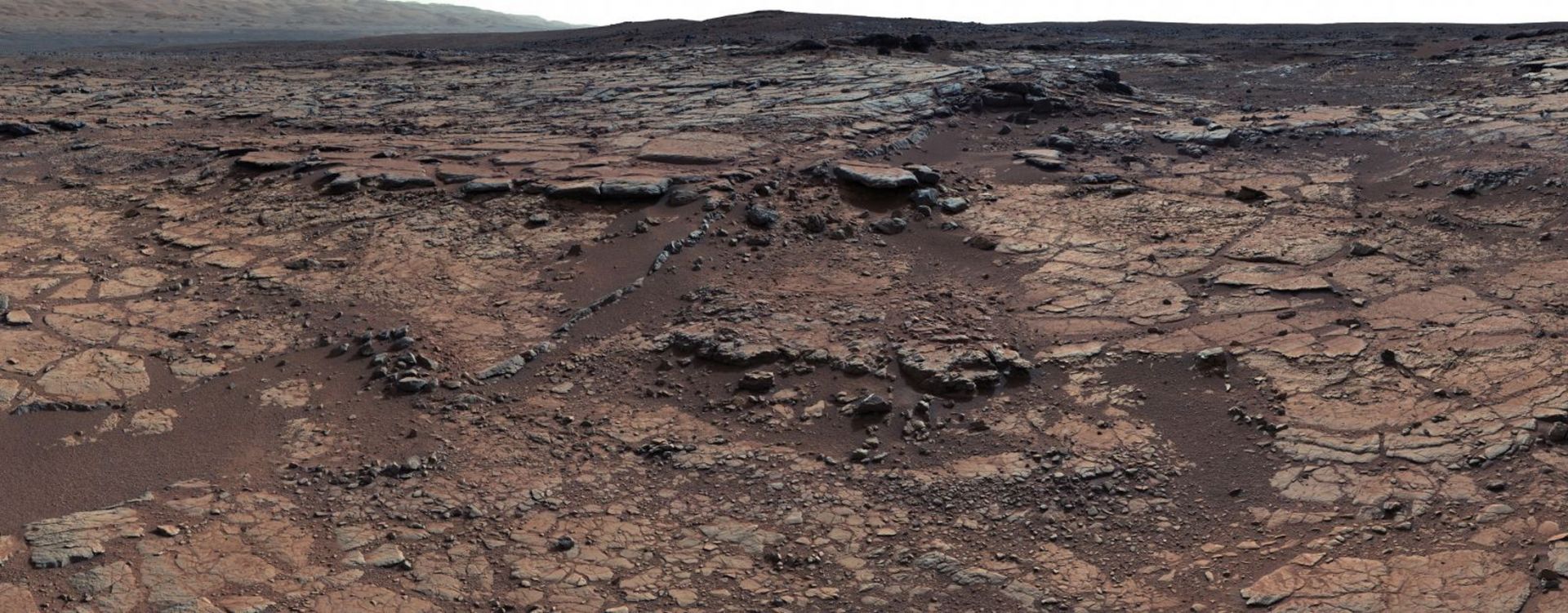
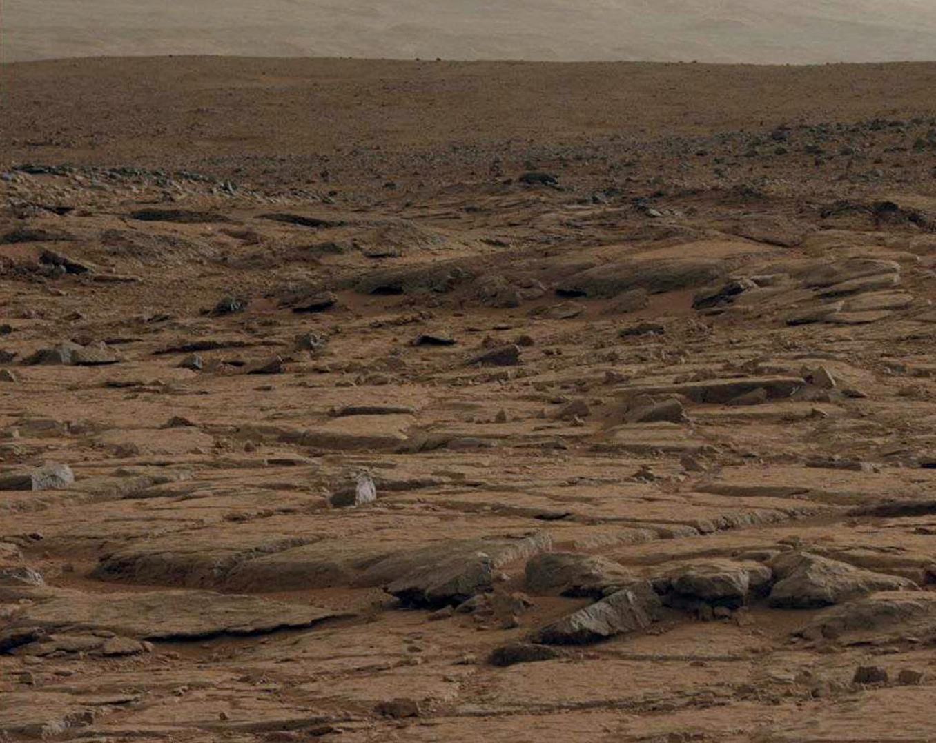
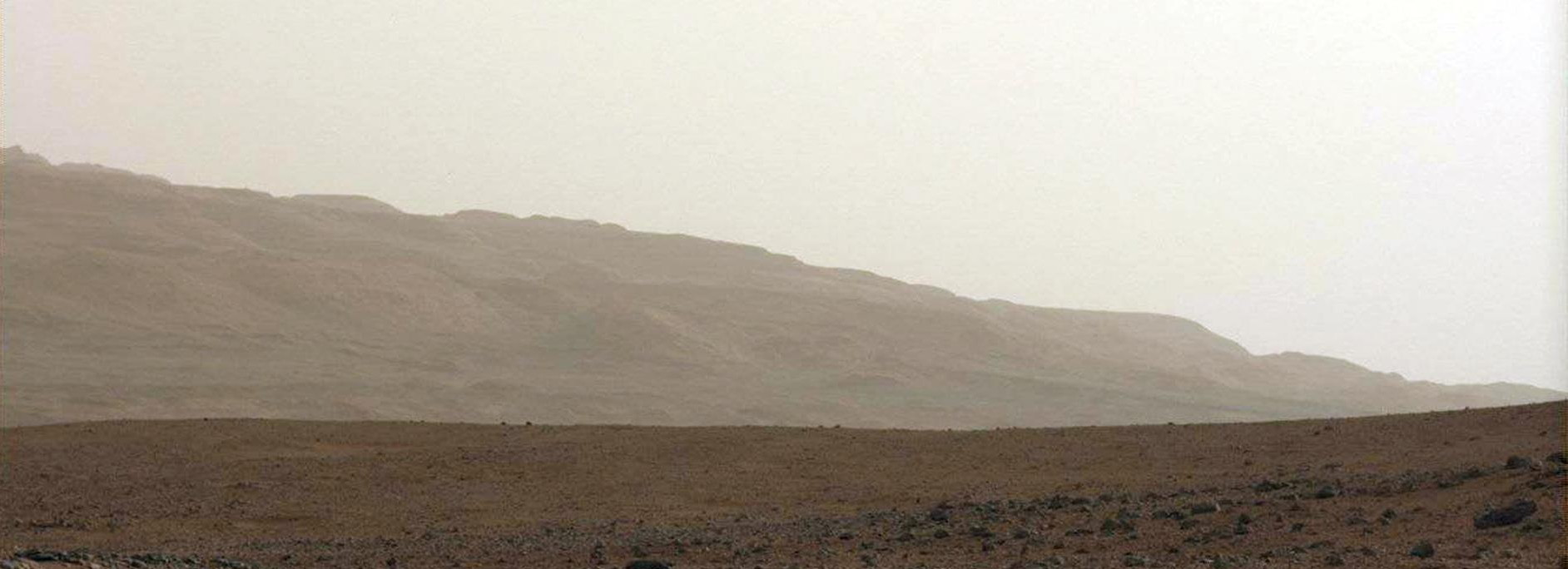
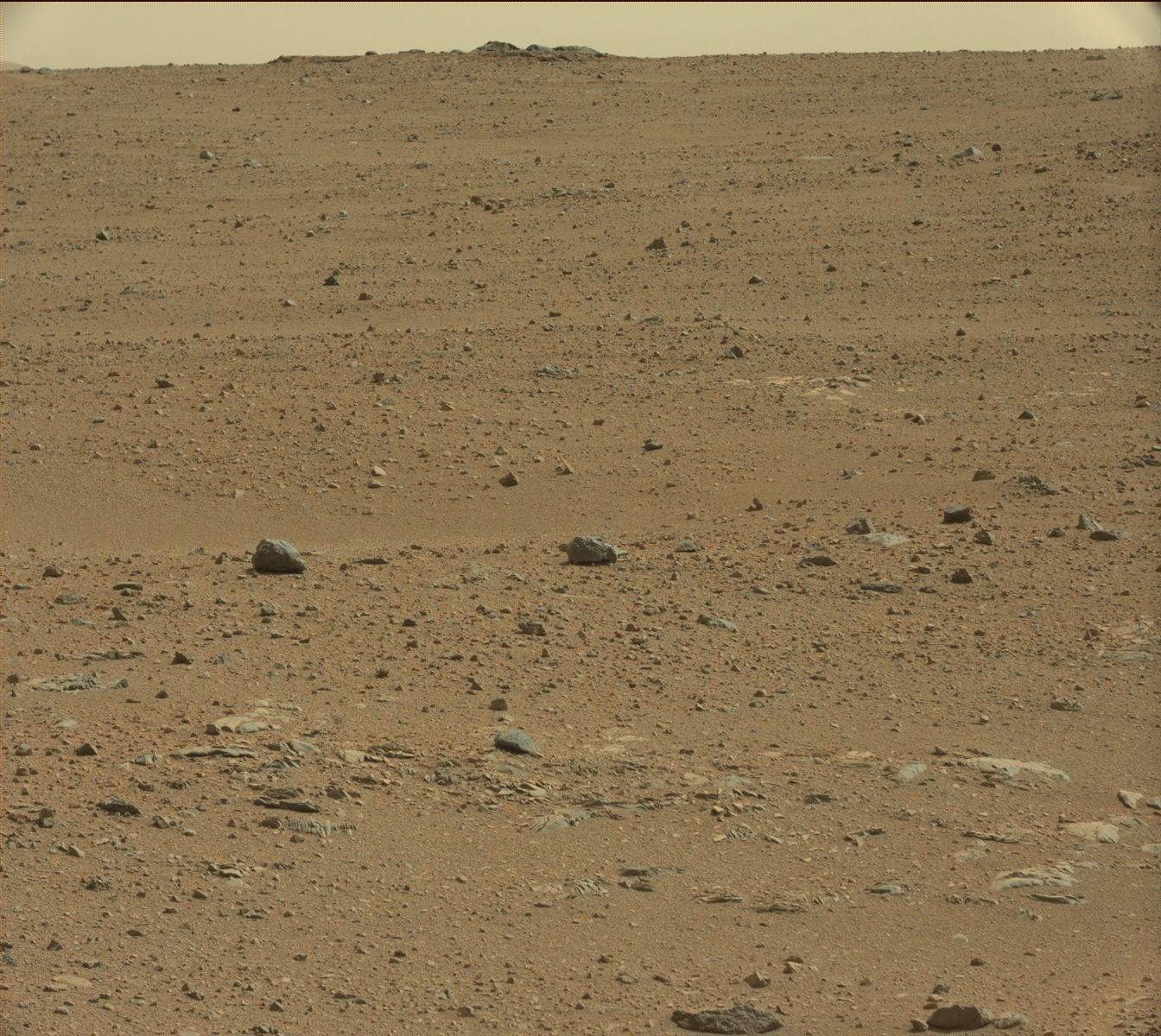
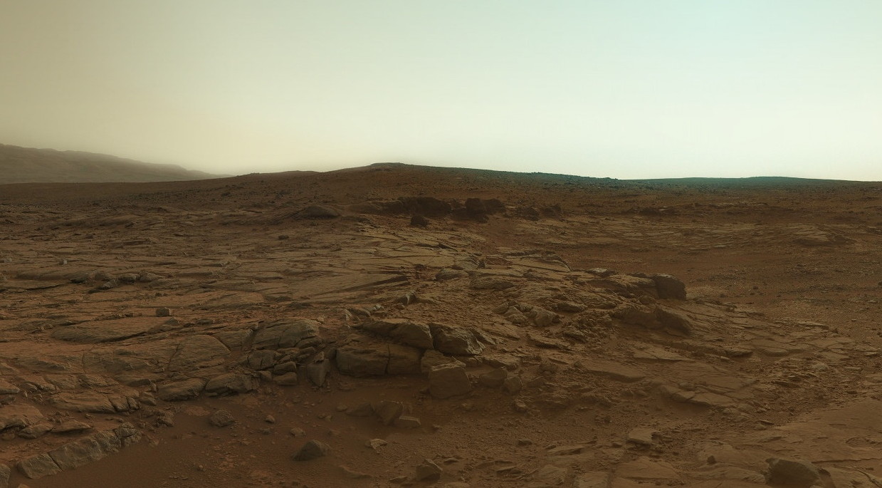
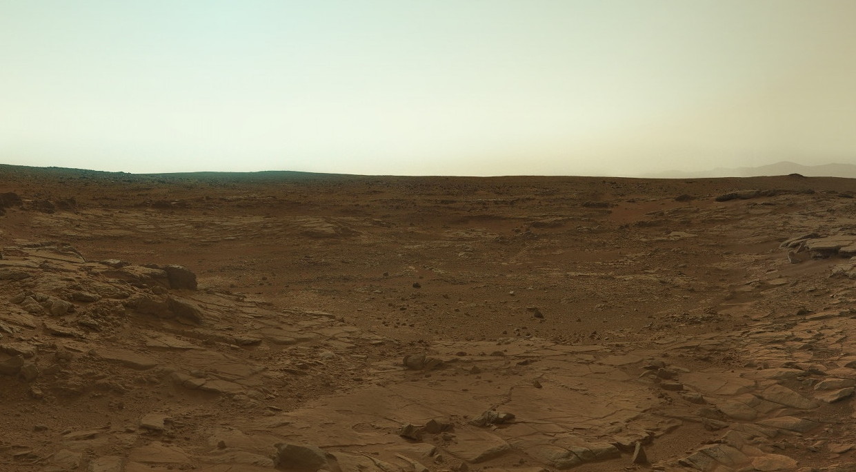
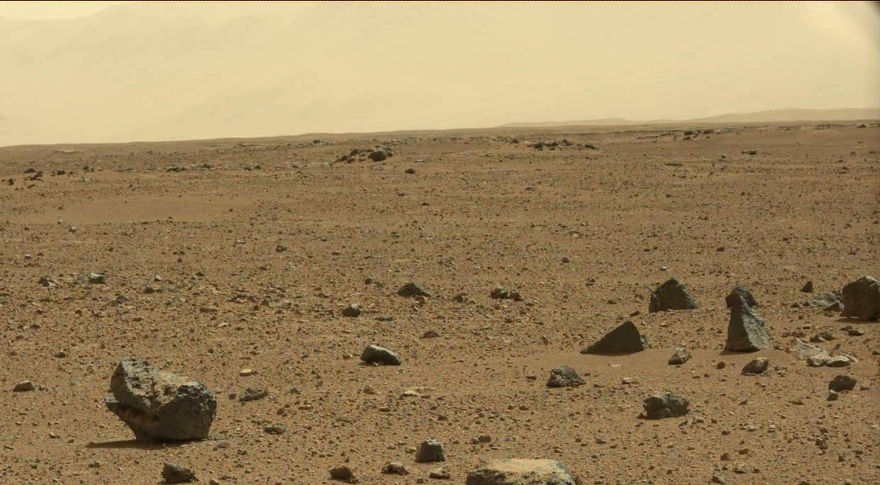
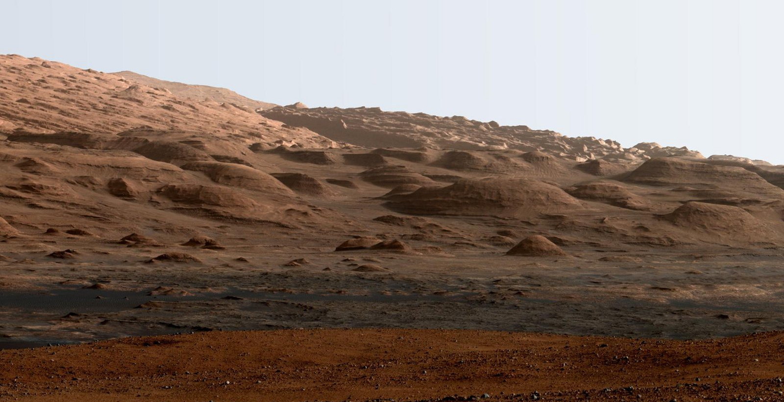
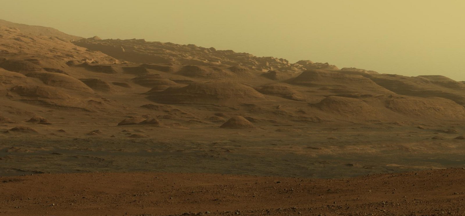
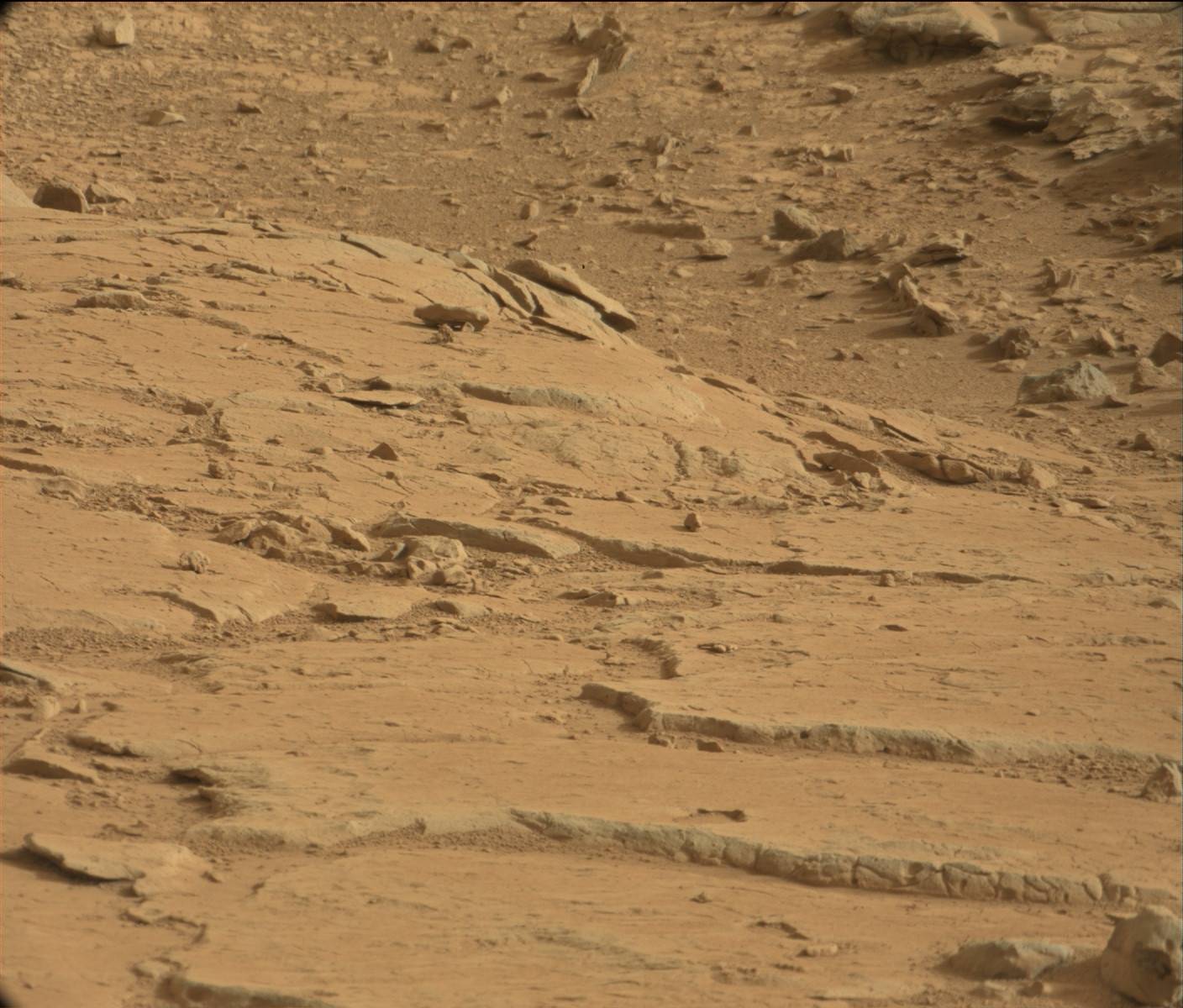
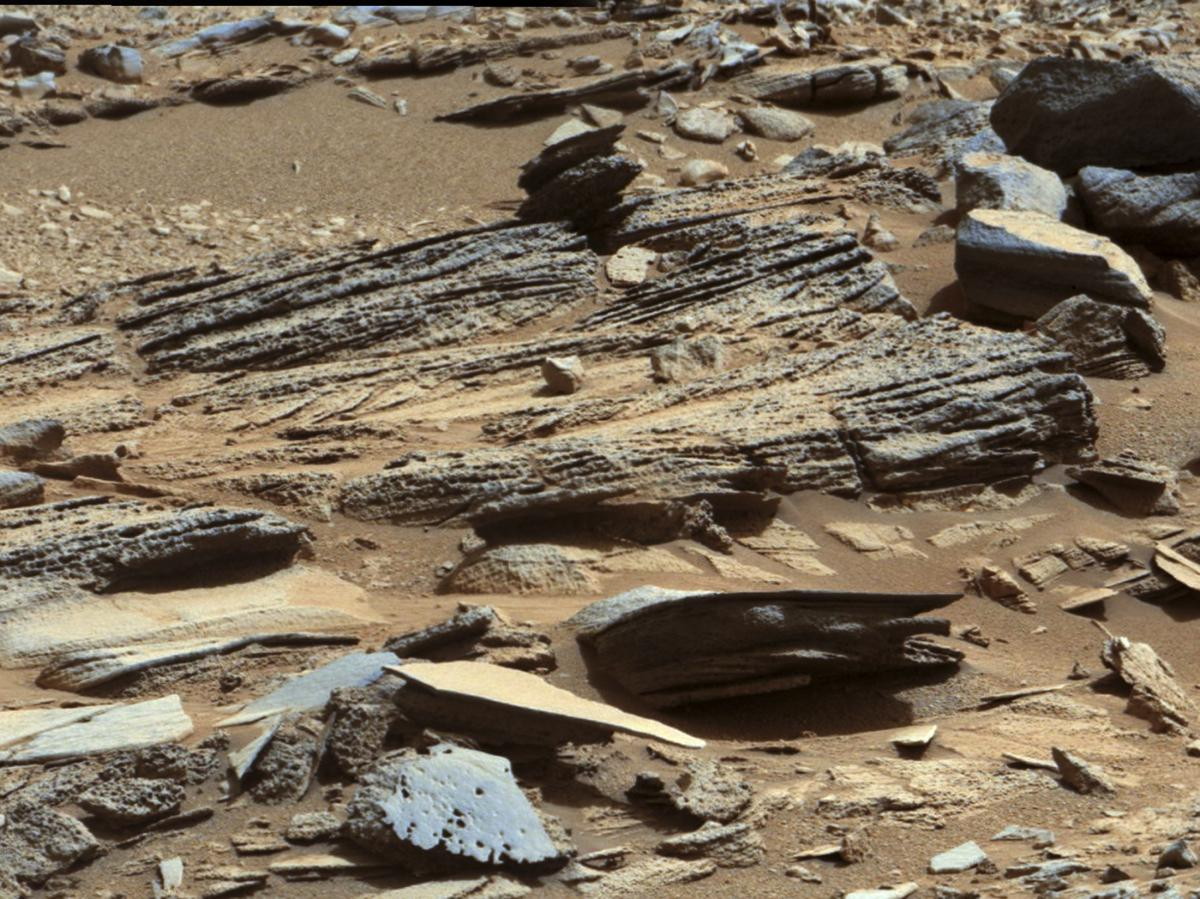
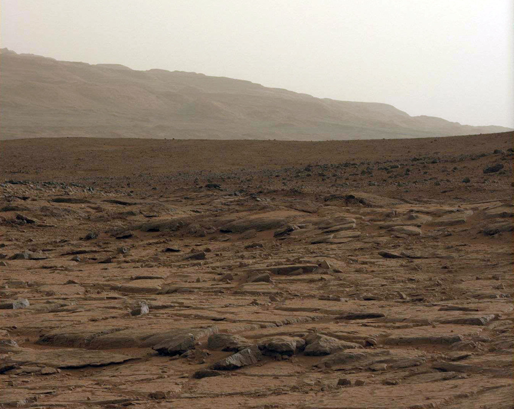
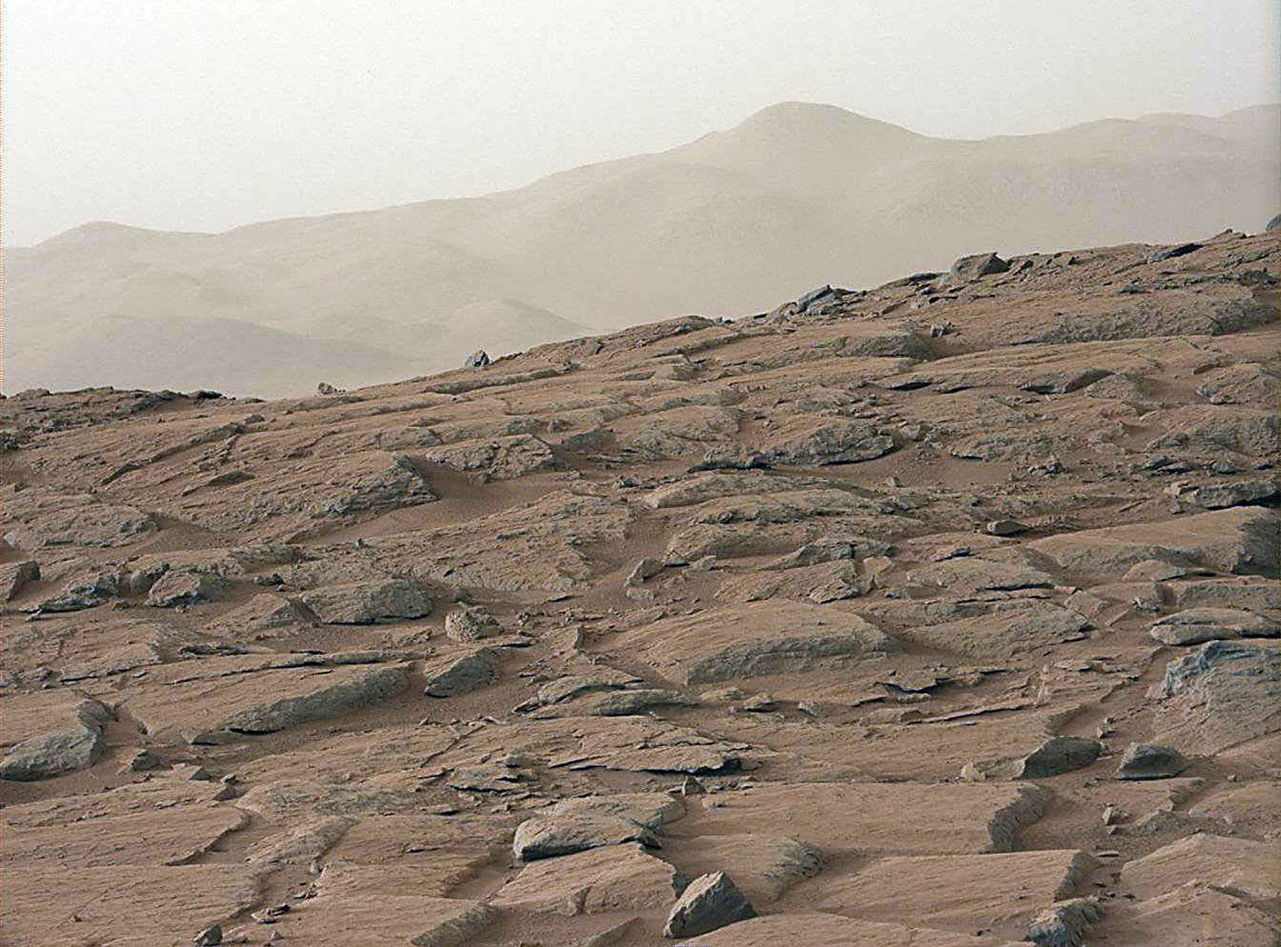
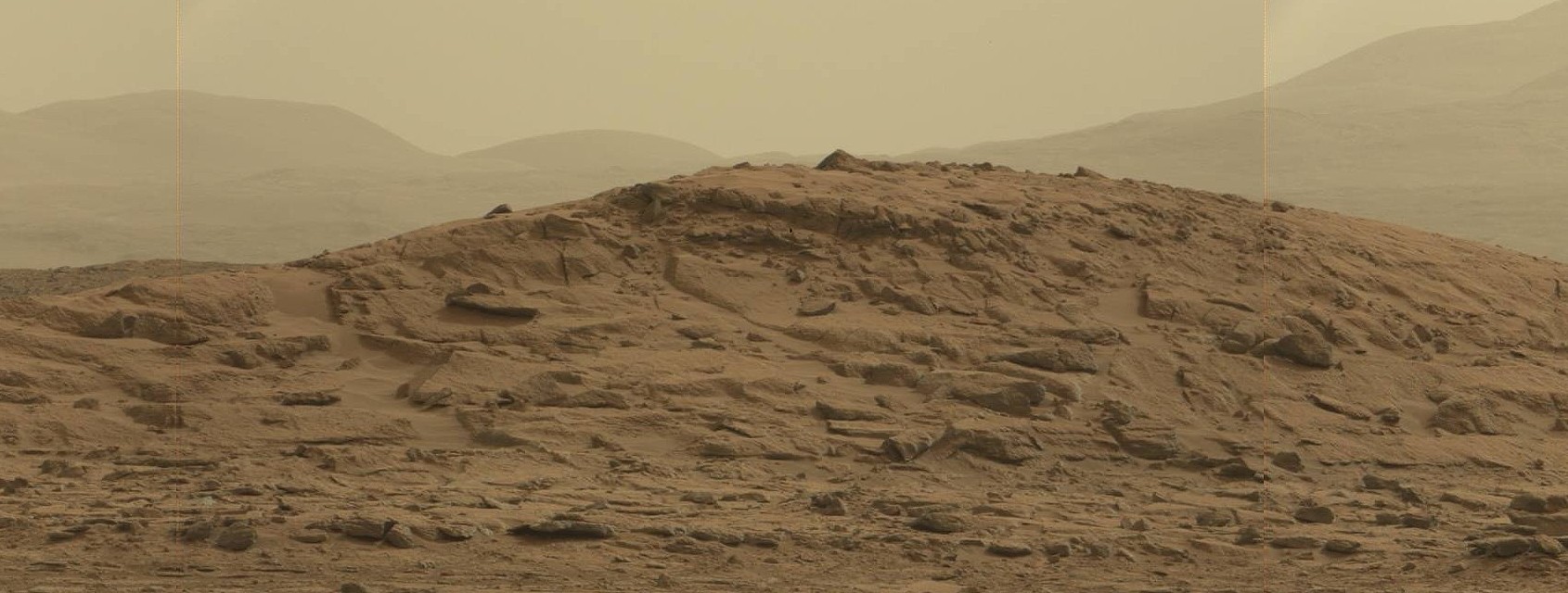
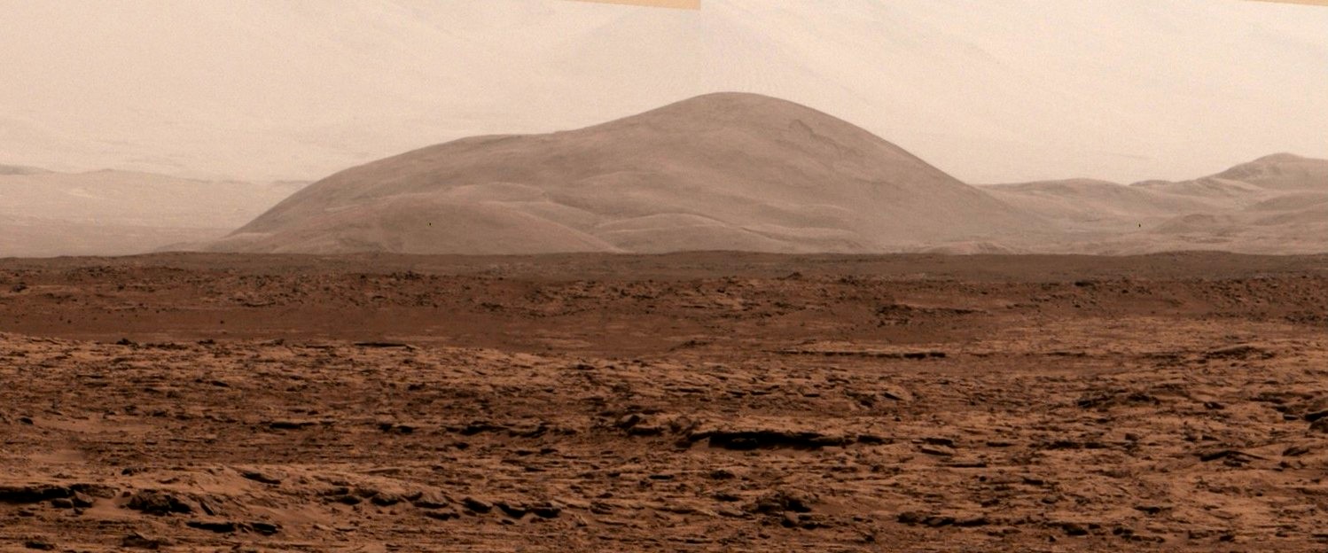
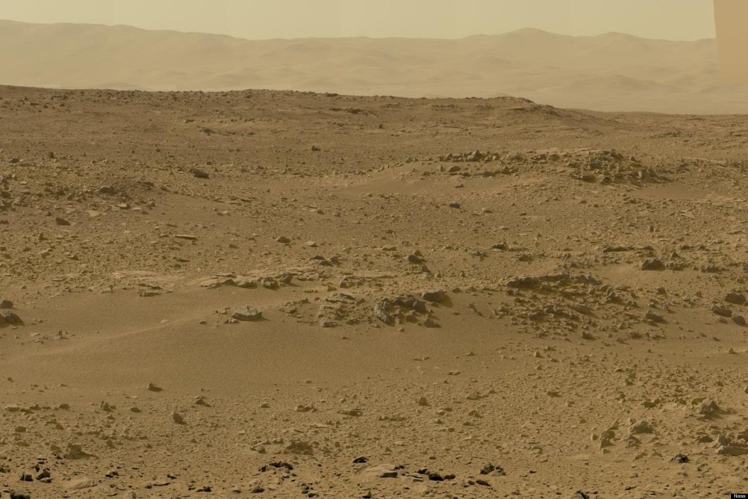
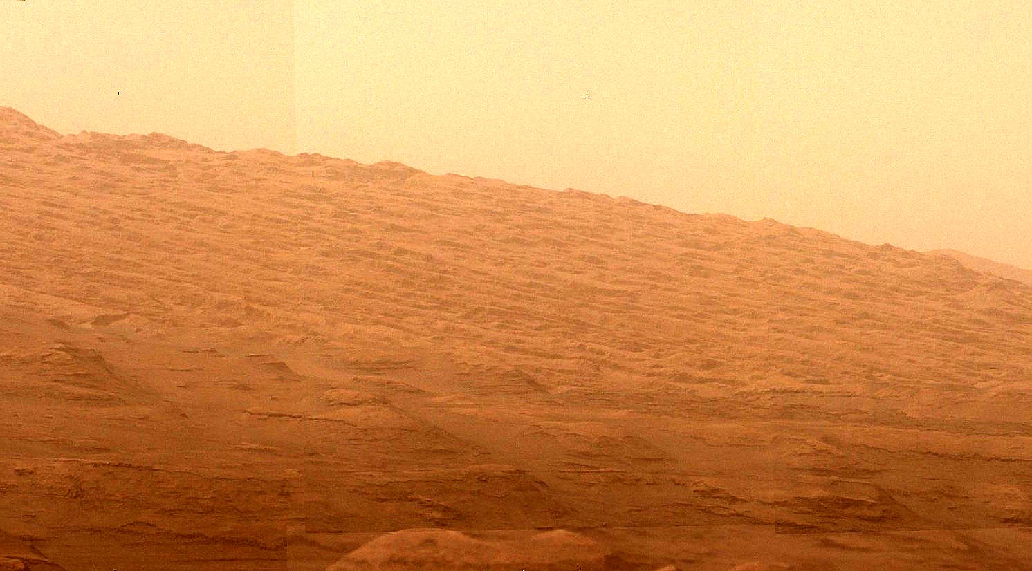
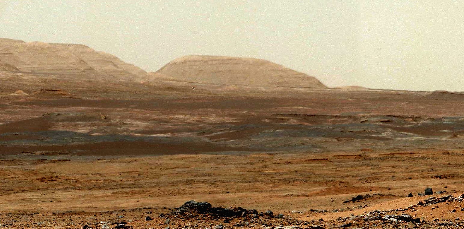
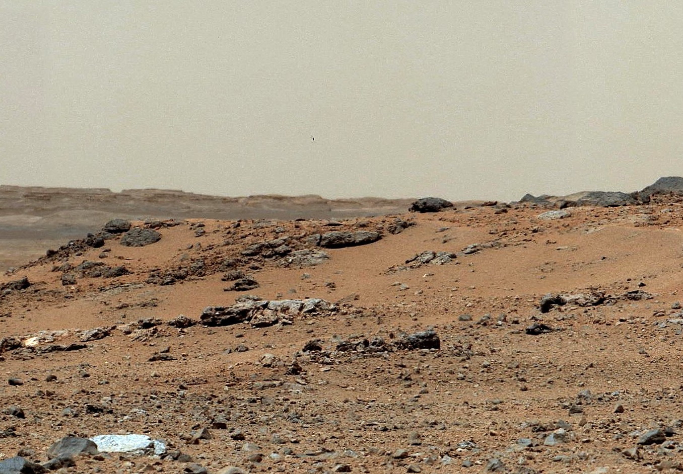
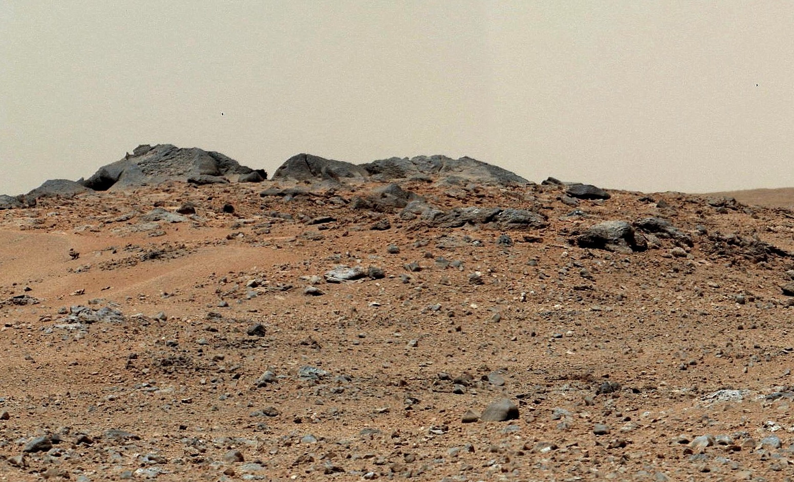
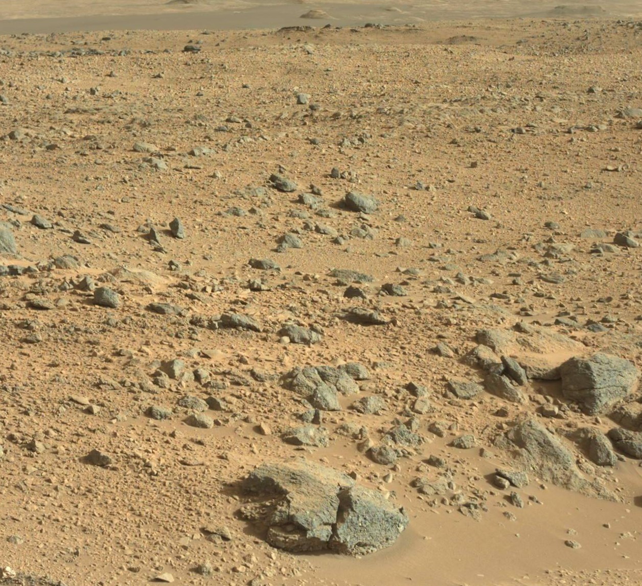
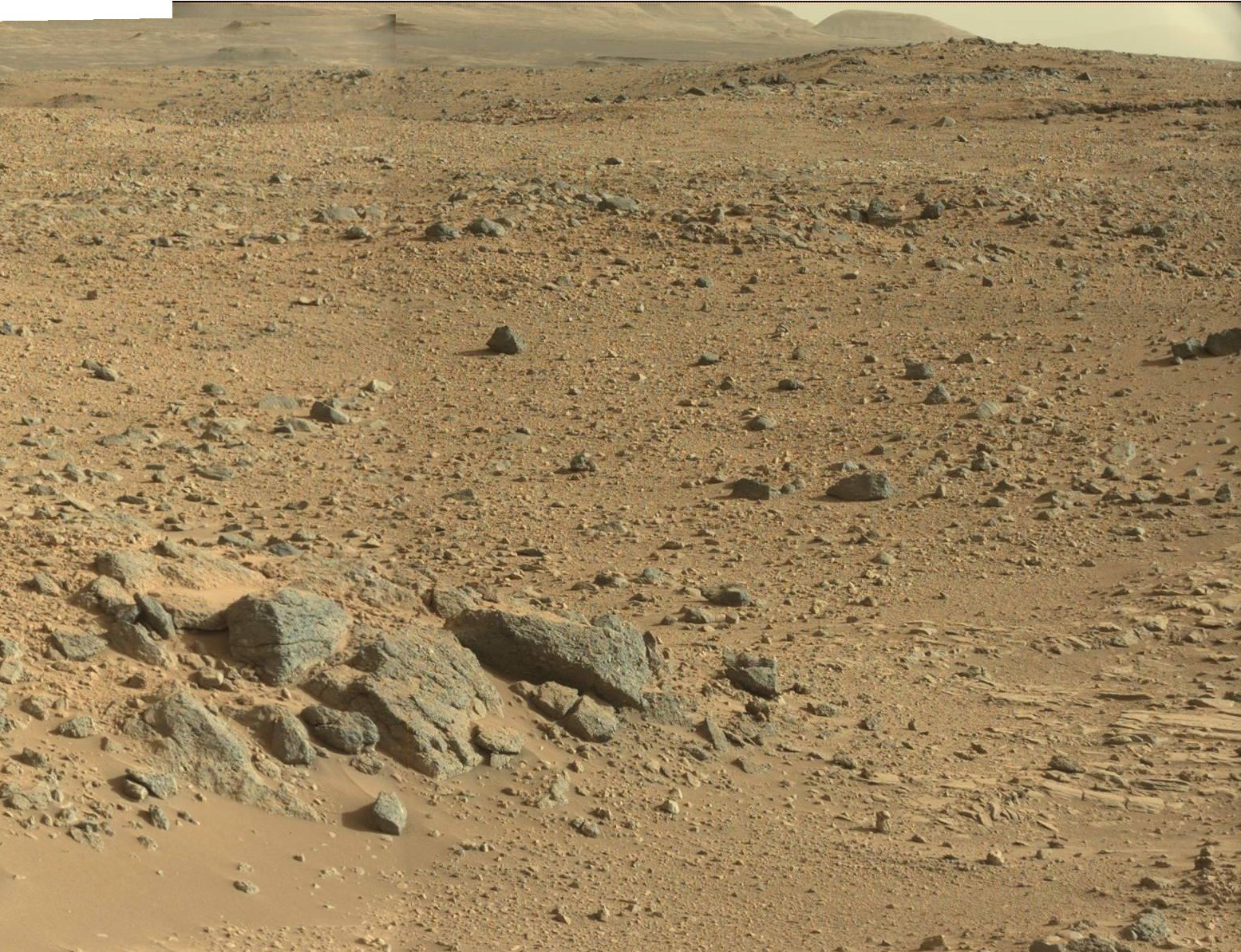
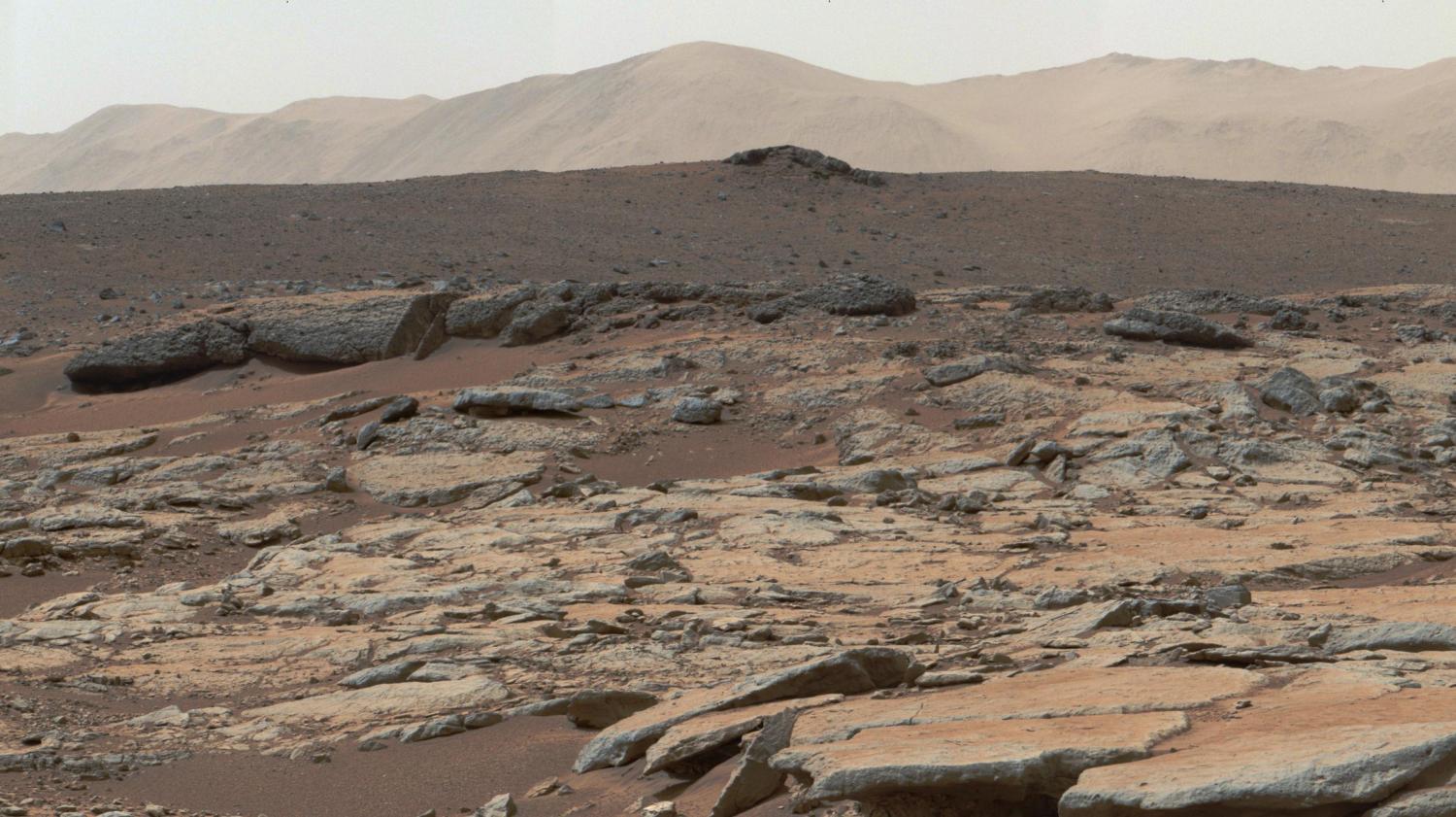
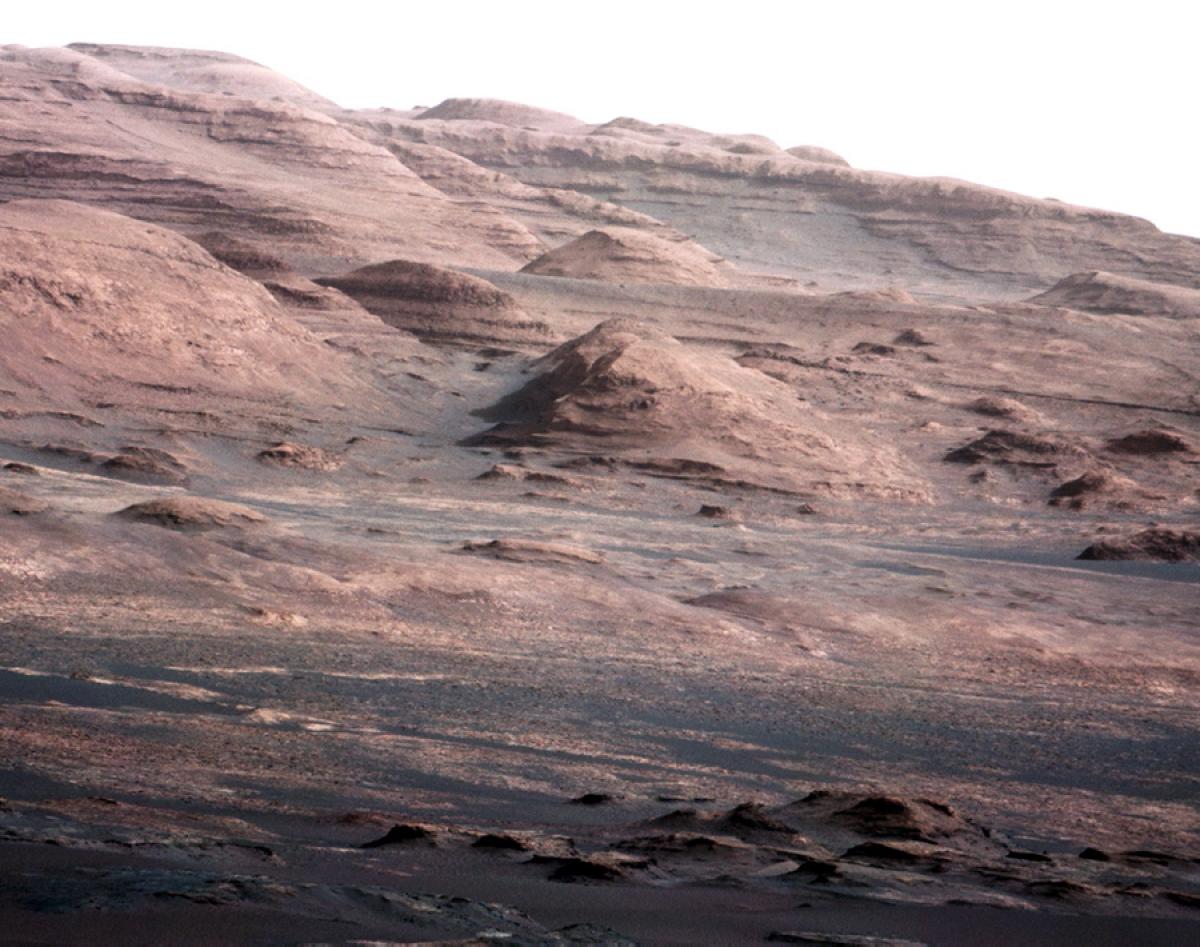
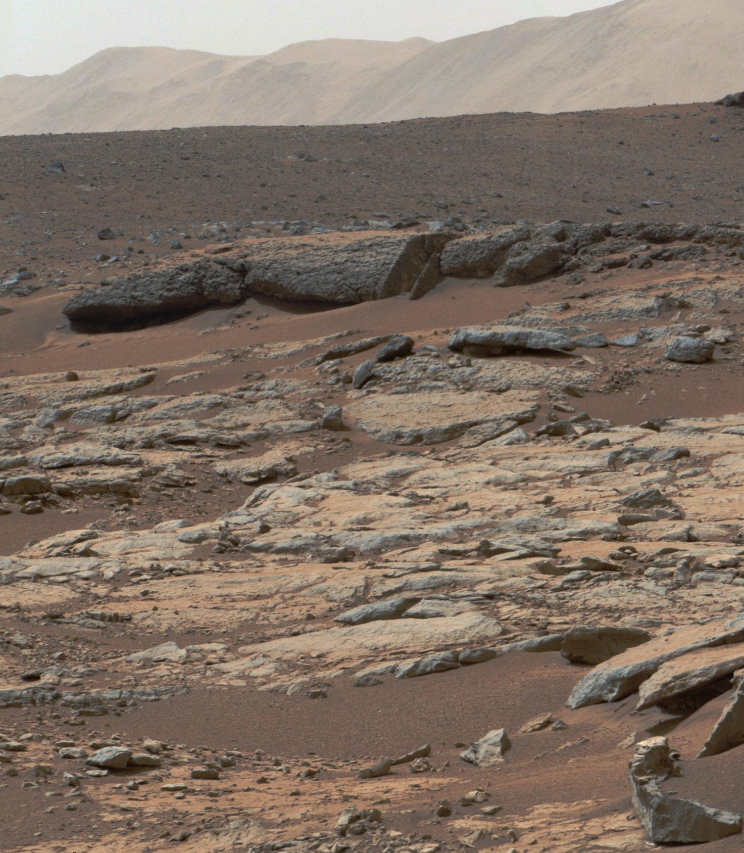
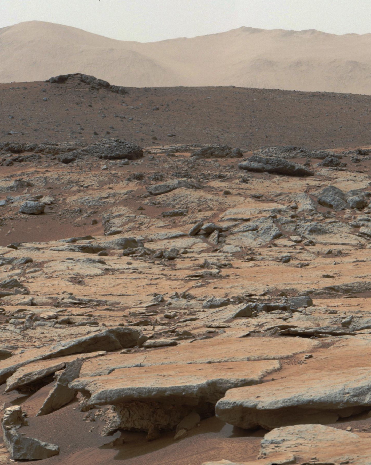
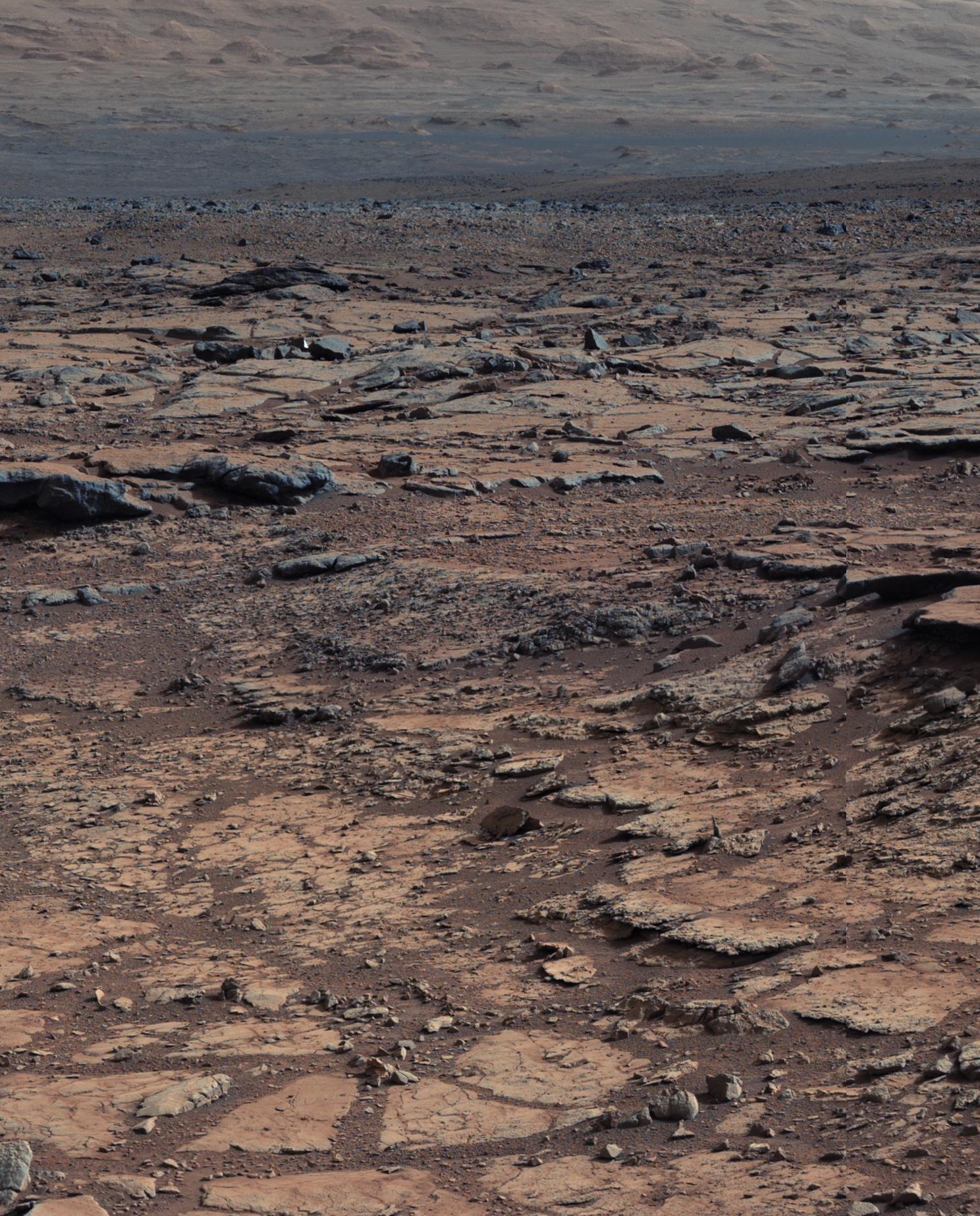
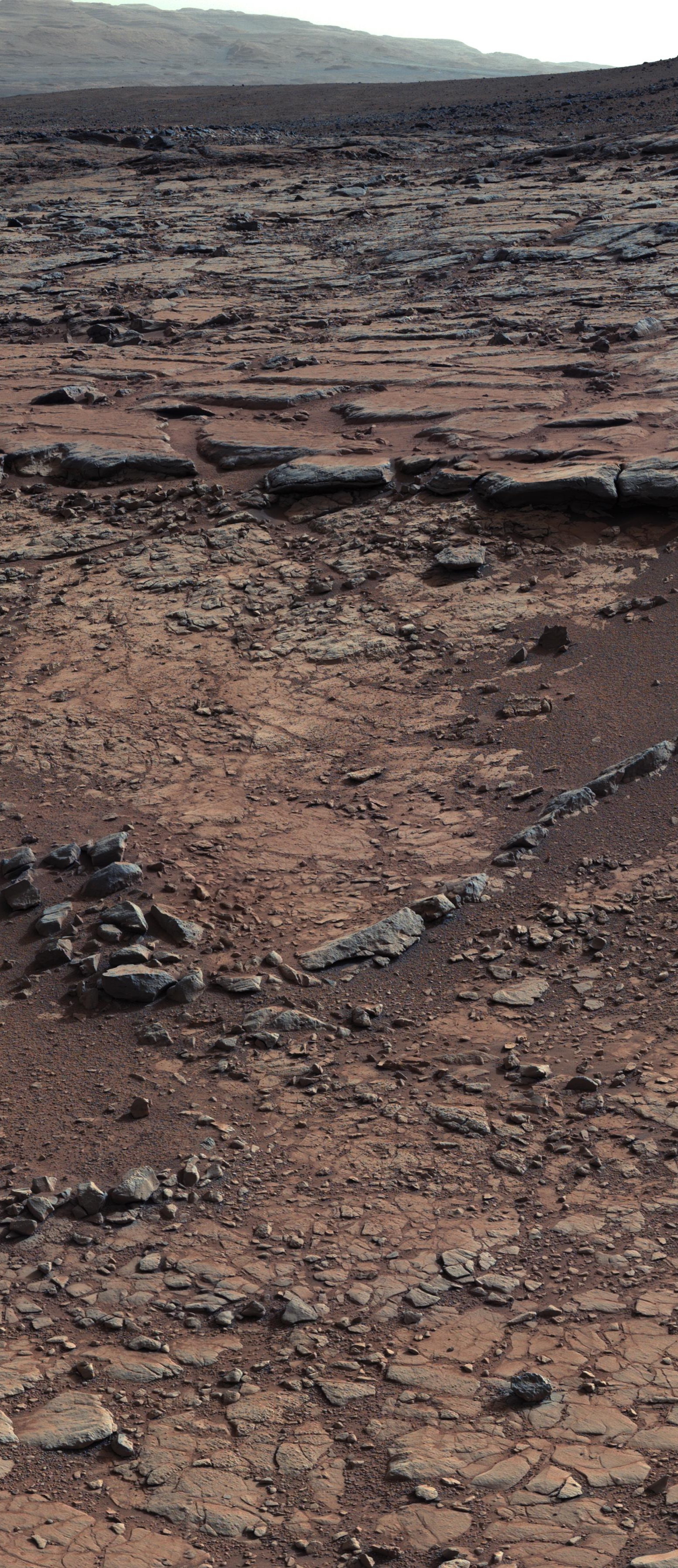
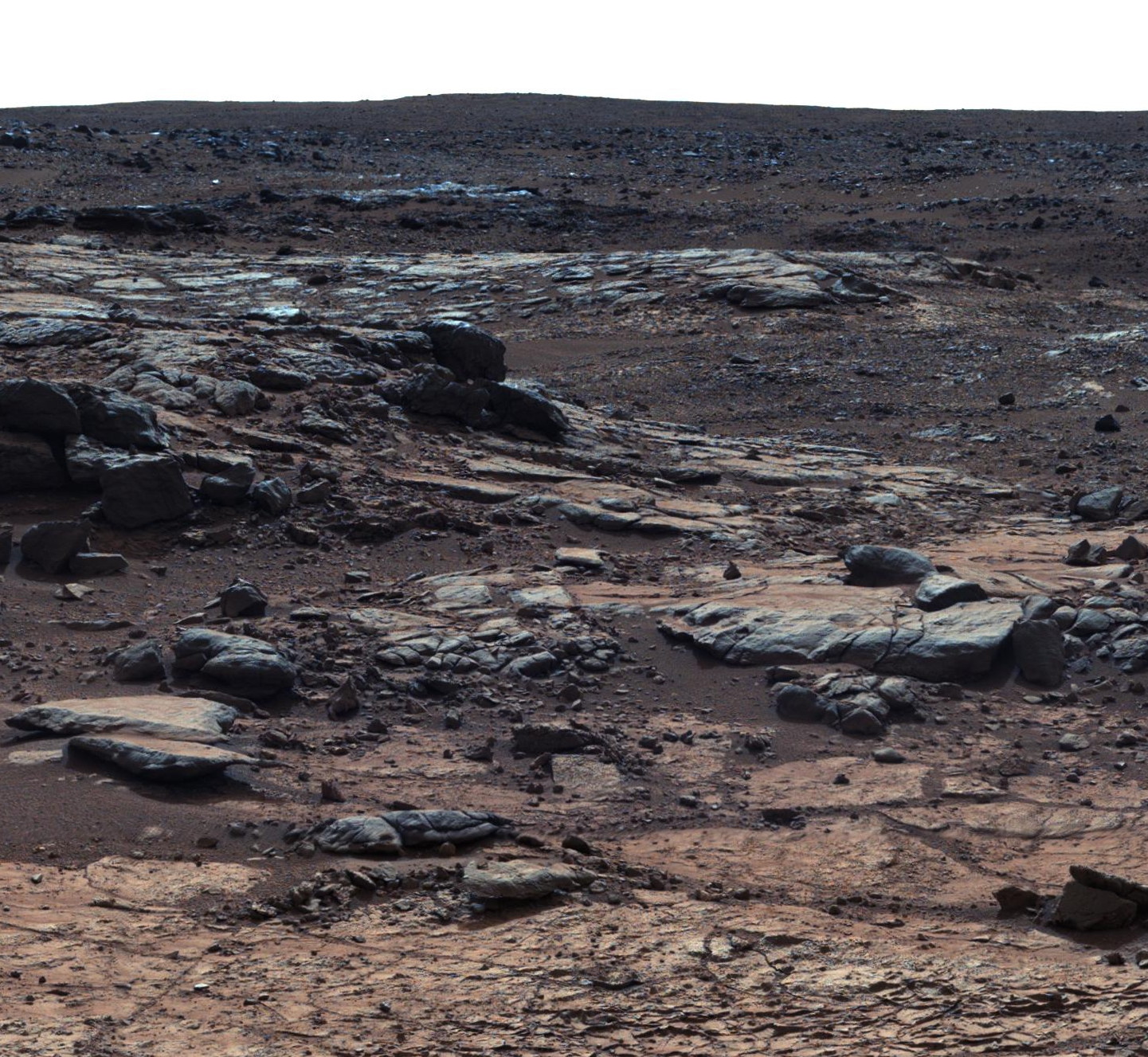
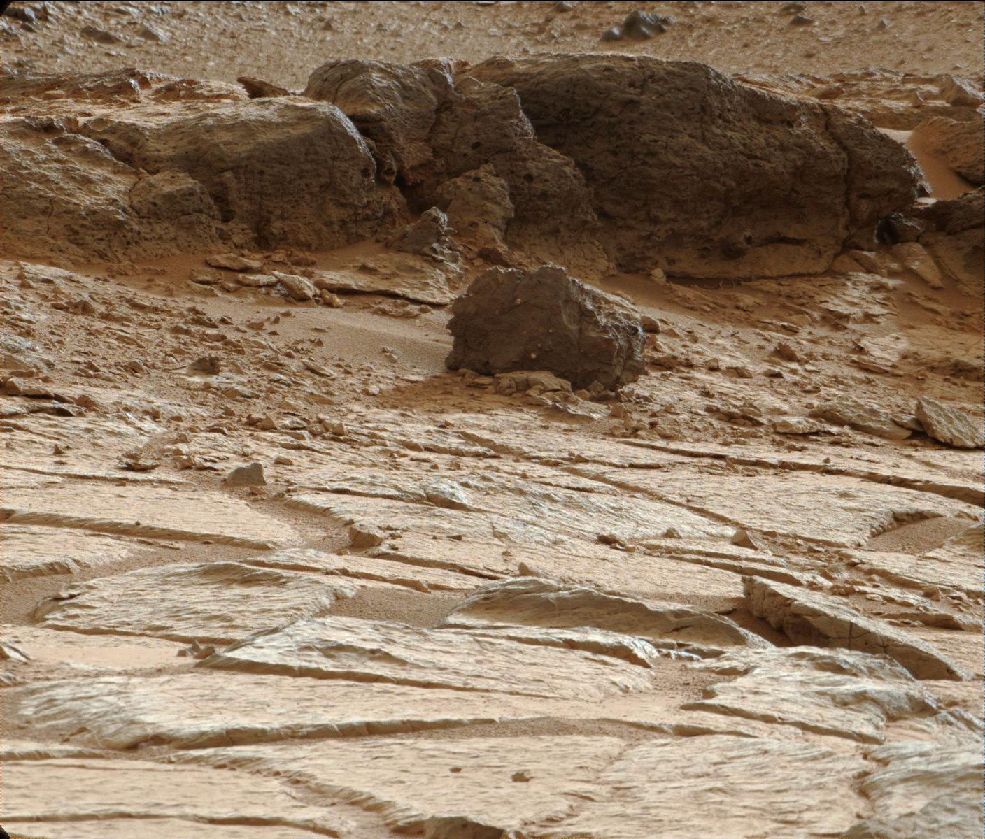
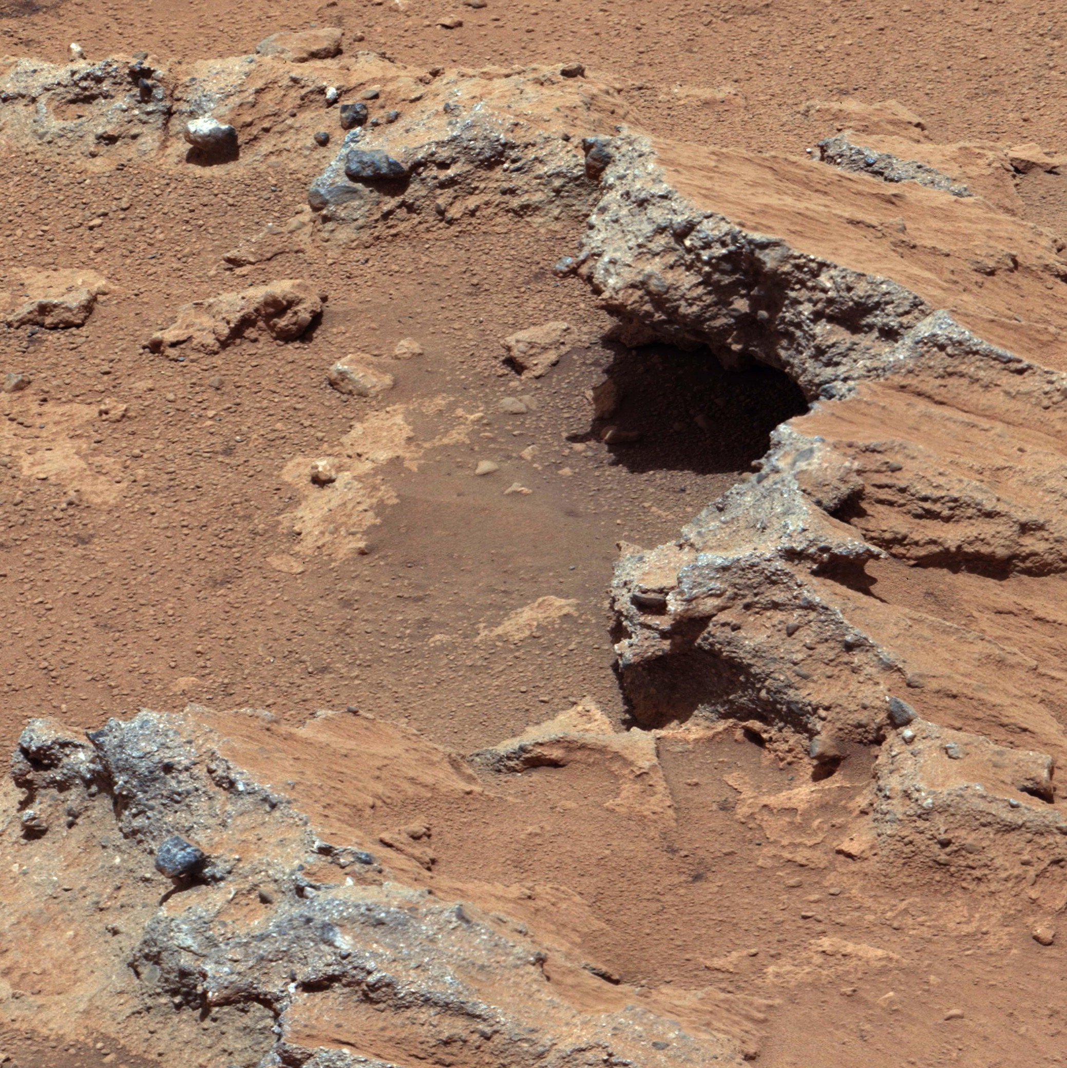
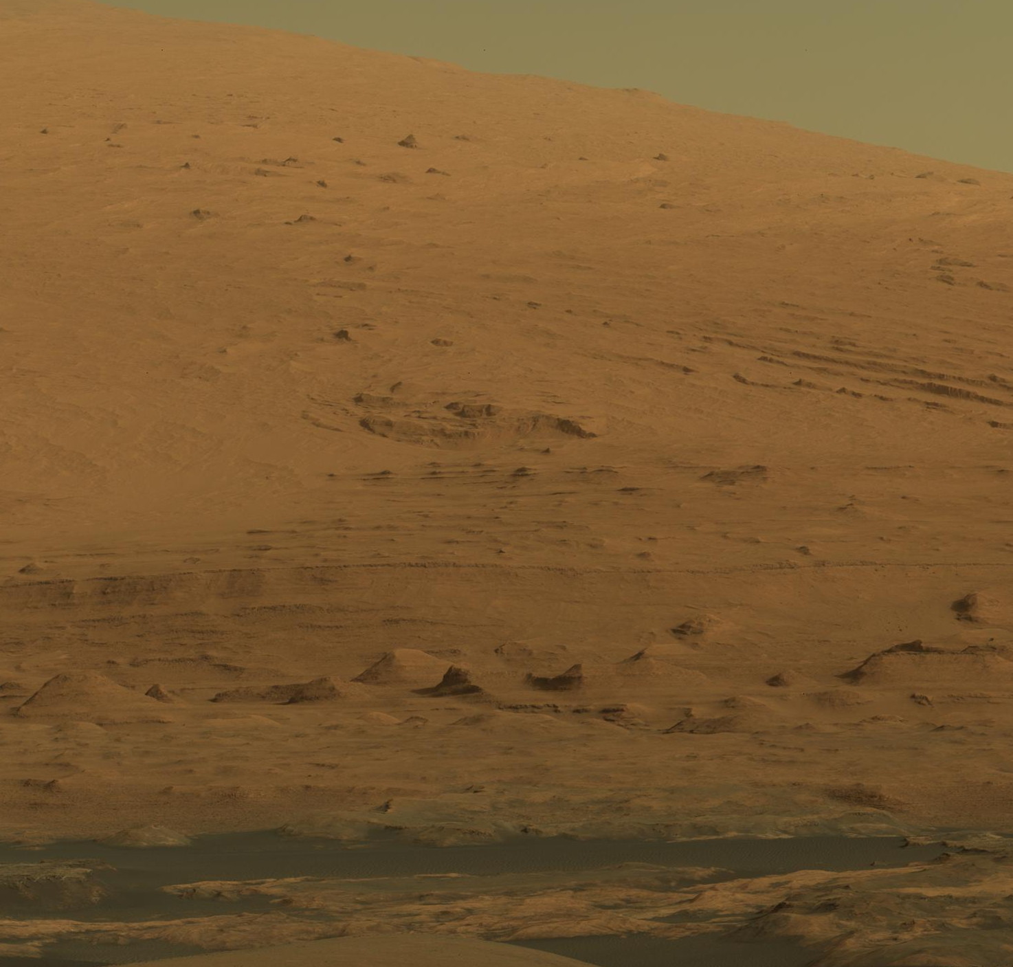
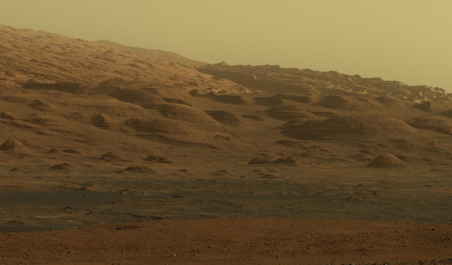
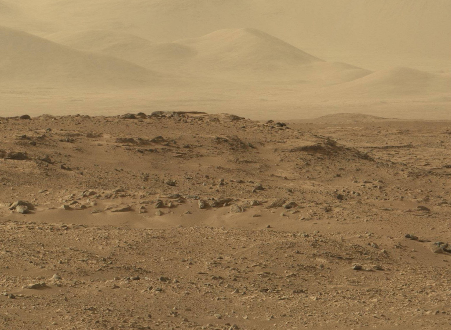
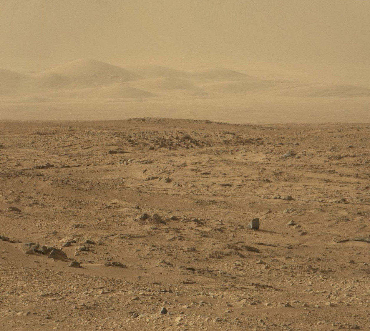
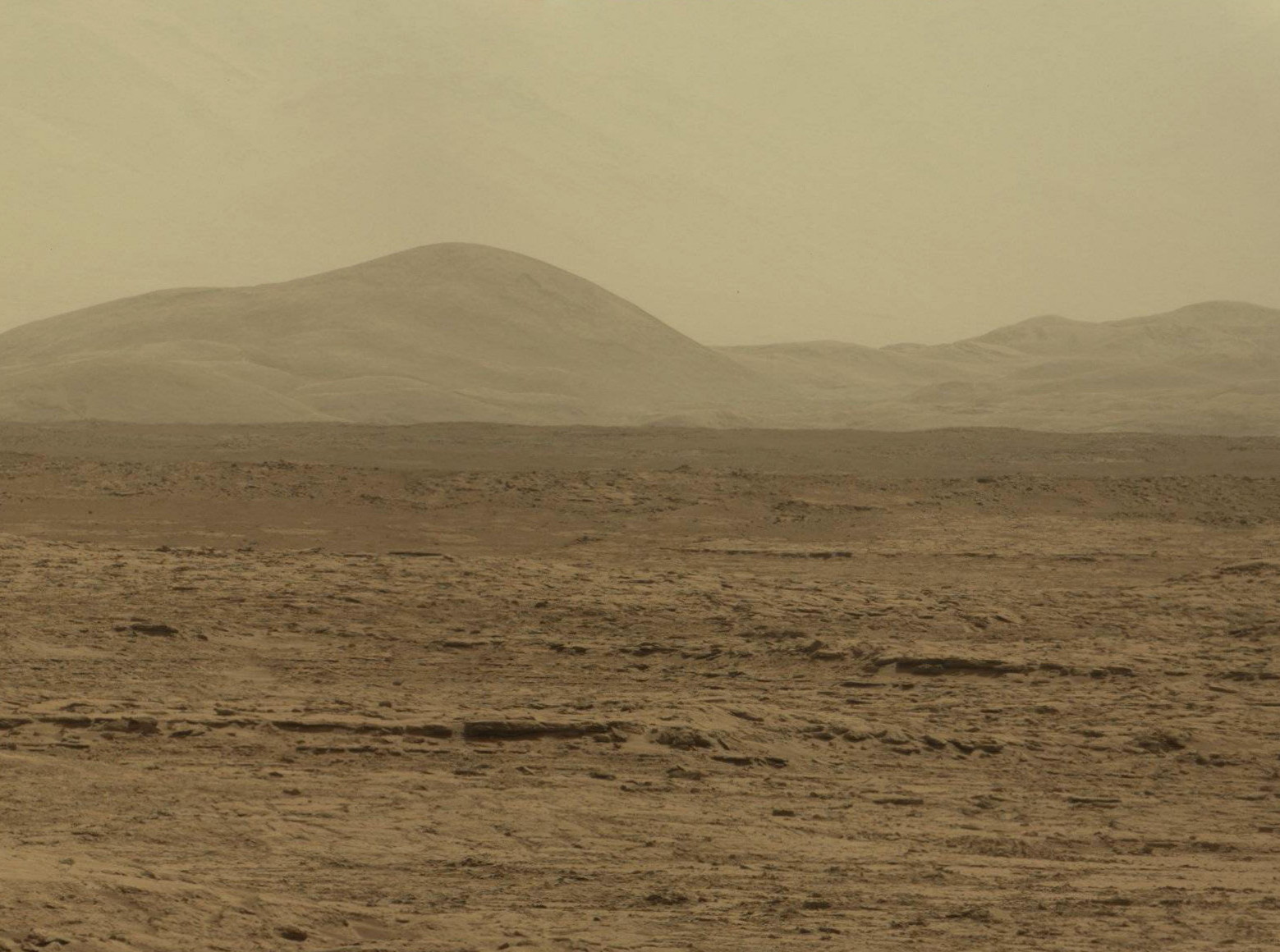
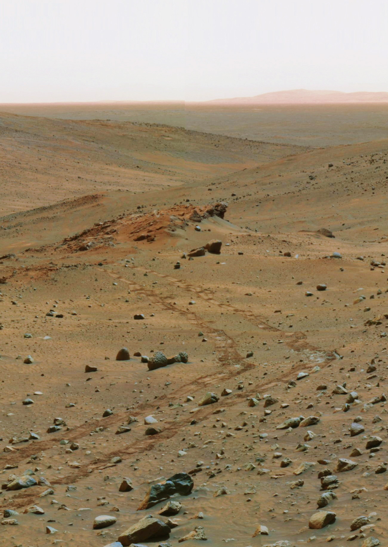
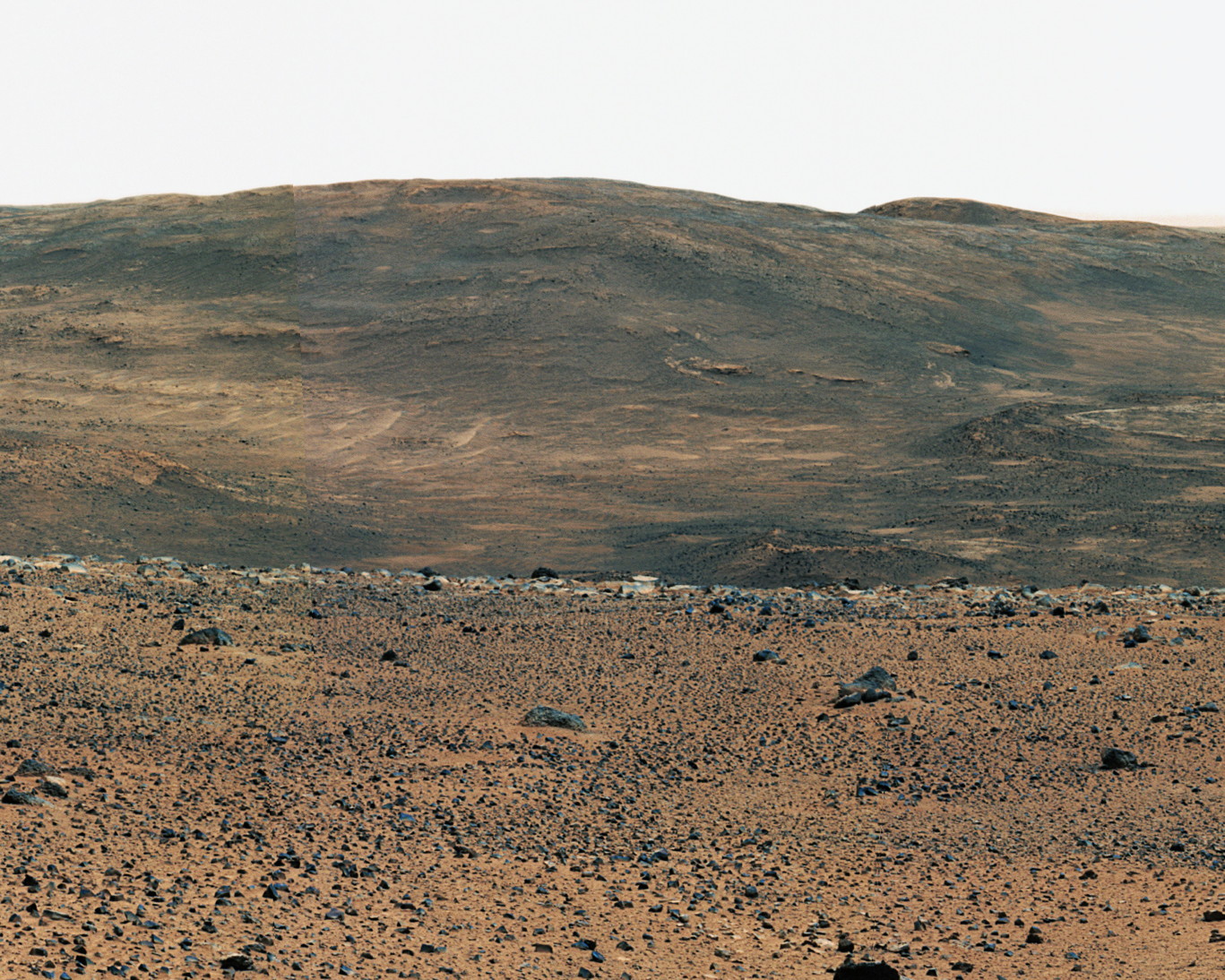
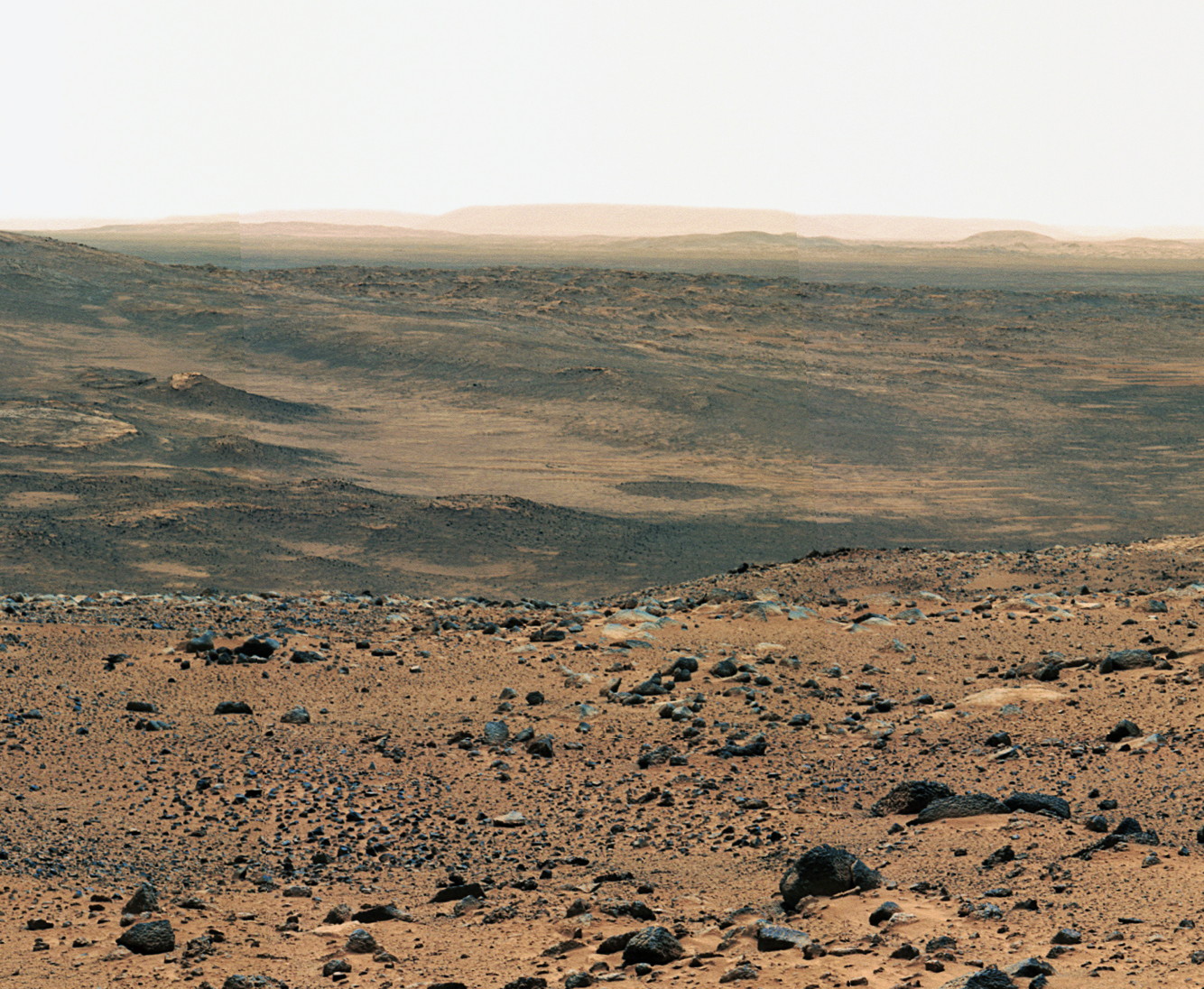
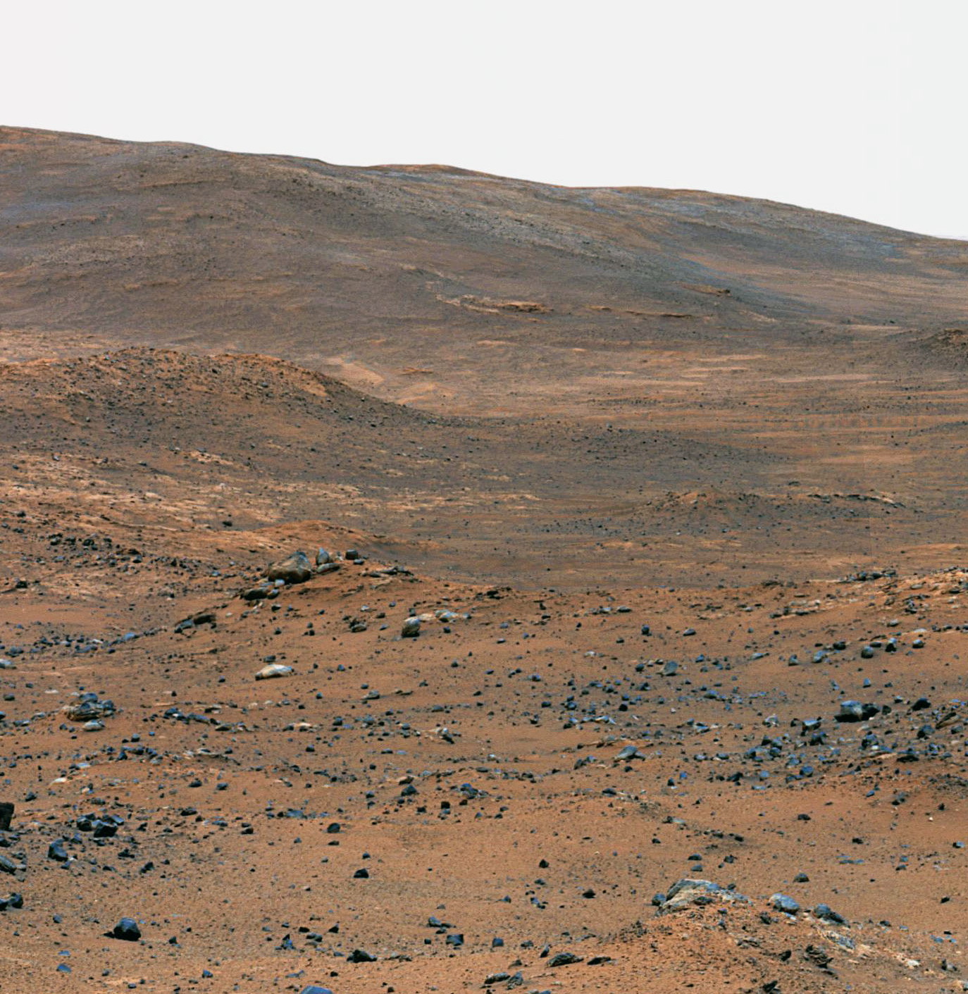
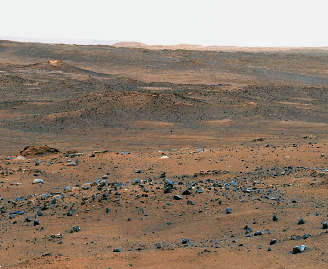
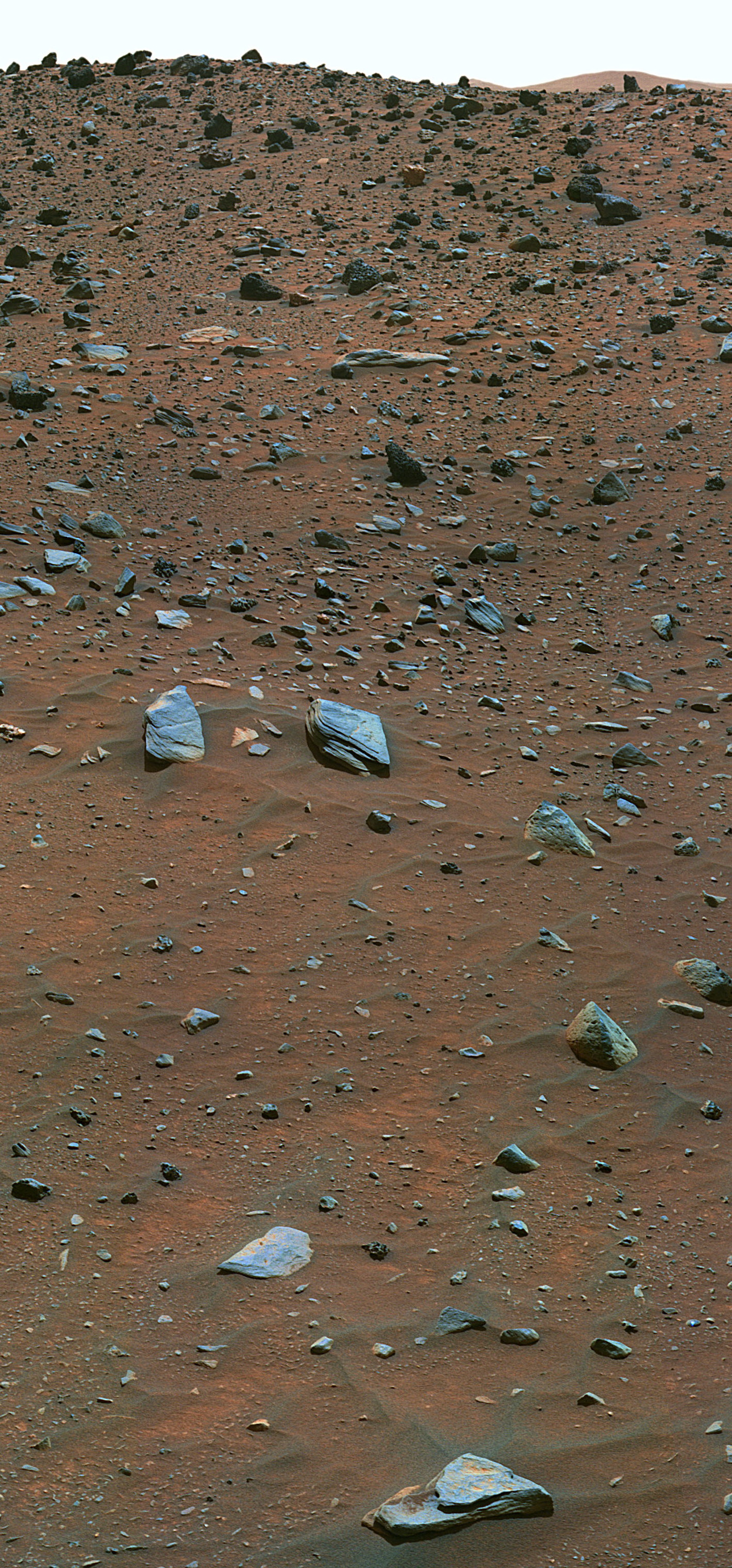
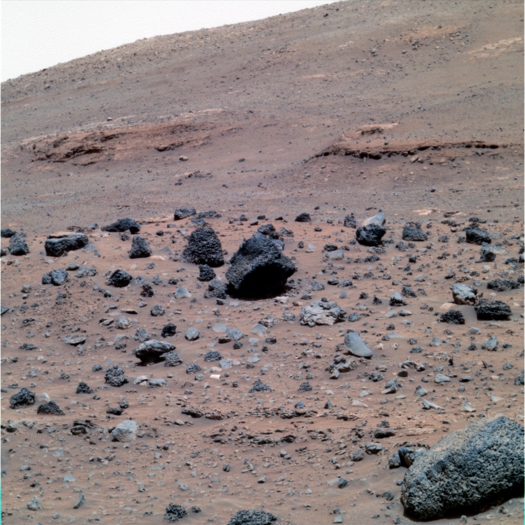
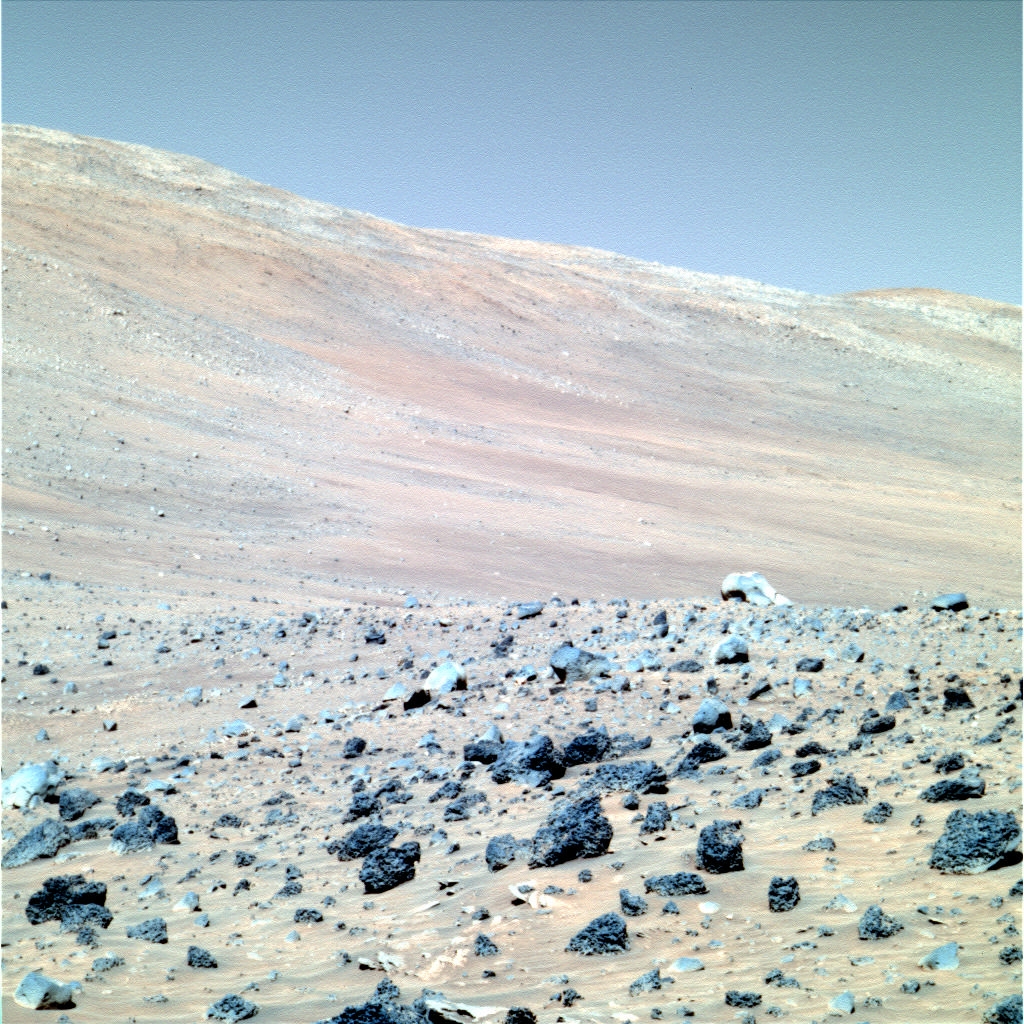
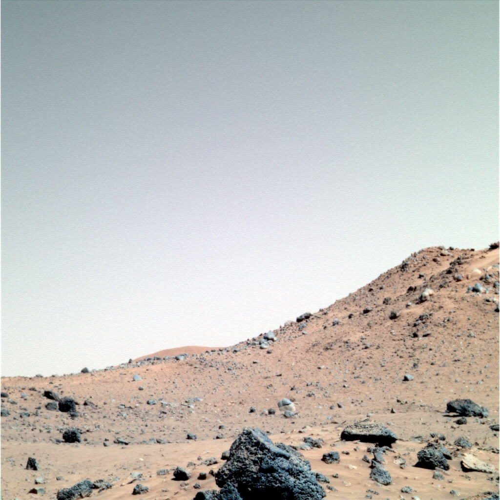
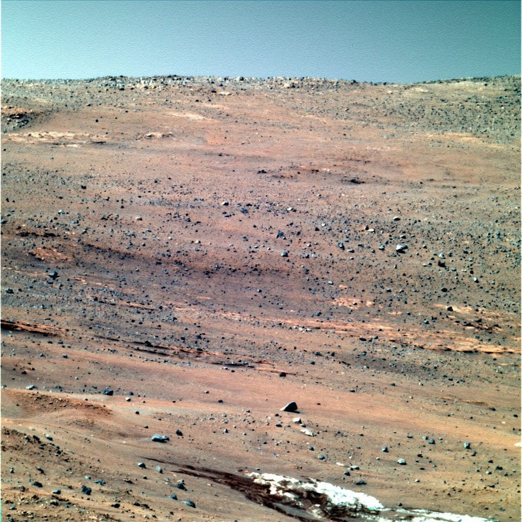
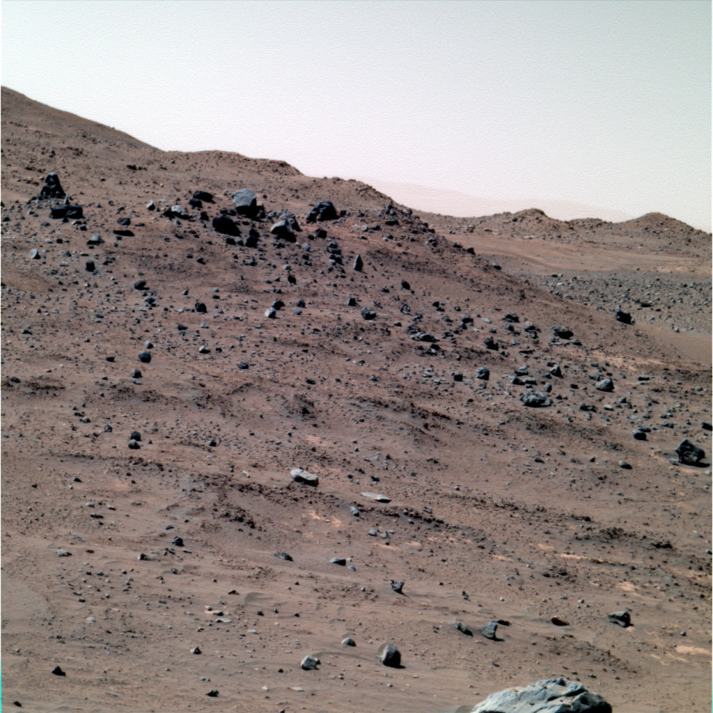
- Curiosity (Mars Science Laboratory Curiosity Rover) (since 08/2012)
- (Launch date : 11/26/2011) — (Landing date : August 06, 2012)
- — (USA). The Mars Science Laboratory mission's Curiosity rover, the most technologically advanced rover ever built, landed in Mars' Gale Crater the evening of Aug. 5 PDT (morning of Aug. 6 EDT) using a series of complicated landing maneuvers never before attempted.
- —Raw images : http://mars.jpl.nasa.gov/msl/multimedia/raw/
- — Raw images (by sol and from all cams) : http://mars.jpl.nasa.gov/msl/multimedia/raw/?s=#/?slide=494
- — All images : http://curiosityrover.com/


- Phobos-Grunt (2011)
- (Launch date : November 8, 2011)
- — (Russia). The Phobos-Grunt spacecraft did not perform its scheduled burn to begin its trajectory to Mars and could not leave Earth orbit. It re-entered Earth's atmosphere on 15 January 2012. Phobos-Grunt (alternatively Fobos-Grunt) was a Russian mission designed to land on the martian moon Phobos and return a sample to Earth. Phobos-Grunt was launched with a Chinese Mars orbiter mission, Yinghuo-1.
- Yinghuo-1 (2011)
- (Launch date : November 8, 2011)
- — (China). The Yinghuo-1 ("Firefly") mission is a Chinese Mars orbiter scheduled to launch in tandem with the Russian Phobos-Grunt mission in November 2011. The primary scientific objectives of the mission are to study martian space environmental structure, plasma distribution and other characteristics; the solar wind-atmosphere coupling and energy deposition processes, martian ion escape processes and mechanisms, the regional gravity field of Mars, and to perform martian and Phobos surface imaging. The mission will also test deep space navigation and communication techniques.
- Phoenix (2007-nov 2008)
- (Launch date : August 4, 2007) — (Landing date : May 25, 2008)
- — (USA). Phoenix was a lander sent to the surface of Mars to search for evidence of past or present microbial life. Phoenix operated science instruments through a 152-sol period (sol 0 through sol 151).
- — Raw images : http://phoenix.lpl.arizona.edu/imageCategories_lander.php — http://www.met.tamu.edu/mars/directory.html (Sol by sol)
- — Color images : http://www.met.tamu.edu/mars/color.html
- Mars Reconnaissance Orbiter (2005-present)
- (Launch date : December 12, 2005) — (Orbiting date : March 10, 2006)
- — (USA). The Mars Reconnaissance Orbiter, or MRO, has studied the Red Planet's atmosphere and terrain from orbit since 2006 and also serves as a key data relay station for other Mars missions, including the Mars Exploration Rover Opportunity and other rovers since 2006.

- Rosetta (2004-present)
- (Launch date : March 2, 2004)
- — (Europe). Rosetta is a robotic spacecraft built and launched by the European Space Agency to perform a detailed study of comet 67P/Churyumov–Gerasimenko. It is part of the ESA Horizon 2000 cornerstone missions and is the first mission designed to both orbit and land on a comet. In 2007, Rosetta also performed a Mars swingby (flyby), and returned images.
- Mars NetLander (2004)
- (Launch date : cancelled)
- — (Europe). For late 2007 (or 2009) CNES (the French Space Agency) and ESA (the European Space Agency) had planned to send to Mars a remote sensing orbiter and four small Netlanders. The Netlanders were to have landed in four different Mars locations. The Landers' mission was to take pictures of the landing site and explore Mars' internal surface and atmosphere. Each of the four landers was to carry instruments for multiple measurements (among them : Microphone by University of California, Berkeley, USA). CNES and ESA cancelled this mission because it was too expensive; both agencies have planned to send other orbiters and landers for missions like ExoMars.
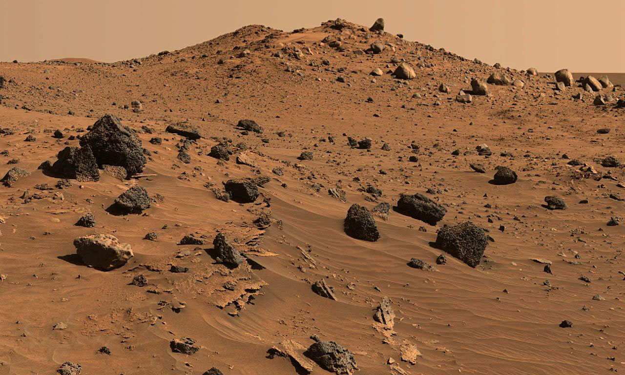
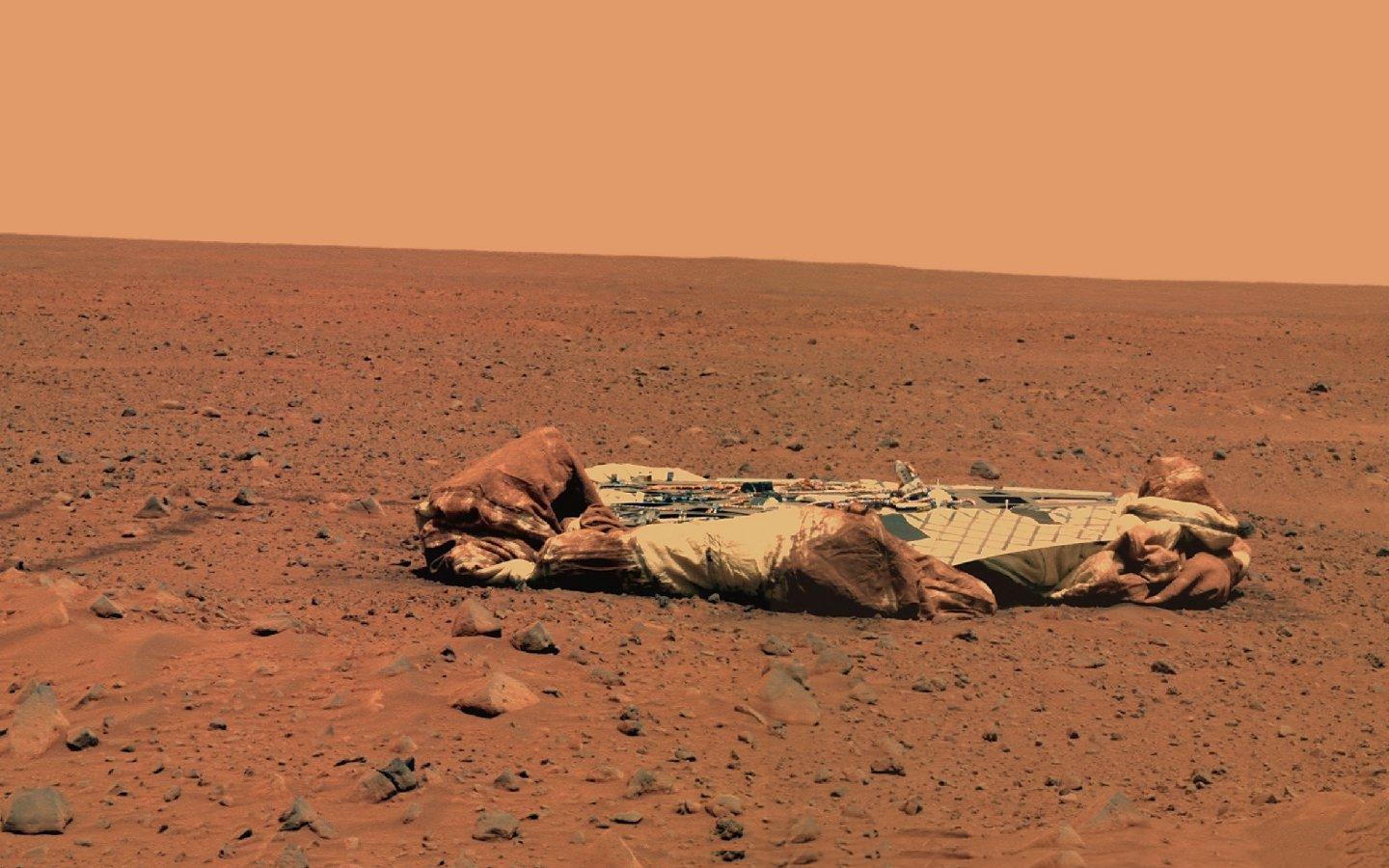
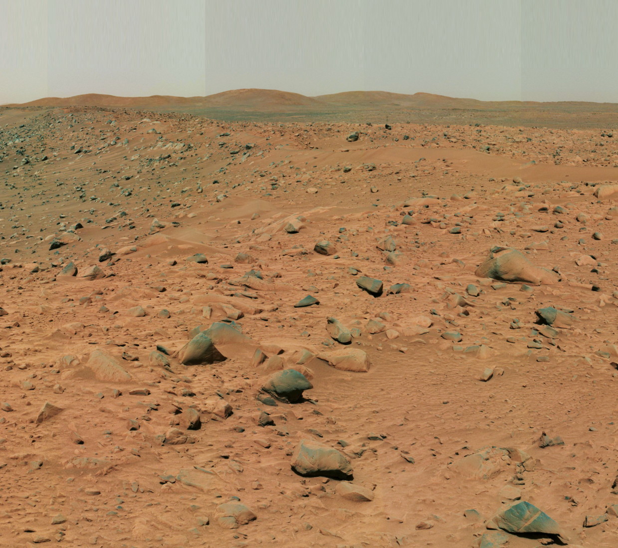
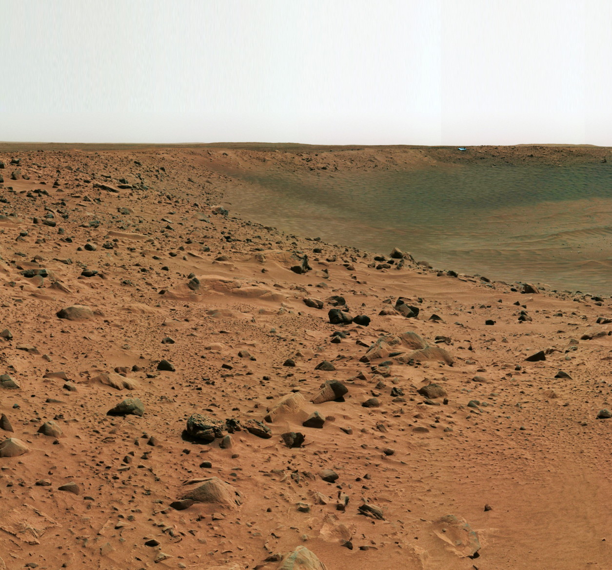
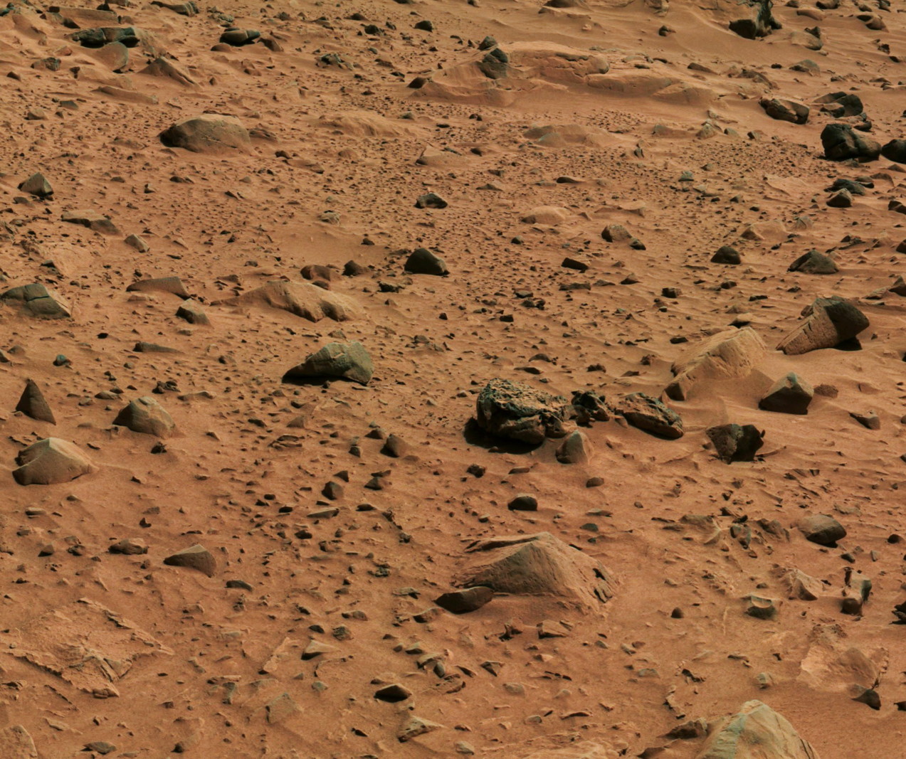
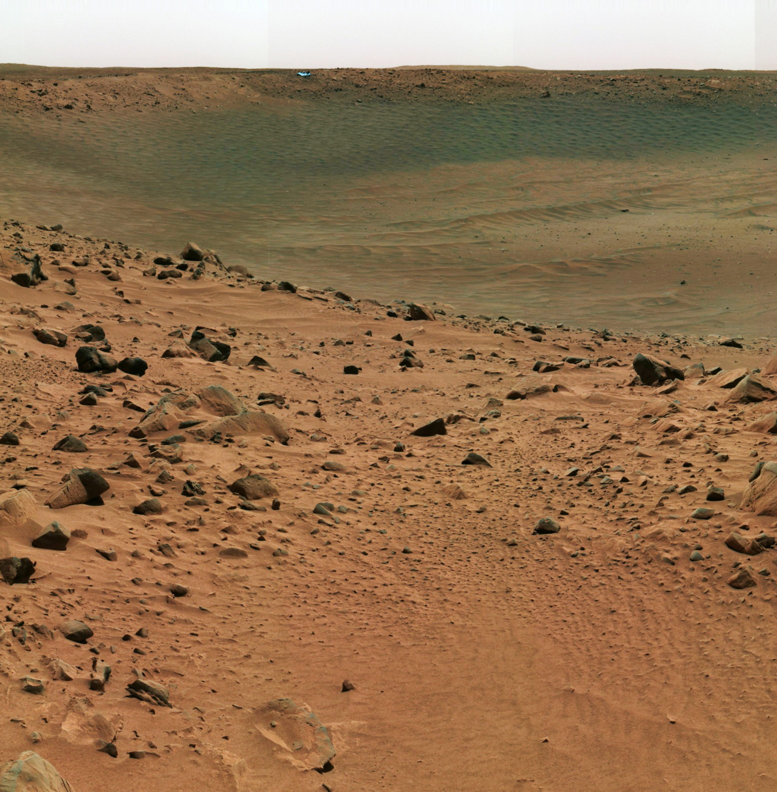
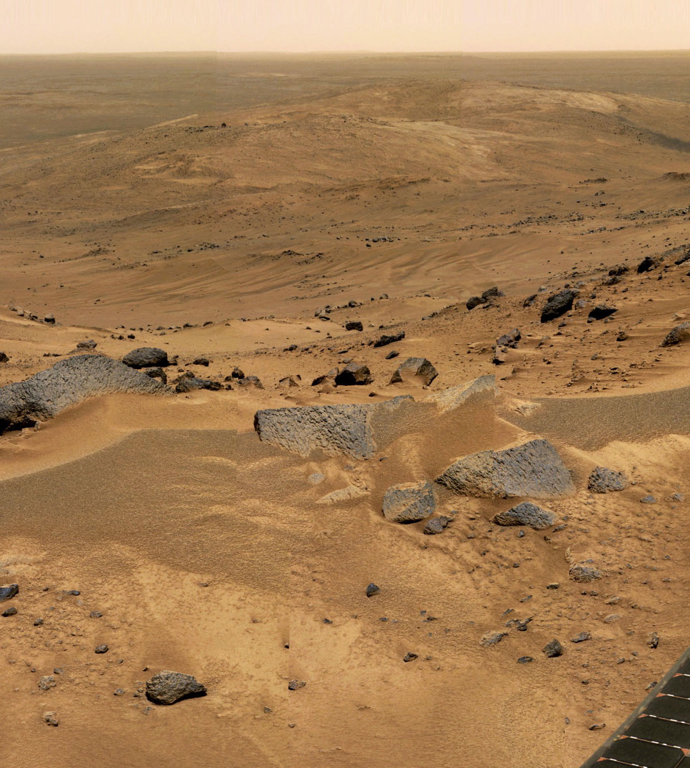
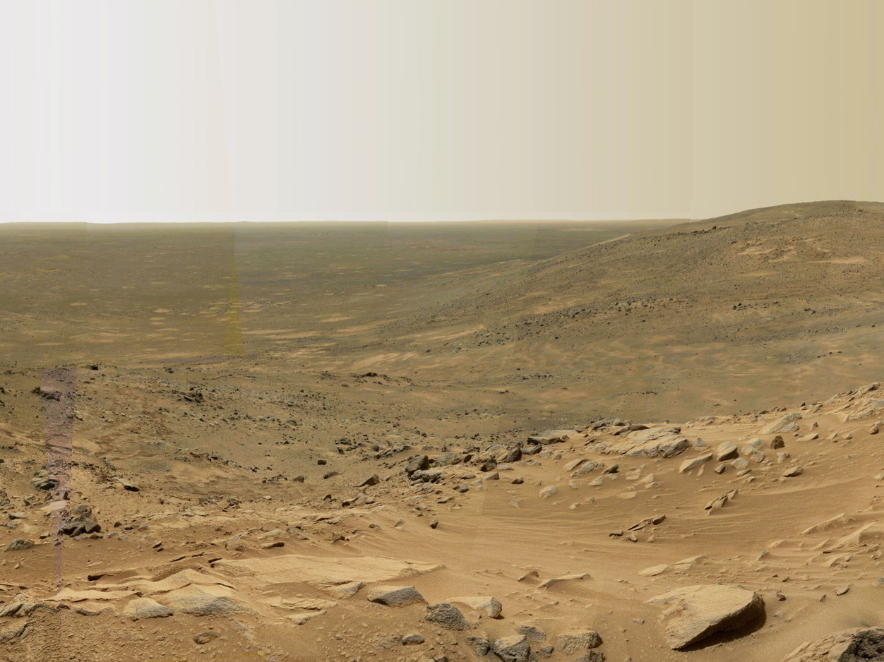
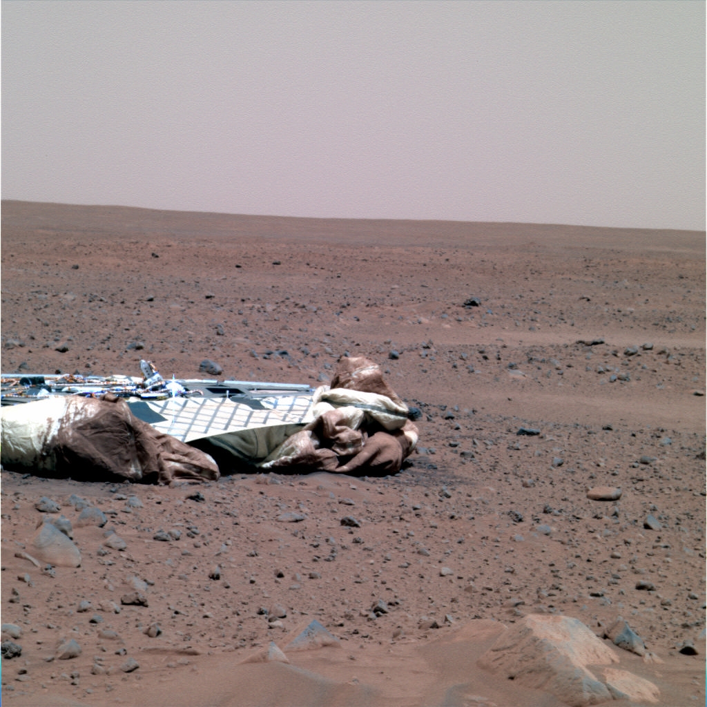
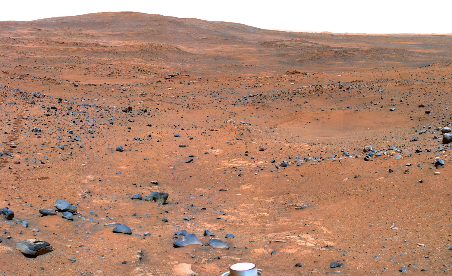
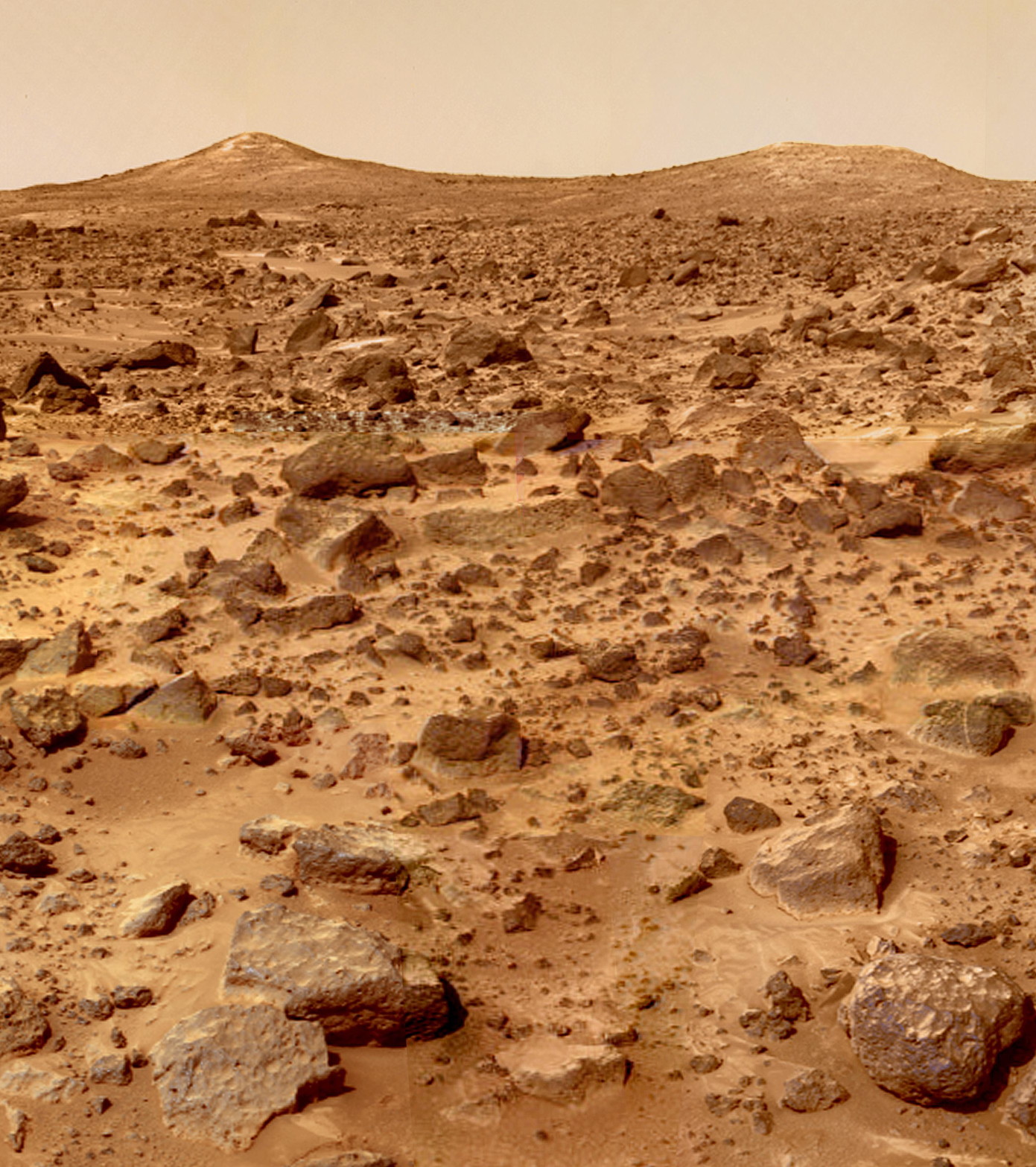
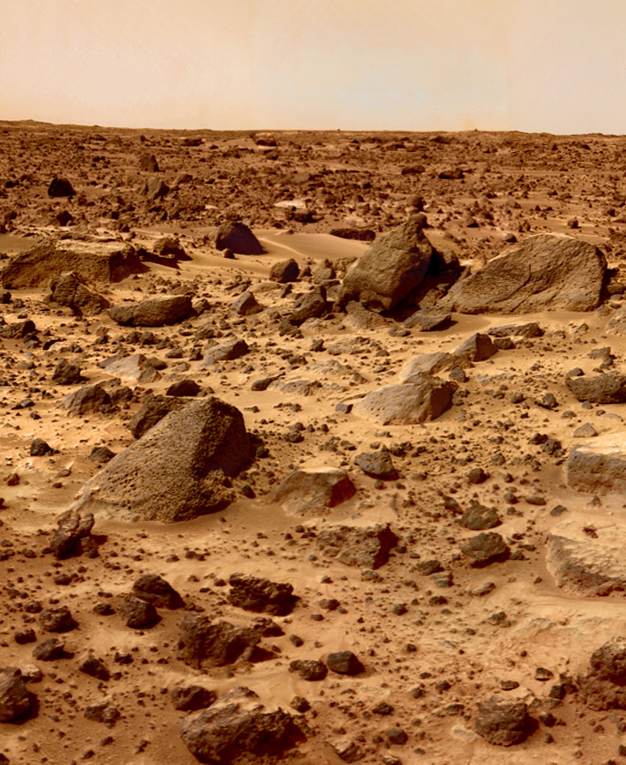
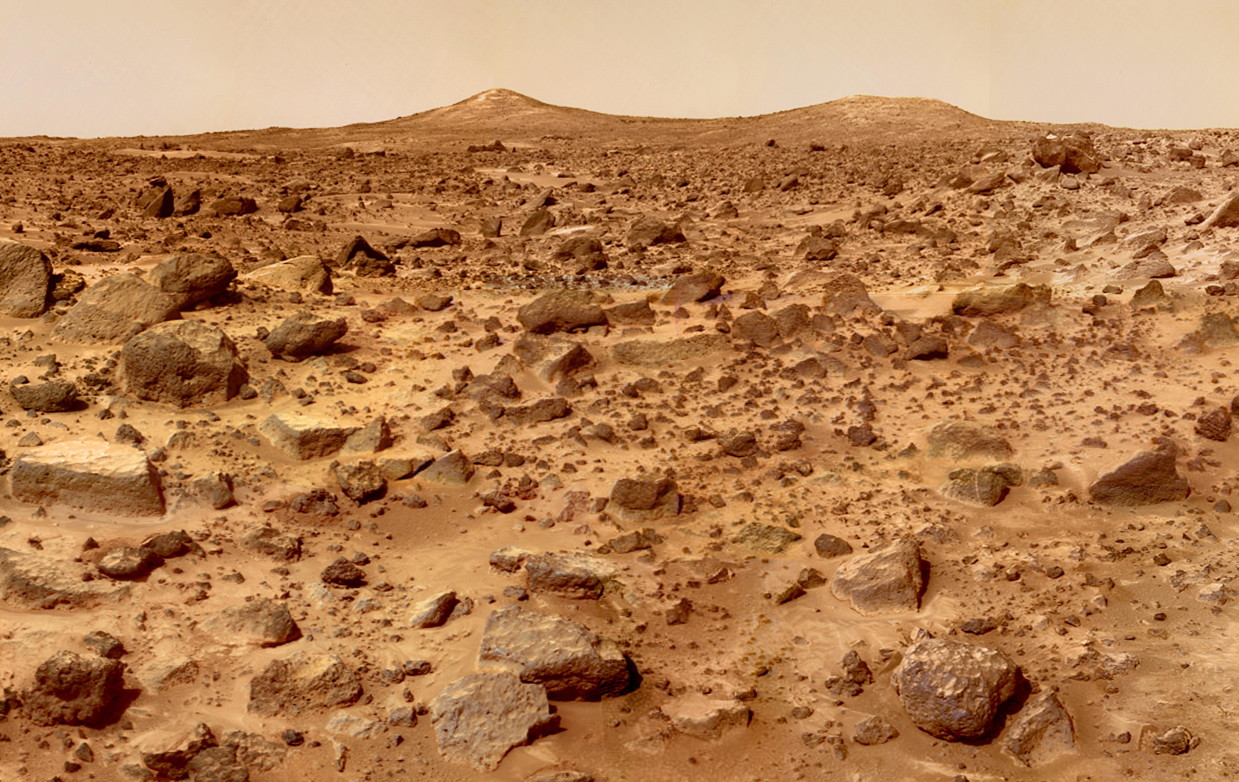
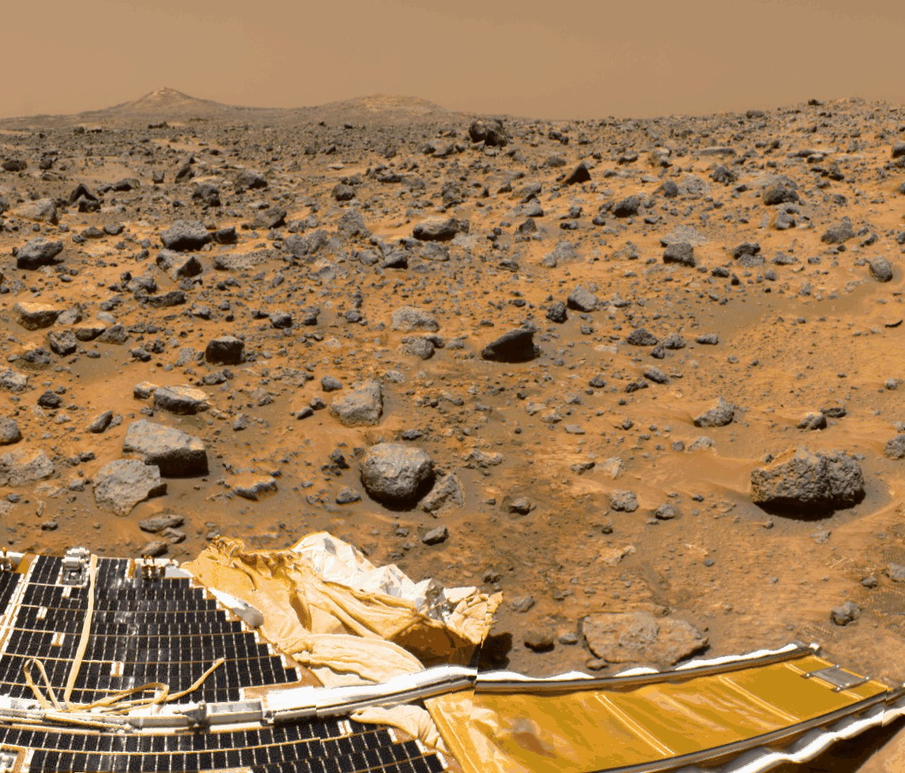
- Spirit - Mars Exploration Rover A - MER-A (2004-mar 2010)
- (Launch date : October 10, 2003) — (Landing date : Jan 4, 2004)
- — (USA). One of two rovers launched in 2003 to explore Mars and search for signs of past life, Spirit far outlasted her planned 90-day mission.
- — Raw images : http://marsrovers.jpl.nasa.gov/gallery/all/spirit.html — https://archive.org/details/MarsRoverSpirit — http://www.exploratorium.edu/mars/spiritopp.php
- — Raw images : http://areo.info/mer/spirit/
- — Panorama images : http://marsrovers.jpl.nasa.gov/gallery/panoramas/spirit/
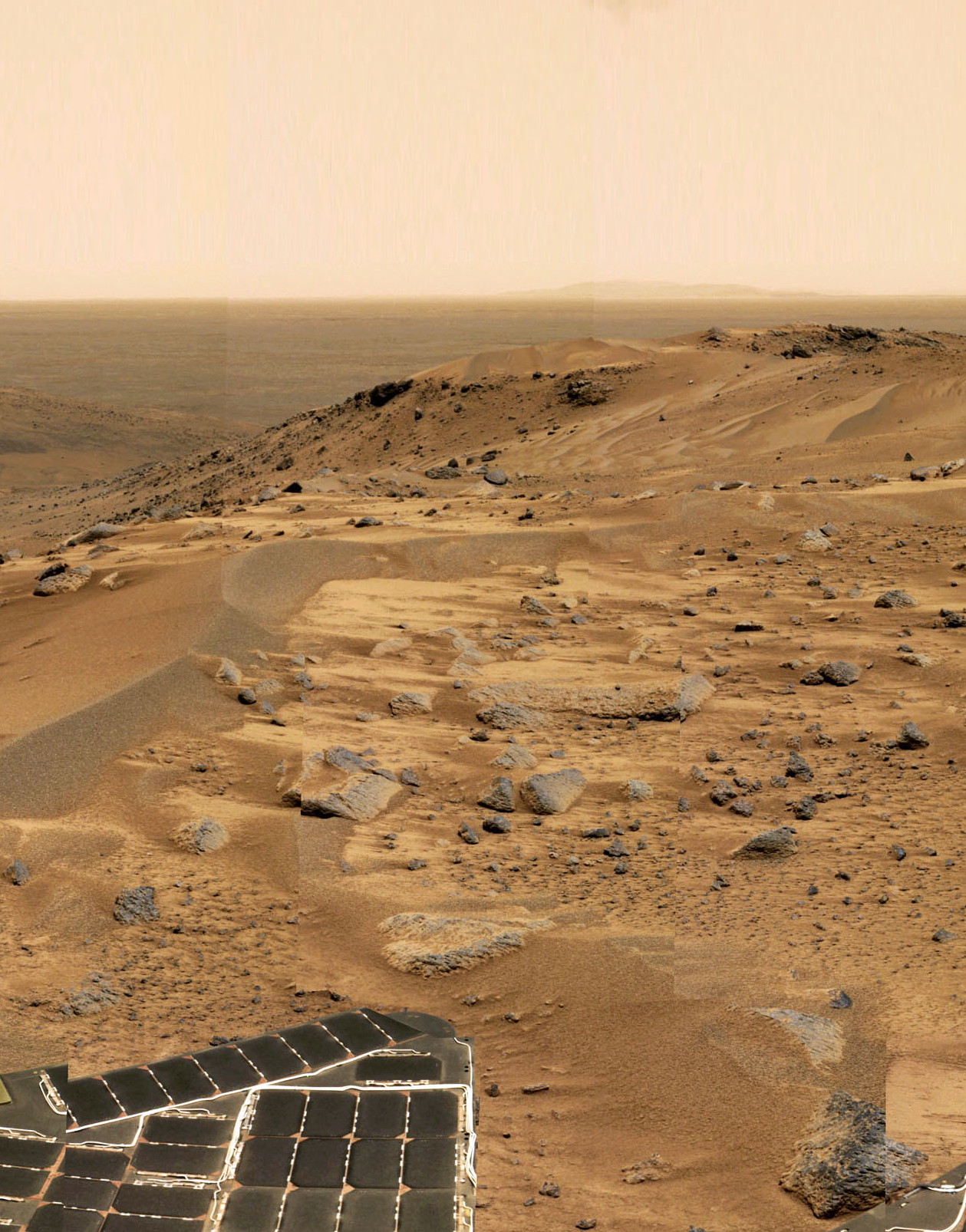


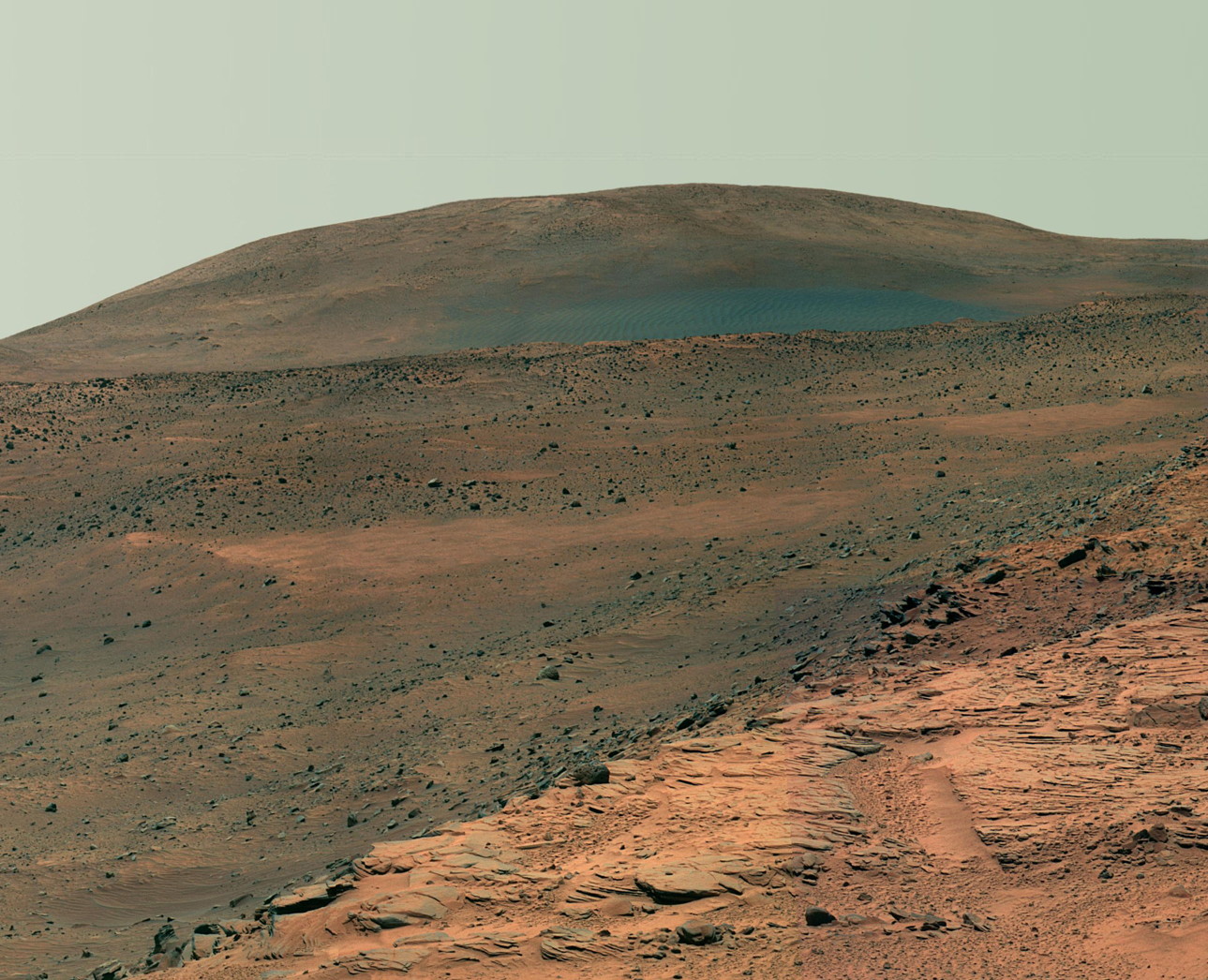
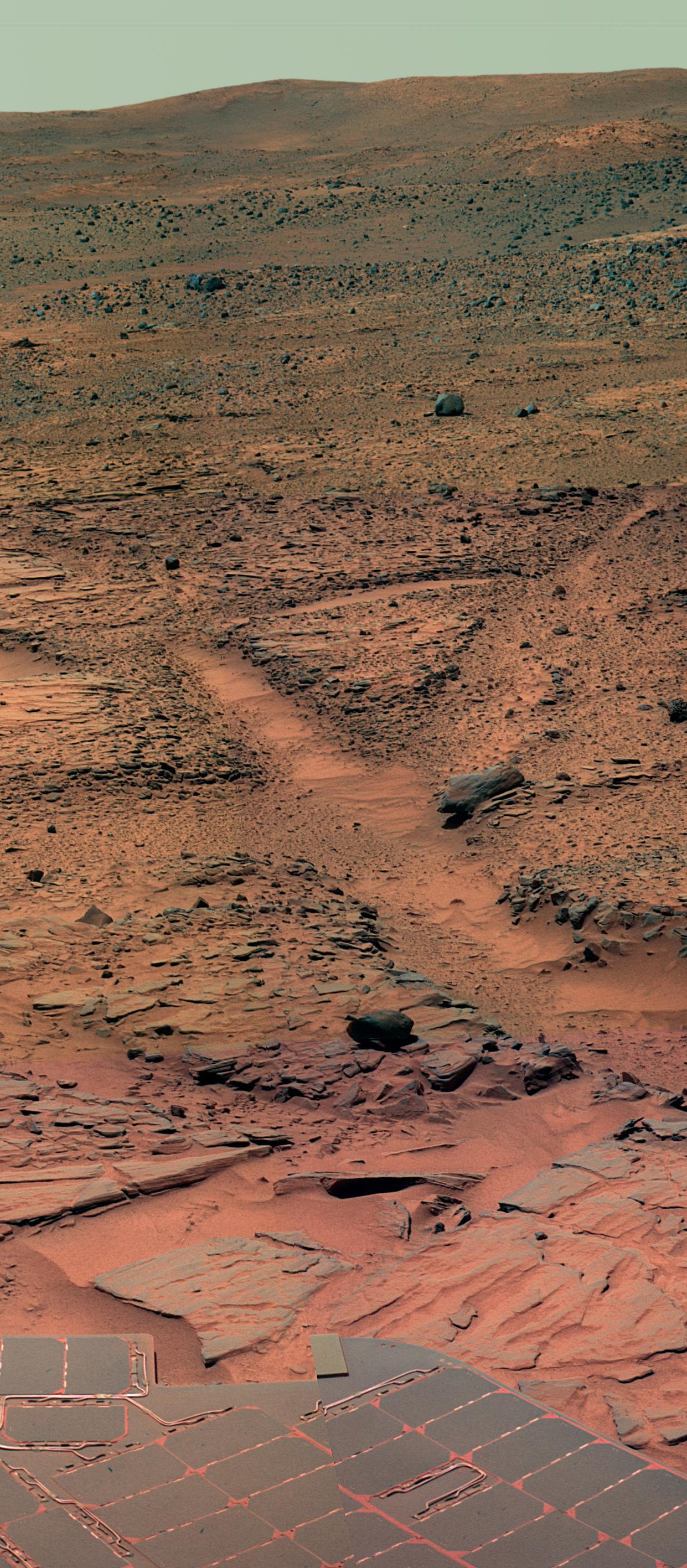
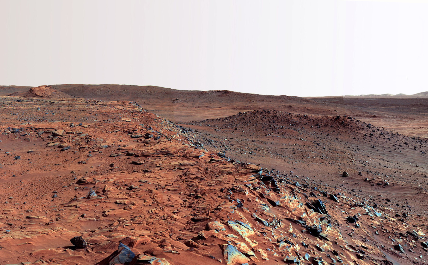
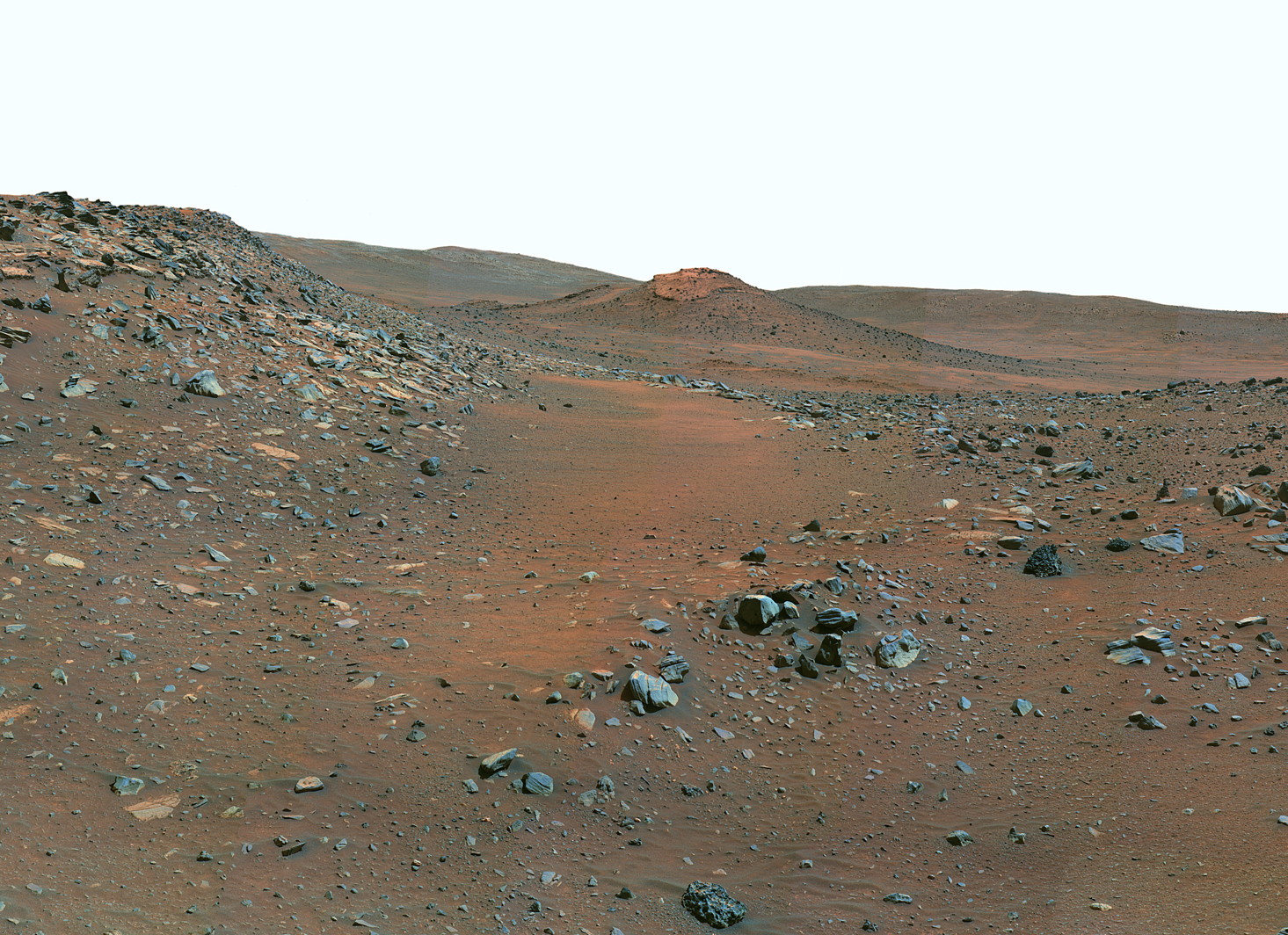

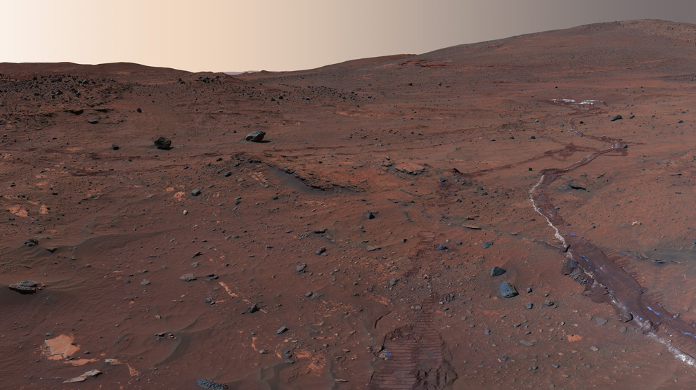


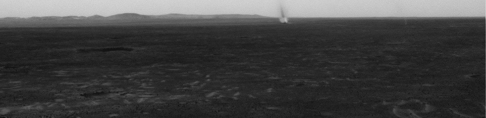
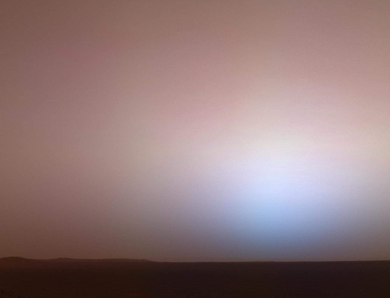
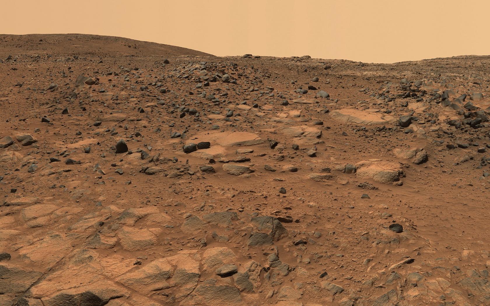
- Opportunity - Mars Exploration Rover B - MER-B (2004-present)
- (Launch date : July 7, 2003) — (Landing date : Jan 25, 2004)
- — (USA). Opportunity was the second of the two rovers launched in 2003 to land on Mars and begin traversing the Red Planet in search of signs of past life. (Dec 27, 2013 = Sol 3529)
- — Raw images : http://marsrovers.jpl.nasa.gov/gallery/all/opportunity.html — https://archive.org/details/MarsRoverOpportunity — http://www.exploratorium.edu/mars/spiritopp.php
- — Raw images : http://areo.info/mer/opportunity/
- — Panorama images : http://marsrovers.jpl.nasa.gov/gallery/panoramas/opportunity/
- Mars Express (Orbiter & Beagle 2 lander) (2003)
- (Launch date : June 2, 2003)
- — (Europe). Mars Express is a European Space Agency (ESA) mission to Mars. It consists of an orbiter, the Mars Express Orbiter, and a lander, Beagle 2. The scientific objectives of the Mars Express Orbiter are to obtain global high-resolution photo-geology (10 m resolution), mineralogical mapping (100 m resolution) and mapping of the atmospheric composition, study the subsurface structure, the global atmospheric circulation, and the interaction between the atmosphere and the subsurface, and the atmosphere and the interplanetary medium. The Beagle 2 lander objectives were to characterize the landing site geology, mineralogy, and geochemistry, the physical properties of the atmosphere and surface layers, collect data on martian meteorology and climatology, and search for possible signatures of life. Mars Express arrived at Mars after a 400 million km journey and a course correction in September, in December 2003. The Beagle 2 is a lander initially mounted on the top deck of the Mars Express Orbiter. It was released from Mars Express on 19 December and reached Mars on 25 December. However no signals have been received from the lander and the mission has been declared lost.
- (2001) Mars Odyssey (2001-2010)
- (Launch date : April 7, 2001) — (Orbiting date : October 24, 2001) — (Stop date : December 15, 2010)
- — (USA). With almost 10 years in orbit and counting, the 2001 Mars Odyssey spacecraft has spent more time in orbit around the Red Planet, collecting data on Mars' climate and geology, than any other spacecraft in history. Its mission is to use spectrometers and electronic imagers to detect evidence of past or present water and volcanic activity on Mars. It also acts as a relay for communications between the Mars Exploration Rovers, Mars Science Laboratory, and the Phoenix lander to Earth. By December 15, 2010 it broke the record for longest serving spacecraft at Mars, with 3,340 days of operation, claiming the title from NASA's Mars Global Surveyor.3 It currently holds the record for the longest-surviving continually active spacecraft in orbit around a planet other than Earth at 12 years, 2 months, and 5 days.
- Mars Polar Lander / Deep Space 2 (Mars Surveyor '98 Lander) (1999)
- (Launch date : Jan 3, 1999) — (Lost date : Dec 3, 1999)
- — (USA). Designed to dig for water ice on Mars with a robotic arm, the Mars Polar Lander would have been the first-ever spacecraft to land on a polar region of the Red Planet. On December 3, 1999, however, after the descent phase was expected to be complete, the lander failed to reestablish communication with Earth. Among scientific instruments, a microphone was placed on board the spacecraft Mars Polar Lander. This microphone was intended to be the first instrument to record sounds on another planet.
- — Microphone : http://nssdc.gsfc.nasa.gov/nmc/experimentDisplay.do?id=1999-001A-04
- MSO (Mars Climate Orbiter) (Mars Surveyor '98 Orbiter) (1998-1999)
- (Launch date : December 11, 1998) — (Lost date : September 23, 1999)
- — (USA). Designed to study Mars from orbit and serve as a communications relay for the Mars Polar Lander and Deep Space probes, the Mars Climate Orbiter was unsuccessful due to a navigation error caused by a failure to translate English units to metric. On September 23, 1999, communication with the spacecraft was lost as the spacecraft went into orbital insertion.
- Nozomi (Planet-B) (1998)
- (Launch date : March 7, 1998)
- — (Japan). Efforts to put the Nozomi spacecraft into martian orbit have been abandoned. An attempt to fire thrusters to orient the craft for a Mars orbit insertion burn failed on December 9. The smaller thrusters were successfully fired and Nozomi flew past Mars at a distance of 1000 km on 14 December and went into a heliocentric orbit with a period of roughly two years. The new plan was for Nozomi to remain in heliocentric orbit for an additional four years, including two Earth flybys in December 2002 and June 2003, and encounter Mars at a slower relative velocity in December 2003. On 21 April 2002 as Nozomi was approaching Earth for the gravity assist maneuver, powerful solar flares damaged the spacecraft's onboard communications and power systems.
- MGS Mars Global Surveyor (1996-)
- (Launch date : November 7, 1996) — (Stop date : January, 2007)
- — (USA). Mars Global Surveyor was a global mapping mission that examined the entire planet, from the ionosphere down through the atmosphere to the surface. The Mars Global Surveyor orbiter, which operated on Mars for more than nine years, was designed to study the composition of Mars, map its topography and monitor weather paterns. It beamed back data also about the geology, magnetic field, and climate. It completed its primary mission in January 2001 and was in its third extended mission phase when, on 2 November 2006, the spacecraft failed to respond to messages and commands. A faint signal was detected three days later which indicated that it had gone into safe mode. Attempts to recontact the spacecraft and resolve the problem failed, and NASA officially ended the mission in January 2007.
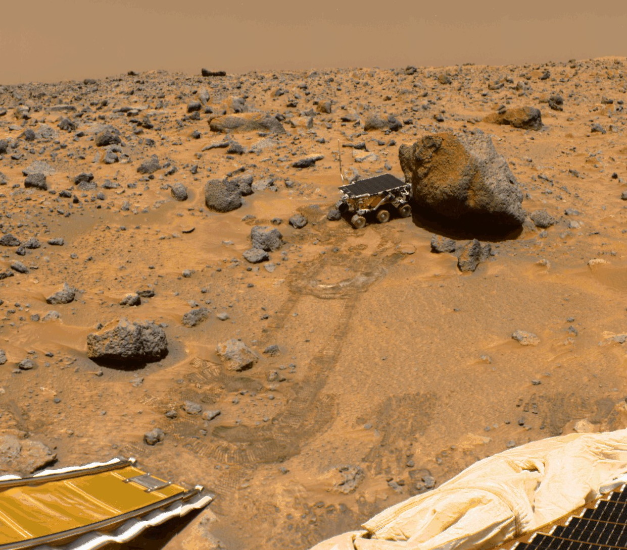
- Mars Pathfinder / Sojourner Rover (1996-1997)
- (Launch date : December 4, 1996) — (Landing date : July 4, 1997) — (Stop date : September 27, 1997)
- — (USA). The Mars Pathfinder mission, designed to demonstrate a low-cost method for delivering a set of science instruments to the Red Planet, was the first wheeled vehicle to be used on any other planet in the solar system and served as the foundation for the Mars rovers of today. The landers that preceded this mission had to conduct all their experiments in just one place. But, along with a stationary lander, the Pathfinder mission introduced the first rover—the 23-pound (10-kg) Sojourner—which rolled onto the martian surface in early July 1997 and communicated with Earth until late that September. Although the mission was planned to last from a week to a month, the rover operated successfully for almost three months. Communication failed after 7 October, with a final data transmission received from Pathfinder at 10:23 UTC on September 27, 1997. Admittedly, Sojourner couldn't rove very far—only about 30 feet (10 m)—because it had to stay in communication with the lander, the Carl Sagan Memorial Station. (83 sols of operation)
- — Raw images : http://pds-imaging.jpl.nasa.gov/volumes/mpf.html — http://nssdc.gsfc.nasa.gov/planetary/marspath_images.html — http://mars.jpl.nasa.gov/MPF/mpf/image-arc.html
- — Raw images : http://mars.jpl.nasa.gov/MPF/ops/other.html (by sol)

- Mars Observer (1992)
- (Launch date : September 25, 1992) — (Lost date : August 21, 1993)
- — (USA). The Mars Observer was based on a commercial Earth-orbiting spacecraft and designed to study and take high-resolution photography of the Martian surface. During the interplanetary cruise phase, communication with the spacecraft was lost on August 21, 1993, 3 days prior to orbital insertion. Attempts to re-establish communication with the spacecraft were unsuccessful.
- Phobos 2 (1988)
- (Launch date : July 12, 1988) - (Stop date : March 27, 1989)
- — (Soviet Union). Phobos 2 operated nominally throughout its cruise and Mars orbital insertion phases, gathering data on the Sun, interplanetary medium, Mars, and Phobos. Shortly before the final phase of the mission, during which the spacecraft was to approach within 50 m of Phobos' surface and release two landers, one a mobile 'hopper', the other a stationary platform, contact with Phobos 2 was lost. The mission ended when the spacecraft signal failed to be successfully reacquired on 27 March 1989. The cause of the failure was determined to be a malfunction of the on-board computer.
- Phobos 1 (1988)
- (Launch date : July 7, 1988) - (Stop date : September, 1988)
- — (Soviet Union). Phobos 1, and its companion spacecraft Phobos 2, were the next-generation in the Venera-type planetary missions, succeeding those last used during the Vega 1 and 2 missions to comet P/Halley. The objectives of the Phobos missions were to: - conduct studies of the interplanetary environment; - perform observations of the Sun; - characterize the plasma environment in the Martian vicinity; - conduct surface and atmospheric studies of Mars; and, - study the surface composition of the Martian satellite Phobos. Phobos 1 operated nominally until an expected communications session on 2 September 1988 failed to occur.
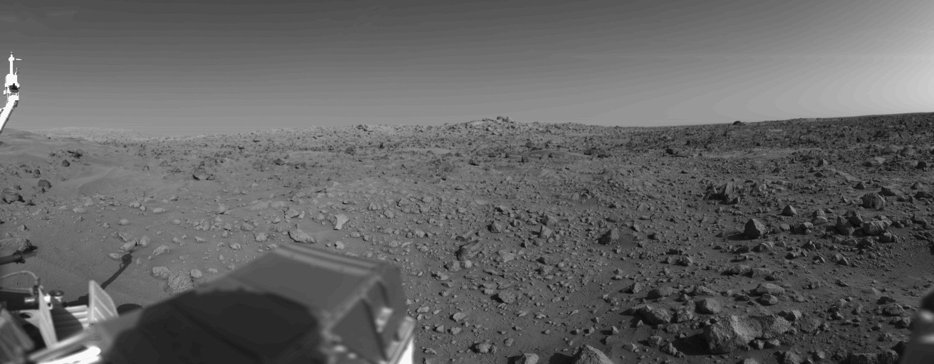
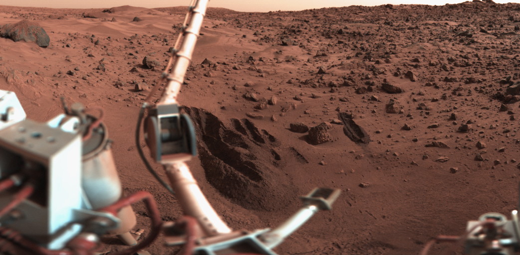
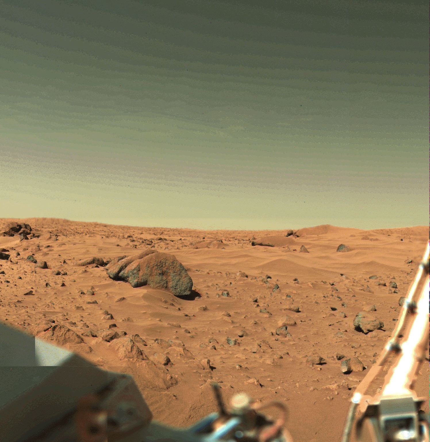
- Viking 2 (orbiter and lander) (1976-1980)
- (Launch date : September 09, 1975) — (Landing date : Nov, 1976) — (Stop date : April 11, 1980)
- (USA). Viking 2 landed on Mars in November 1976 — immediately following the first successful spacecraft landing on Mars by Viking 1 — and was part of NASA's early two-part mission to investigate the Red Planet and search for signs of life. (1281 sols of operation)
- — Raw images : http://mars.jpl.nasa.gov/MPF/mpf/image-arc.html (http://petermasek.tripod.com/viking.html ) — http://www.msss.com/mars/pictures/viking_lander/viking_lander.html — http://www.astrosurf.com/nunes/explor/explor_vik.htm
- — Raw images : http://pdsimg.jpl.nasa.gov/Atlas/Atlas.html
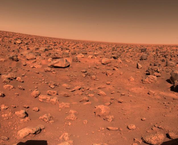
- Viking 1 (orbiter and lander) (1976-1980)
- (Launch date : August 20, 1975) — (Landing date : July 20, 1976) — (Stop date : August 17, 1980)
- — (USA). The first spacecraft to successfully land on Mars, Viking 1 was part of a two-part mission to investigate the Red Planet and search for signs of life. The Viking orbiters imaged the entire surface of the planet, while the landers also transmitted images of the surface, analyzed surface samples for signs of life, and studied the composition of the atmosphere. Data from the Viking missions led to a good understanding of martian topography, from its huge volcanoes and deep canyons to its lava-covered plains. (1775 sols of operation)
- — Raw images : http://mars.jpl.nasa.gov/MPF/mpf/image-arc.html (http://petermasek.tripod.com/viking.html ) — http://www.msss.com/mars/pictures/viking_lander/viking_lander.html — http://www.astrosurf.com/nunes/explor/explor_vik.htm
- — Raw images : http://pdsimg.jpl.nasa.gov/Atlas/Atlas.html
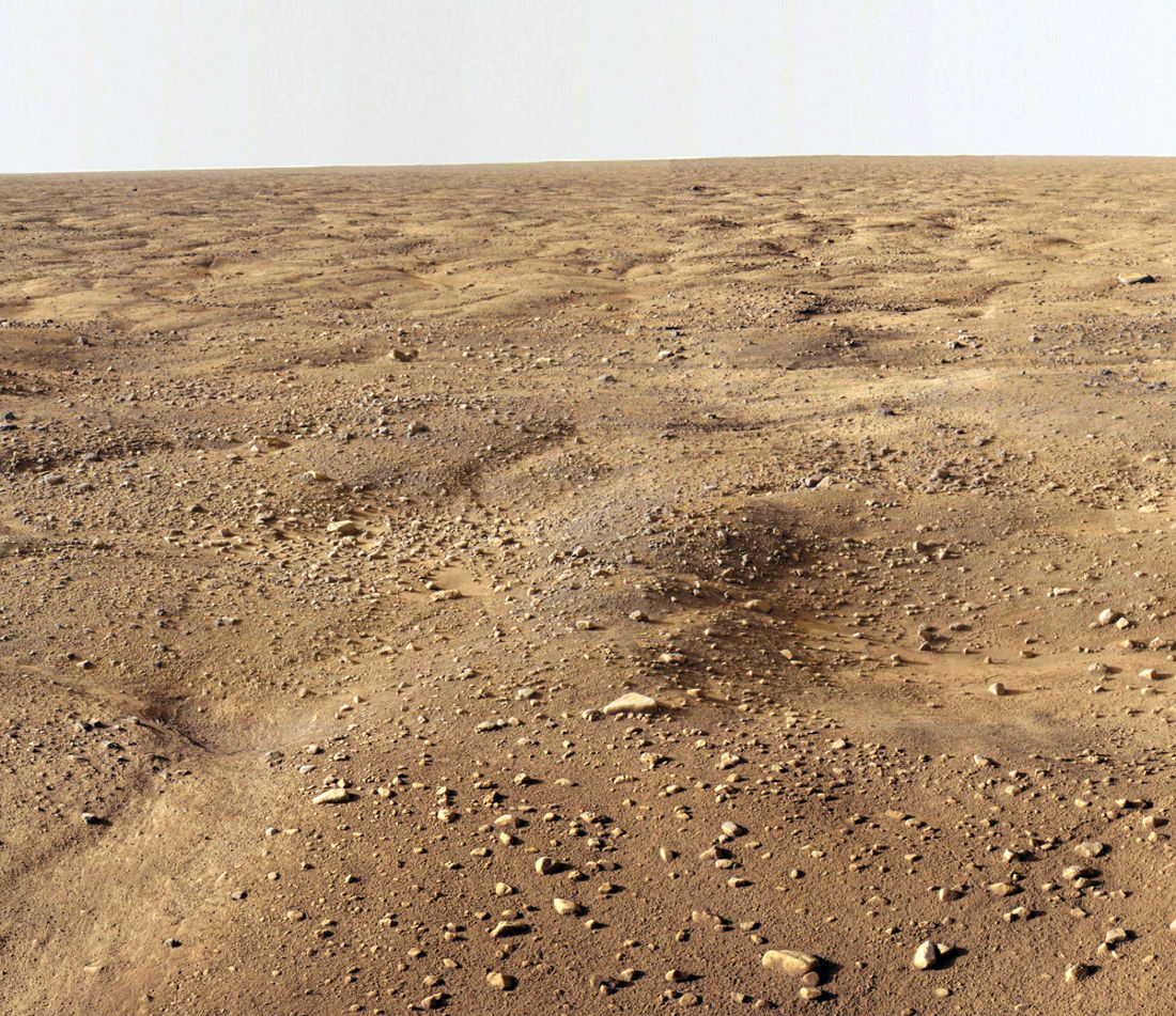
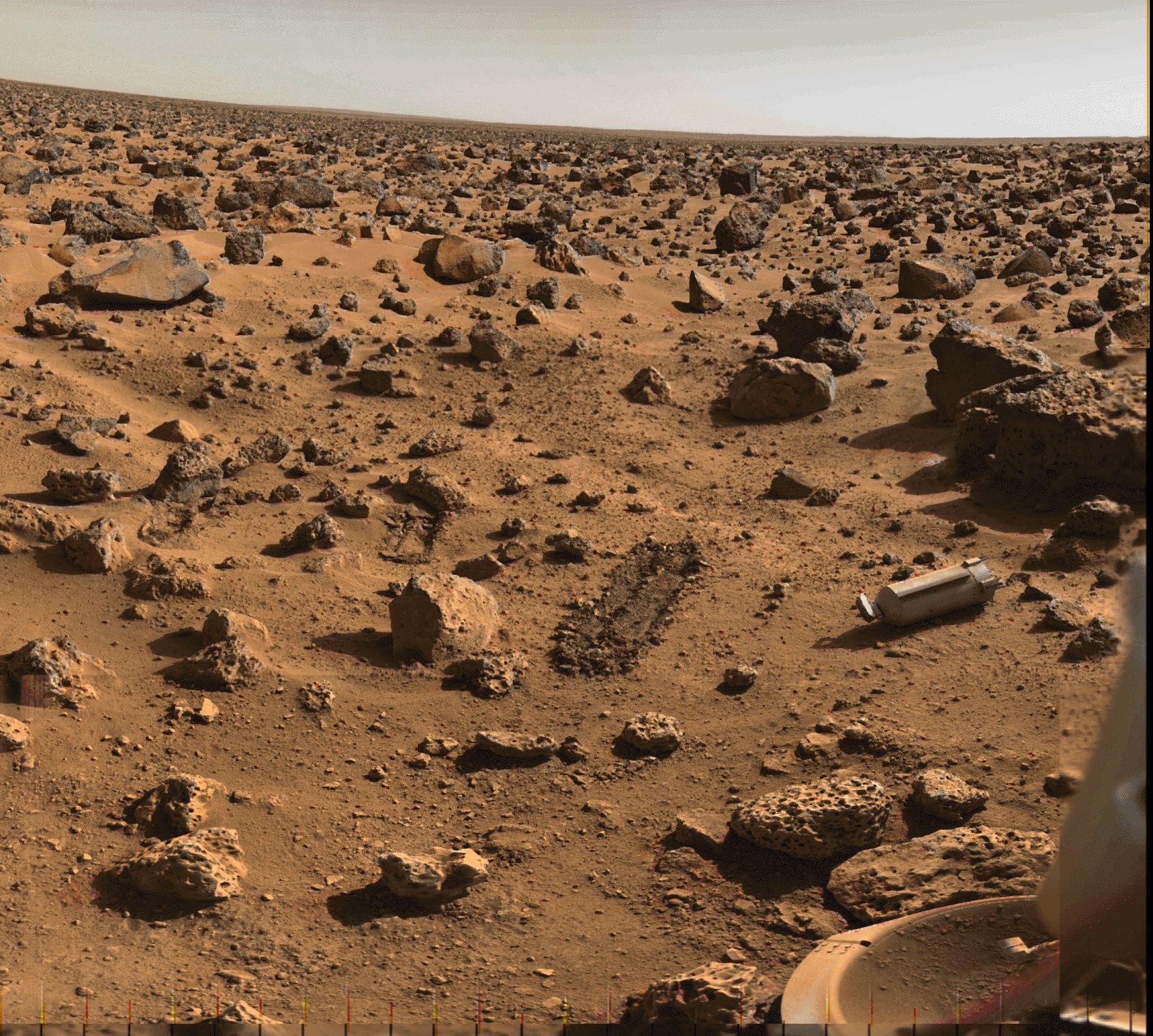
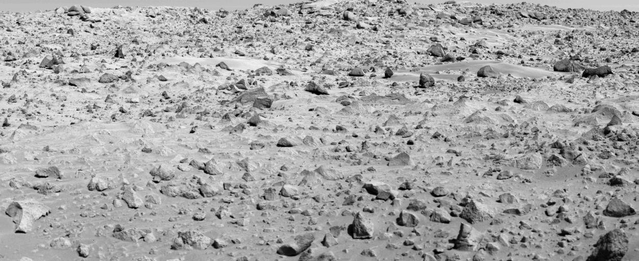
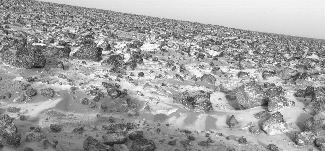
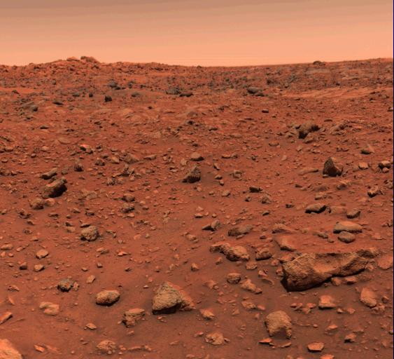
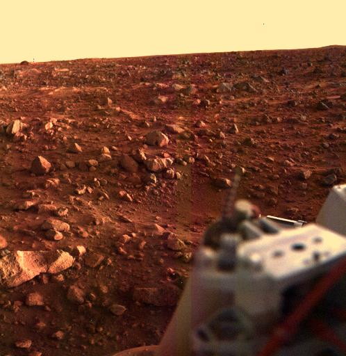
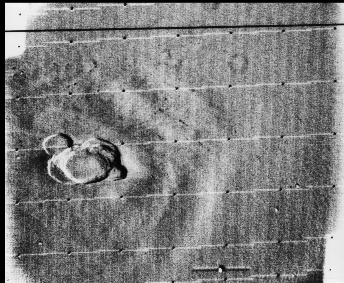
![This is the first photograph ever taken on the surface of the planet Mars. It was obtained by Viking 1 just minutes after the spacecraft landed successfully early today [July 20, 1976]. We see both rocks and finely granulated material--sand or dust. Many of the small foreground rocks are flat with angular facets. Several larger rocks exhibit irregular surfaces with pits and the large rock at top left shows intersecting linear cracks. Extending from that rock toward the camera is a vertical linear dark band which may be due to a one-minute partial obscuration of the landscape due to clouds or dust intervening between the sun and the surface.](../files/imgmars/mars1201_PIA00381.jpg)

- Mars 7 (1973-1972)
- (Launch date : August 9, 1973) - (Stop date : March, 1974)
- — (Soviet Union). Mars 4, 5, 6, and 7 comprised an associated group of Soviet spacecraft launched towards Mars in July and August of 1973. The Mars 7 interplanetary station was intended to be a Mars lander. It consisted of a flyby bus and a descent module. The descent module was designed to enter the martian atmosphere and make in-situ studies of the atmosphere and surface, but a malfunction on board caused the lander to miss the planet. It reached Mars on 9 March 1974. Due to a problem in the operation of one of the onboard systems (attitude control or retro-rockets) the landing probe separated prematurely (4 hours before encounter) and missed the planet by 1300 km. The early separation was probably due to a computer chip error which resulted in degradation of the systems during the trip to Mars. The lander and bus continued on into heliocentric orbits.
- Mars 6 (1973-1974)
- (Launch date : August 5, 1973) - (Stop date : March, 1974)
- — (Soviet Union). The Mars 6 interplanetary station consisted of a flyby bus and an attached descent module. The descent module separated from the bus on reaching Mars and was designed to enter the martian atmosphere and make in-situ studies of the Mars atmosphere and surface. After one course correction burn on 13 August 1973, it reached Mars on 12 March 1974. The descent module separated from the bus at a distance of 48,000 km from Mars. The bus continued on into a heliocentric orbit after passing within 1600 km of Mars. The descent module entered the atmosphere at 09:05:53 UT at a speed of 5.6 km/s. The parachute opened at 09:08:32 UT after the module had slowed its speed to 600 m/s by aerobraking. During this time the craft was collecting data and transmitting it directly to the bus for immediate relay to Earth. Contact with the descent module was lost at 09:11:05 UT in "direct proximity to the surface", probably either when the retrorockets fired or when it hit the surface at an estimated 61 m/s. Mars 6 landed at 23.90 S, 19.42 W in the Margaritifer Sinus region of Mars. The descent module transmitted 224 seconds of data before transmissions ceased, the first data returned from the atmosphere of Mars. Unfortunately, much of the data were unreadable due to a flaw in a computer chip which led to degradation of the system during its journey to Mars.
- Mars 5 (1973-1974)
- (Launch date : July 25, 1973) - (Stop date : February, 1974)
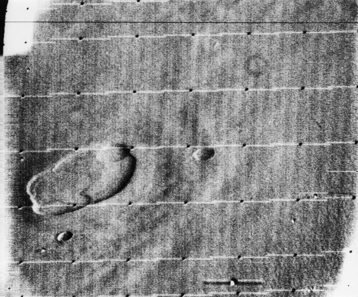
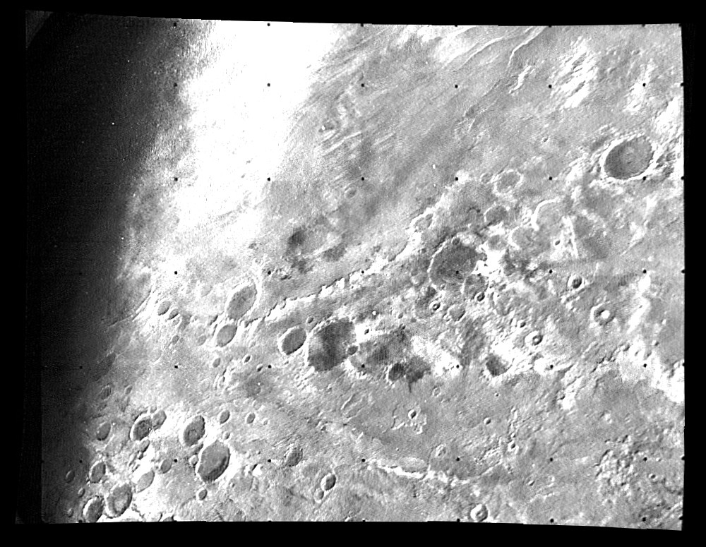
- — (Soviet Union). The Mars 5 automatic station was designed to orbit Mars and return information on the composition, structure, and properties of the martian atmosphere and surface. The spacecraft was also designed to act as a communications link to the Mars 6 and 7 landers. The orbiter operated only a few days and returned atmospheric data and images of a small portion of the martian southern hemisphere. After a mid-course correction burn on 3 August, the spacecraft reached Mars on 12 February 1974 at 15:45 UT and was inserted into an elliptical 1755 km x 32,555 km, 24 hr, 53 min. orbit with an inclination of 35.3 degrees. Mars 5 collected data for 22 orbits until a loss of pressurization in the transmitter housing ended the mission. About 60 images were returned over a nine day period showing swaths of the area south of Valles Marineris, from 5 N, 330 W to 20 S, 130 W.
- Mars 4 (1973)
- (Launch date : July 21, 1973)
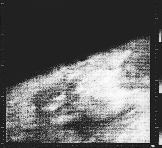
- — (Soviet Union). The Mars 4 automatic station was intended to be a Mars orbiter mission. It was presumably very similar in design and intended mission to the Mars 5 orbiter launched 4 days later. Mars 4 reached Mars on 10 February 1974. Due to a flaw in the computer chip which resulted in degradation of the chip during the voyage to Mars, the retro-rockets never fired to slow the craft into Mars orbit, and Mars 4 flew by the planet at a range of 2200 km. It returned one swath of pictures and some radio occultation data which constituted the first detection of the nightside ionosphere on Mars. It continued to return interplanetary data from solar orbit after the flyby.
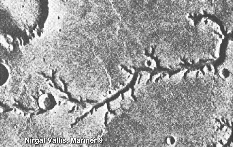
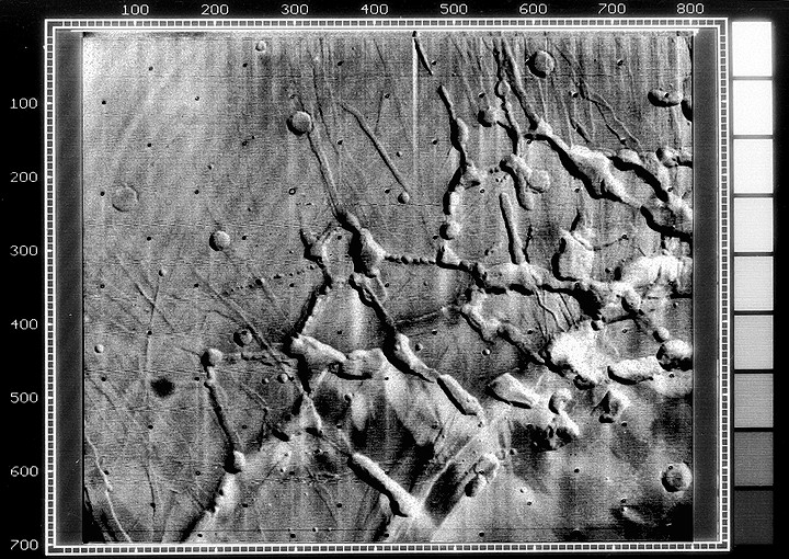
- Mariner 9 (Mariner I) (1971-1972)
- (Launch date : May 30, 1971) — (Stop date : October 27, 1972)
- — (USA). In 1971, the Mariner 9 spacecraft beat the Soviet Mars 2 to the Red Planet to become the first spacecraft to orbit another planet. Flyby missions were soon replaced by orbiters and orbiter/landers. The early landers did not fare well, but orbiters including Mariner 9 and the Soviet Mars 2 and Mars 3, all launched in 1971, returned substantial data and images, showing, for example, that there were mountains almost 14 miles (22 km) high.
- Mars 3 (1971-1972)
- (Launch date : May 28, 1971) - (Stop date : August 22, 1972)
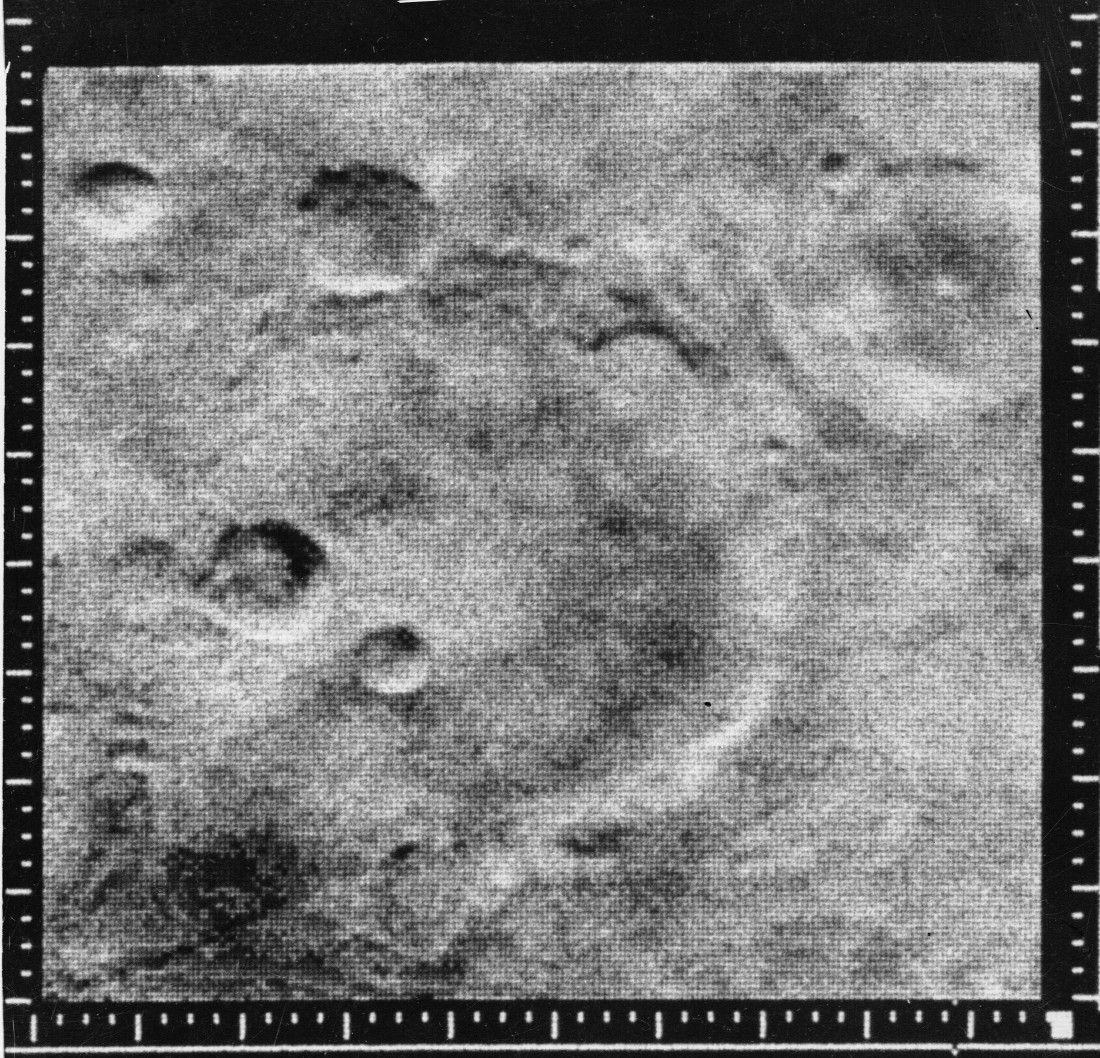
- — (Soviet Union). The Mars 2 and Mars 3 missions consisted of identical spacecraft, each with a bus/orbiter module and an attached descent/lander module. The primary scientific objectives of the Mars 2 orbiter were to image the martian surface and clouds, determine the temperature on Mars, study the topography, composition and physical properties of the surface, measure properties of the atmosphere, monitor the solar wind and the interplanetary and martian magnetic fields, and act as a communications relay to send signals from the lander to Earth. Mars 2 released the descent module (71-045D) 4.5 hours before reaching Mars on 27 November 1971. The descent module entered the martian atmosphere at roughly 6.0 km/s at a steeper angle than planned. The descent system malfunctioned and the lander crashed at 45 deg S, 313 deg W, delivering the Soviet Union coat of arms to the surface. The Mars 2 and 3 orbiters sent back a large volume of data covering the period from December 1971 to March 1972, although transmissions continued through August. It was announced that Mars 2 and 3 had completed their missions by 22 August 1972, after 362 orbits completed by Mars 2 and 20 orbits by Mars 3. The probes sent back a total of 60 pictures. Mars 3, made the first successful soft landing on Mars, using retro-rockets and parachutes, but the instruments stopped working after just 20 seconds.
- Mars 2 (1971-1972)
- (Launch date : May 19, 1971) - (Stop date : August 22, 1972)
- — (Soviet Union). Ibid.
- Cosmos 419 (Kosmos) (1971)
- (Launch date : May 10, 1971)
- — (Soviet Union). This launch was intended to be a Mars orbiting mission. It is widely believed this spacecraft was launched with the primary purpose of overtaking Mariner 8, which had been launched (unsuccessfully, as it turned out) two days earlier, and becoming the first Mars orbiter. The spacecraft was presumably similar to the orbiter section of the later Mars 2 mission, a cylindrical shaped spacecraft 3 meters high with two solar panels extending from the sides, two large dish antennae, on top of retro-rockets and fuel tanks. It carried an instrument to measure solar radiation which was supplied by the French. The spacecraft re-entered Earth's atmosphere 2 days later on 12 May 1971.
- Mariner 8 (Mariner H) (1971)
- (Launch date : May 9, 1971)
- — (USA). Designed to be the first American spacecraft to study the Red Planet from a Martian orbit, Mariner 8 (also called Mariner H) fell victim to a malfunction in the stage's flight-control system shortly after launch.
- Mars 1969B (1969-)
- (Launch date : April 2, 1969)
- — This Soviet Mars mission was never officially announced but has since been identified as a planned orbiter. At 0.02 seconds after liftoff, one of the six 11D43 first stage rockets exploded. The control system initially compensated for the lost engine and the launch proceeded on 5 engines until 25 seconds after liftoff at approximately 1 km altitude the rocket began to tip over to a horizontal position. The five engines shut down and the rocket impacted and exploded 41 seconds after liftoff approximately 3 km from the launch pad.
- Mars 1969A (1969)
- (Launch date : March 27, 1969)
- — This Soviet Mars mission was never officially announced but has since been identified as a planned orbiter. After successful operation of the first two stages, the third stage of the Proton SL-12/D-1-e (8K82K, #240-01 + 11S824) launcher experienced a malfunction in a rotor bearing which caused the turbopump to catch fire. The engine shut down 438.66 seconds after launch and exploded, the remains of the craft landing in the Altai mountains.
- Mariner 7 (1969-)
- (Launch date : March 27, 1969)
- — (USA). The Mariner 7 spacecraft made a close flyby of Mars just five days after its twin spacecraft, Mariner 6, in 1969. On July 29, 1969, less than a week before closest approach, NASA Jet Propulsion Laboratory lost contact with Mariner 7. Based on the observations that Mariner 6 made, Mariner 7 was reprogrammed in flight to take further observations of areas of interest and actually returned more pictures than Mariner 6, despite the battery's failure. In total 201 photos were taken and transmitted back to Earth, adding more detail than the earlier mission, Mariner 4.

- Mariner 6 (1969)
- (Launch date : February 24, 1969)
- — (USA). Along with its twin Mariner 7 spacecraft, Mariner 6 was designed to make a close flyby of Mars to study the surface for signs of life and develop technology for future missions.
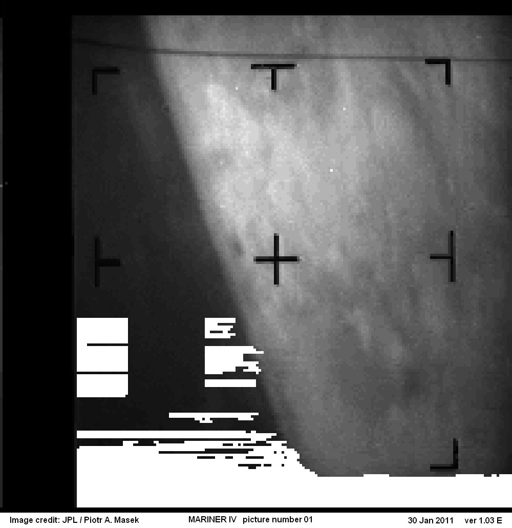
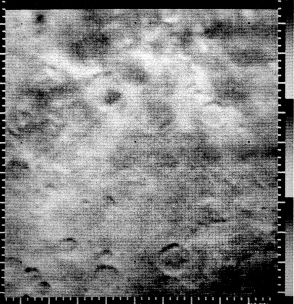
- Mariner 4 (Mariner-Mars 1964) (1964-1967)
- (Launch date : November 28, 1964) — (Stop date : December 21, 1967)
- — (USA). One of the great successes of the early American space program, the Mariner 4 mission journeyed to Mars — making its closest approach on July 15, 1965 — and took the first photos of another planet from space. NASA's Mariner 4 accomplished the first successful flyby in 1965 and sent back long-anticipated images of the martian surface. The images showed a cratered terrain reminiscent of the moon—greatly surprising those who expected to see canals built by intelligent life forms and lush vegetation. On December 21, 1967 communications with Mariner 4 were terminated.
- Mariner 3 (Mariner-Mars 1964) (1964)
- (Launch date : November 5, 1964)
- — (USA). Mariner 3 was designed to fly by Mars and conduct other interplanetary experiments along the way but the shroud encasing the spacecraft atop its rocket failed to open properly, and Mariner 3 did not get to Mars. Unable to collect the Sun's energy for power from its solar panels, the probe soon died when its batteries ran out and is now derelict in a solar orbit. Mariner-Mars 1964 project was intended to conduct close-up (flyby) scientific observations of the planet Mars and transmit information on interplanetary space and the space surrounding Mars, televised images of the Martian surface and radio occultation data of spacecraft signals as affected by the Martian atmosphere back to Earth.
- Zond 2 (1964)
- (Launch date : )
- — (Soviet Union). The Russian probe, Zond 2, successfully flew past Mars in November 1964 – but its radio failed and no data was sent back to Earth.
- Mars 1 (1962)
- (Launch date : )
- — (Soviet Union).
- Sputnik 24 (1962)
- (Launch date : )
- — (Soviet Union).
- Sputnik 22 (1962)
- (Launch date : )
- — (Soviet Union).
- Marsnik 2 (1960)
- (Launch date : )
- — (Soviet Union).
- Marsnik 1 (1960)
- (Launch date : )
- — (Soviet Union).
Next Missions(Edit)
- 2040 — Sun Laiyan, administrator of the China National Space Administration, said on July 20, 2006 that China would start deep space exploration focusing on Mars over the next five years, during the Eleventh Five-Year Plan (2006–2010) Program period. The first uncrewed Mars exploration program could take place between 2014–2033, followed by a crewed phase in 2040-2060 in which crew members would land on Mars and return home. The Mars 500 study of 2011 prepared for this manned mission.
- 2037 — Manned exploration by the United States was identified as a long-term goal in the Vision for Space Exploration announced in 2004 by then US President George W. Bush. The planned Orion spacecraft would be used to send a human expedition to Earth's moon by 2020 as a stepping stone to a Mars expedition. On September 28, 2007, NASA administrator Michael D. Griffin stated that NASA aims to put a person on Mars by 2037.
- mid-2030s — In a major space policy speech at Kennedy Space Center on April 15, 2010, U.S. President Barack Obama predicted a manned Mars mission to orbit the planet by the mid-2030s, followed by a landing: "By the mid-2030s, I believe we can send humans to orbit Mars and return them safely to Earth. And a landing on Mars will follow. And I expect to be around to see it." The United States Congress has mostly approved a new direction for NASA that includes canceling Bush's planned return to the Moon by 2020 and instead proposes asteroid exploration in 2025 and orbiting Mars in the 2030s.
- 2030 — The ESA has plans to land humans on Mars between 2030 and 2035. This will be preceded by successively larger probes, starting with the launch of the ExoMars probe and a planned joint NASA–ESA Mars sample return mission.
- 2023 — In 2012, a new proposal for a one-way human settlement mission to Mars was put forward by the Mars One a private spaceflight project led by Dutch entrepreneur, Bas Lansdorp, to establish a permanent human colony on Mars. Mars One is a Dutch not-for-profit foundation, a Stichting. The plan is to send a communication satellite and path finder lander to the planet by 2016 and, after several stages, land four humans on Mars for permanent settlement in 2023.
- 2021 — The Mars Piloted Orbital Station (or MARPOST) is a Russian proposed manned orbital mission to Mars, using a nuclear reactor to run an electric rocket engine. Proposed in October 2000 by Yuri Karash from the Russian Academy of Cosmonautics as the next step for Russia in space along with the Russian participation in the International Space Station, a 30-volume draft project for MARPOST has been confirmed as of 2005. Design for the ship proposed to be ready in 2012, and the ship itself in 2021.
- 2020 — The Mars 2020 rover mission by NASA would be launched in 2020, and it would be based on the Mars Science Laboratory architecture. Both the payload, and the instruments on board will be openly competed for selection.
- 2018 — In 2013, the Inspiration Mars Foundation founded by Dennis Tito plans a manned mission to flyby Mars in 2018.
- 2018 — Red Dragon is a proposed concept for a low-cost Mars lander mission that would use a SpaceX Falcon Heavy launch vehicle, and a modified Dragon capsule to enter the Martian atmosphere. The concept will be proposed for funding in 2012/2013 as a NASA Discovery mission, for launch in 2018. The primary objective would be the search for evidence of life on Mars (biosignatures), past or present; a substantially unmodified version of the crewed Dragon capsule could be used for payload transport to Mars, and would be a precursor to the ambitious long-term plans of a manned mission to Mars.
- 2018 — ESA and the Russian Federal Space Agency plan to send the ExoMars rover in 2018 to search for past or present microscopic life on Mars.
- 2016 — Trace Gas Orbiter / ExoMars : As part of the ExoMars program, ESA and the Russian Federal Space Agency plan to send the Trace Gas Orbiter and the Schiaparelli lander to Mars in 2016.
- 2016 — The InSight mission (formerly called GEMS), would place a lander on Mars that would be designed to drill beneath the surface and investigate the planet's deep interior to better understand Mars' evolution as a rocky planet.
- 2014 — MetNet (Finland) : MetNet is an atmospheric science mission to Mars, initiated and defined by the Finnish Meteorological Institute. The mission includes sending several tens of MetNet landers on the Martian surface. The objective is to establish a widespread surface observation network on Mars to investigate the planet's atmospheric structure, physics and meteorology. A precursory mission consisting of one lander is scheduled for launch in the launch window starting from 2014.
- Nov 2014 — Rosetta will rendezvous with Comet 67P/Churyumov-Gerasimenko where it will study the nucleus of the comet and its environment for nearly two years, and land a probe on its surface. The lander, Philae, will be delivered to the comet’s surface in November 2014.
- ? — Mars Sample Return is a proposed mission to return samples from the surface of Mars to Earth.
References(Edit)
- http://www.jpl.nasa.gov/missions/
- http://www.flickr.com/photos/nasa-jpl/sets/72157616670931285/
- http://pdsimg.jpl.nasa.gov/Atlas/Atlas.html
- http://photojournal.jpl.nasa.gov/targetFamily/Mars
- Mars Exploration Timeline : http://nssdc.gsfc.nasa.gov/planetary/chronology_mars.html
- Mars Missions list : http://www.planetary.org/explore/space-topics/space-missions/missions-to-mars.html